Bay Lines -Beach of Dreams
Lancaster to Hest Bank- Miles 23 to 42
Mapping 120 Miles of Morecambe Bay through photos, stories and drawings
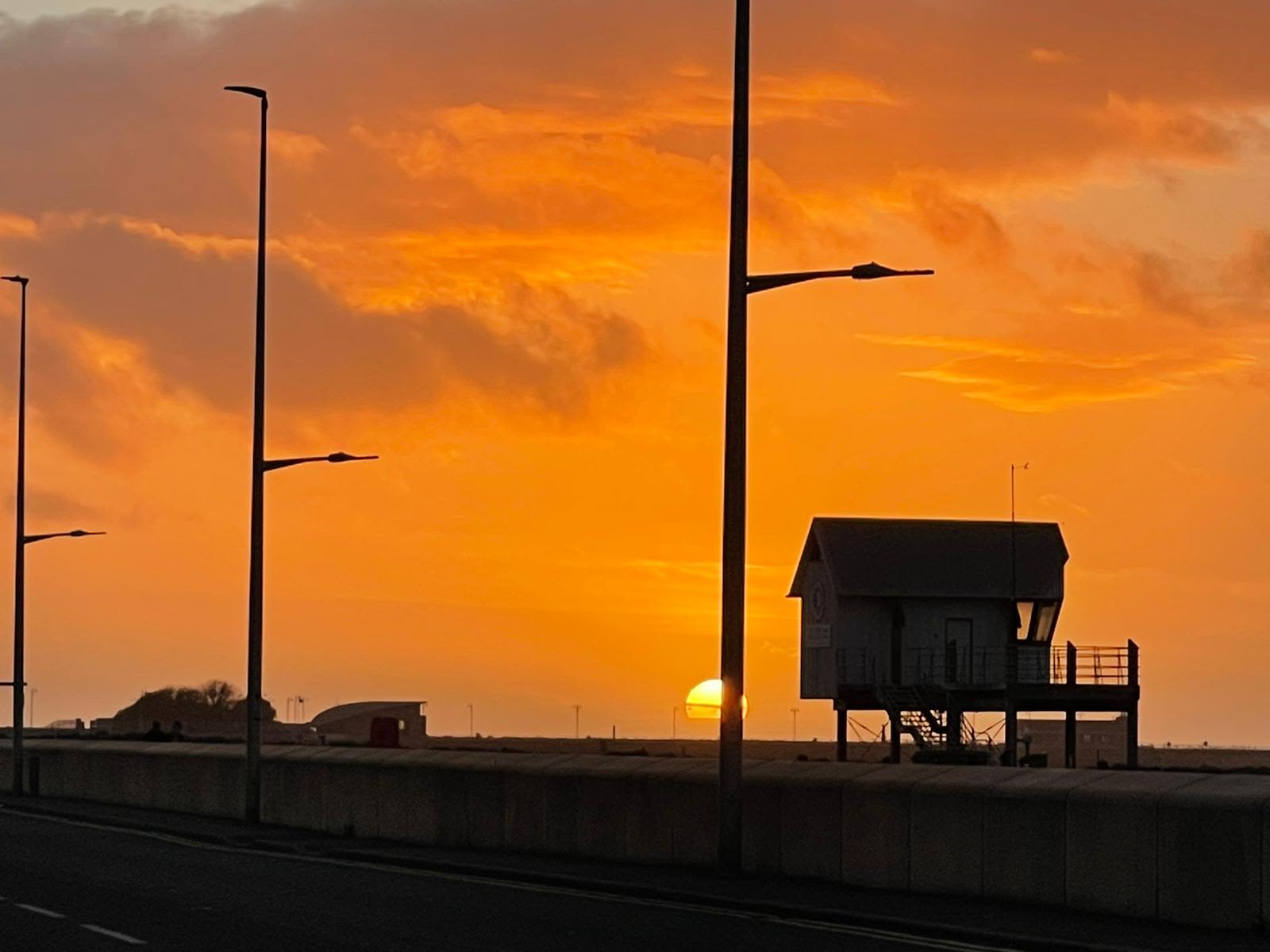

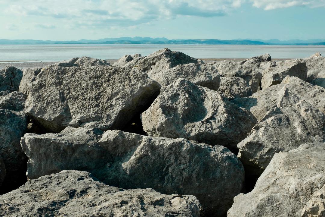
Mile 23 North Side of the Lune at Lancaster
Emma Rucastle
This first mile out of Lancaster is a regular walk for me. It's one of my favourite commutes as I work creatively around the city of Lancaster. I love the view in both directions from the top of Carlisle Bridge: looking back towards the river Lune cutting its way towards the Lune Valley, watched by the Ashton Memorial and the towers and spires of Lancaster and, in the other direction, looking out towards Morecambe Bay and the sea. The colours and reflections are beautiful in every season: long may it last.
Mile 24 - Golden Ball Hotel, Lancaster Road
St George's Quay and New Quay were built in Lancaster in the mid 1700s, and in 1779 a new port was constructed at the mouth of the Lune estuary at Glasson Dock.
As you travel along the north side of the River Lune in the direction of the open sea the estuary widens and city turns to countryside and small riverside hamlets.
The Golden Ball pub is on the north side of the river and westwards you can look towards Glasson Dock and Sunderland Point.

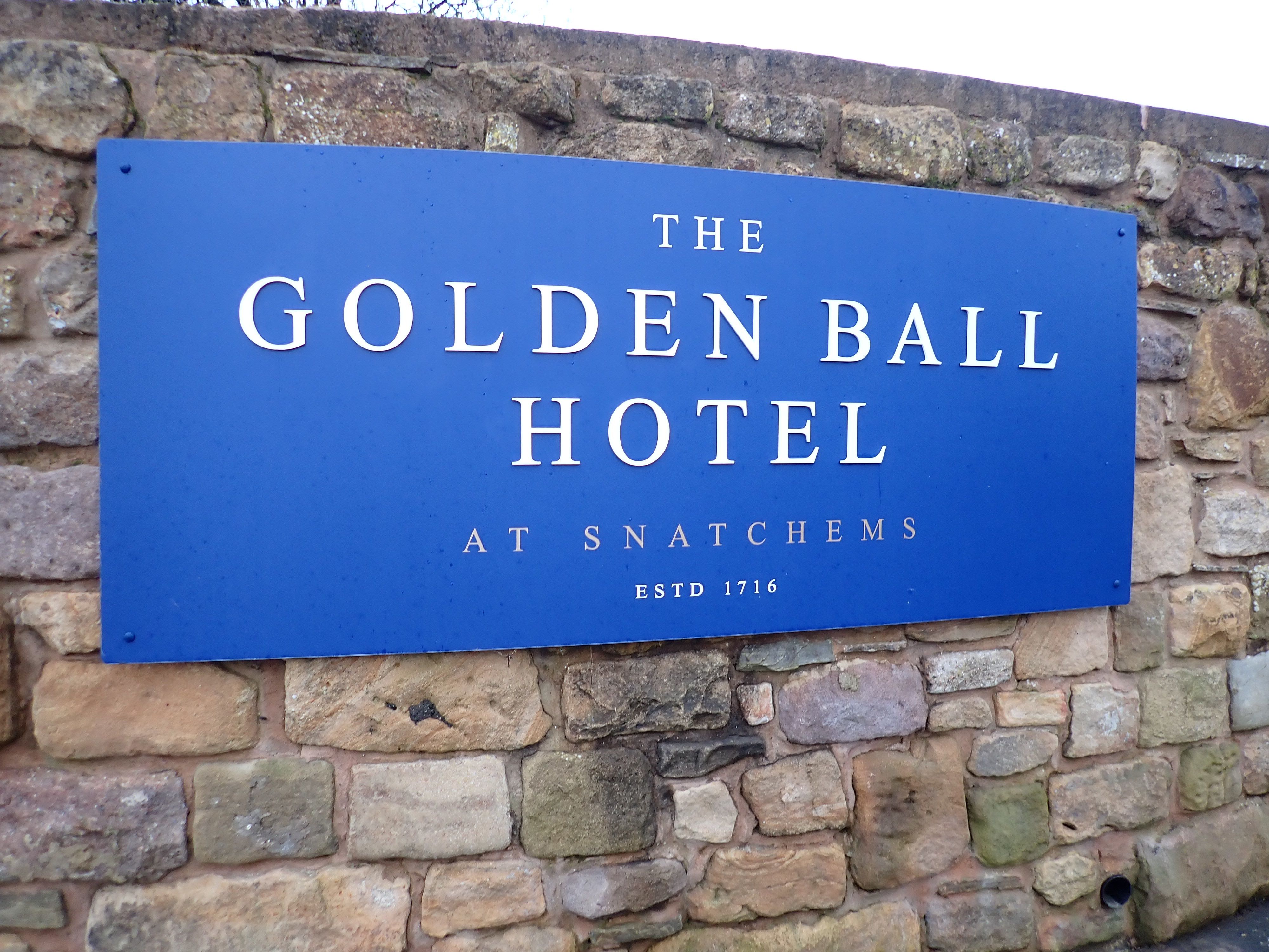
There has been a pub on the site since the 1650s. The road between the pub and river often floods at very high tides.
The Golden Ball's nickname of Snatchems harks back to the era when the navy would entrap men into serving on board ship.
The legend goes that the pressgangs would visit the pub, spot any men the worse for wear, and snatch 'em, and by the time the drinkers sobered up they would be far out to sea.


The Bay Lines - Beach of Dreams project maps 120 miles across Morecambe Bay. In June 2023 artists and walkers from the arts organisation Kinetika walked the whole route of 120 miles around Morecambe Bay carrying silk pennants representing miles of coastline. Their mission - to create 120 new silk pennants, one for each mile of the Bay, to be designed from the mile images and stories contributed by members of the public around the Bay and to be displayed as a coastal art installations at 4 locations across the Bay over August Bank Holiday weekend 2023. The project was commissioned by Ways Around the Bay from the Morecambe Bay Partnership.
Kinetika is working with Kendal-based Rosa Productions as part of a wider multi-year Beach of Dreams exploration of the UK and Ireland coastline.
The is the second of five sections - from Lancaster to Hest Bank -where we walk and map the 120 miles of coastline of Morecambe Bay with photos, stories, and drawings from the Bay Lines, Beach of Dreams participants.
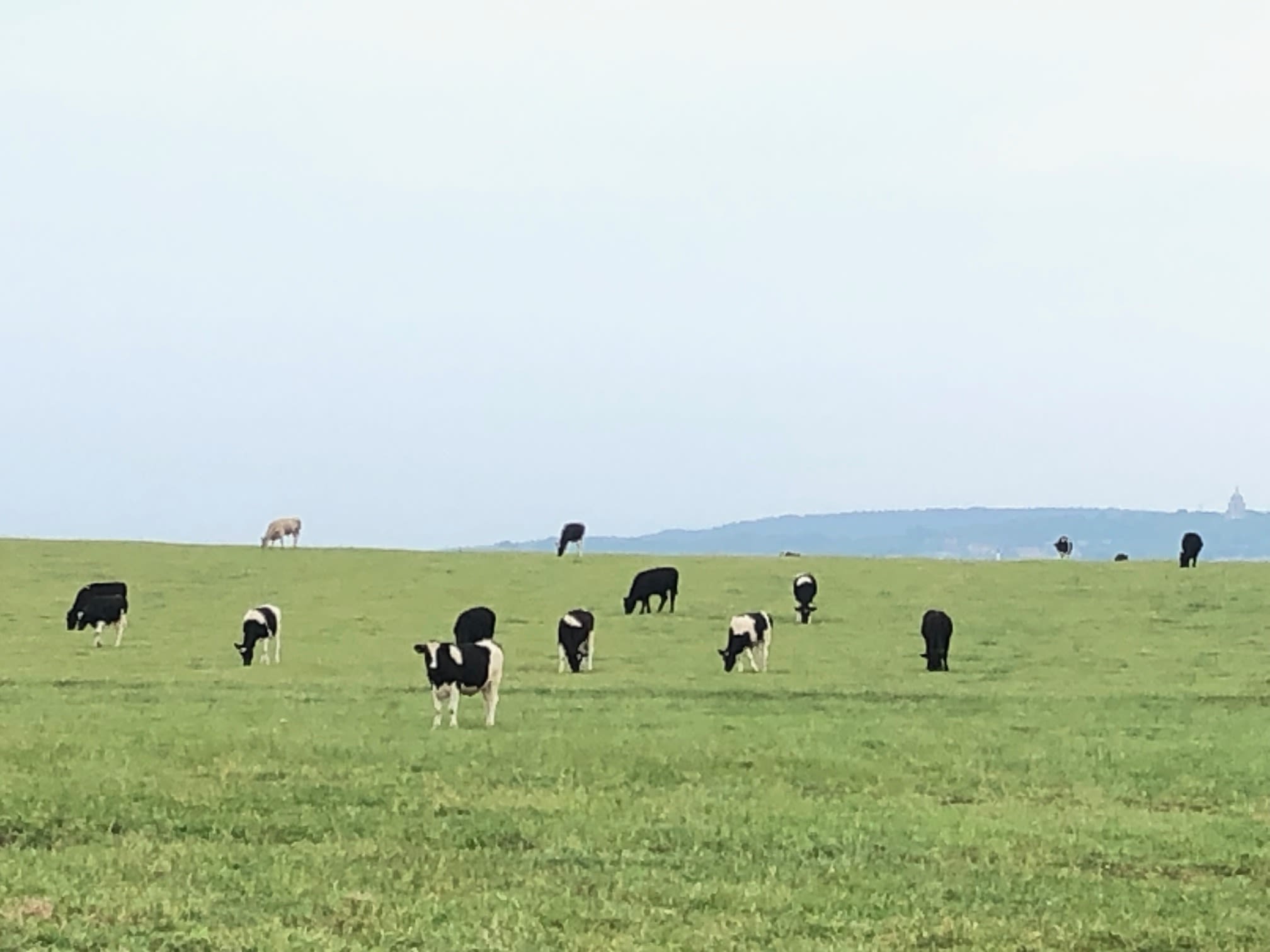
Miles 25 and 26 Heaton with Oxcliffe to Overton
Hilary Smith
INTENSIVE FARMING
Along the north side of the Lune the miles are very uniform intensively managed grassland for livestock, especially cows. The fields are arable grassland with large fields and short trimmed (over-managed) hedgerows with very occasional hedgerow trees which are ageing and dying out. The salt marsh is vegetated and wide in places and some salt water creeks.
It is hard to imagine wildlife using the area and it does not appear that any wildlife enhancements, such as flower rich margins or tree planting have been carried out.
My dream would be that a mile wide buffer zone would be created between this road, and the salt marsh. This area would be allowed to re-wild naturally, and intensive cattle and grassland would be removed. A purpose built cycle track would be created just over the roadside hedge, but public access would not be allowed on the buffer zone or on to the salt marsh.
I fear that someone will decide a river crossing for cars is essential to reduce traffic congestion in Lancaster and develop industrial businesses in Heysham. This could also be linked to tidal barrage which would radically change the river and the whole Bay.

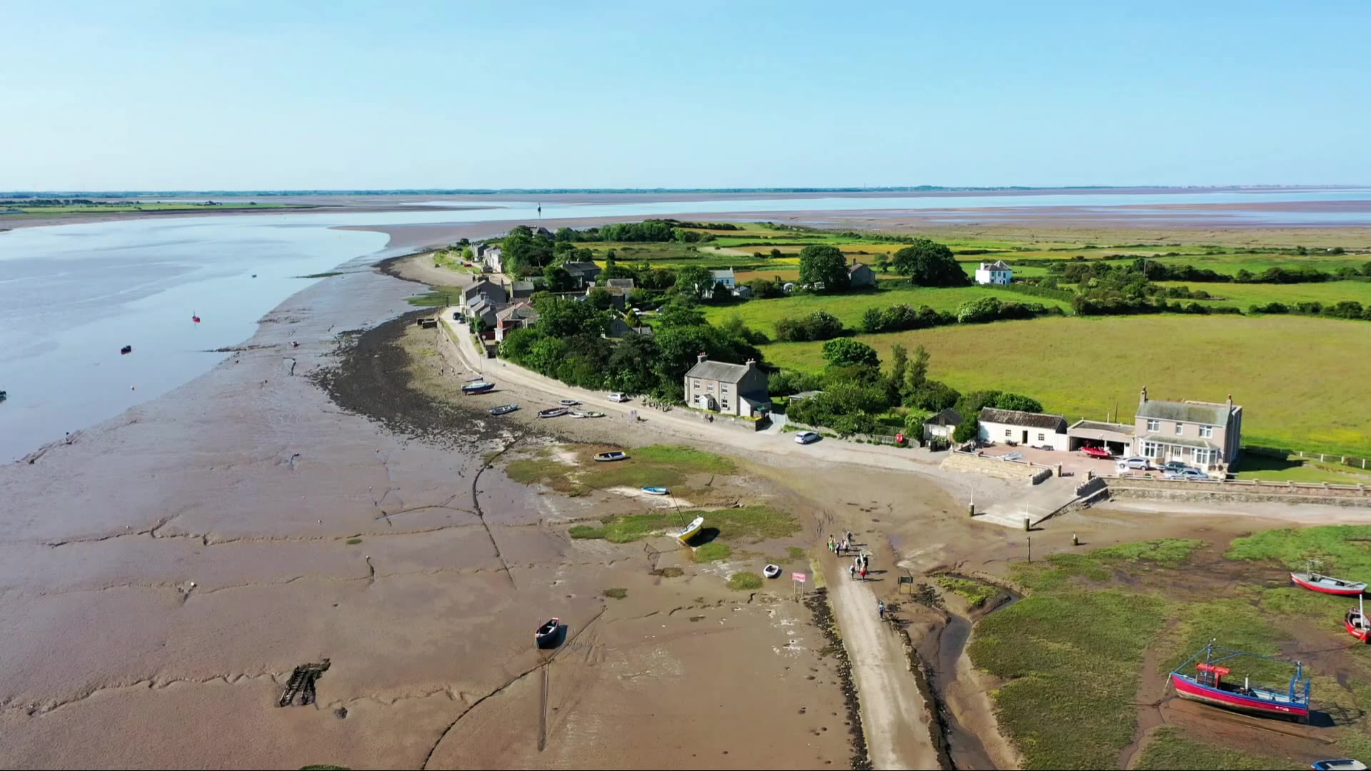
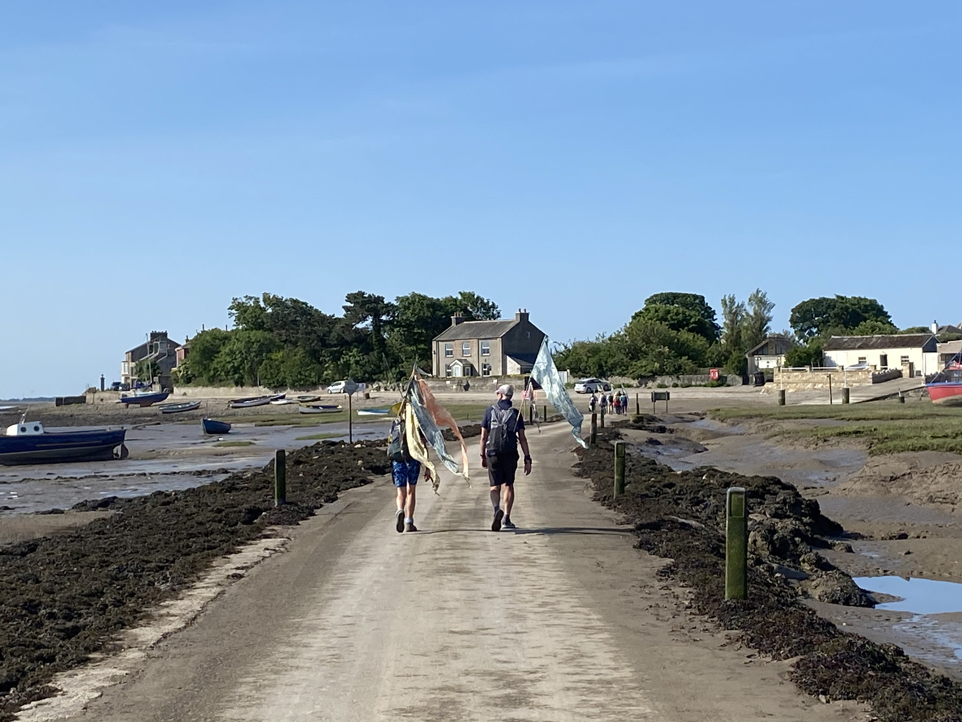
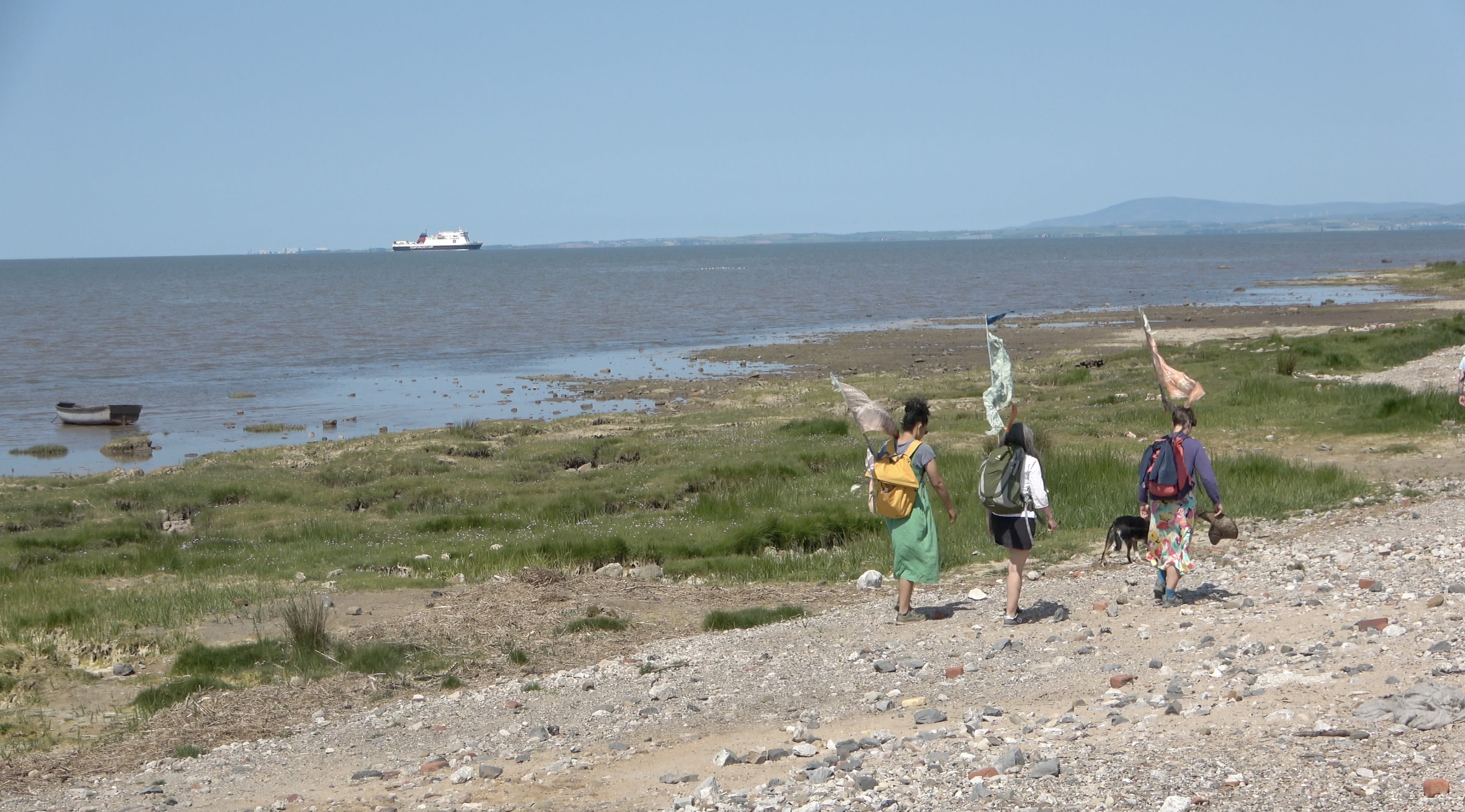
Miles 27 to 30 - Overton and the Sunderland Point Causeway
On a very warm Sunday morning in June the group of walkers with Kinetika artists gathered in Overton village to set out across the causeway and along the Sunderland Point headland to head north to Heysham and Morecambe, led by walks leader and forager Nicola Burgess.
At the approach to the causeway signs warn of tidal flooding. The walkers had carefully planned the route to be more than two hours before high tide as the sea often comes over the causeway as high tide approaches, cutting off Sunderland Point from Overton.
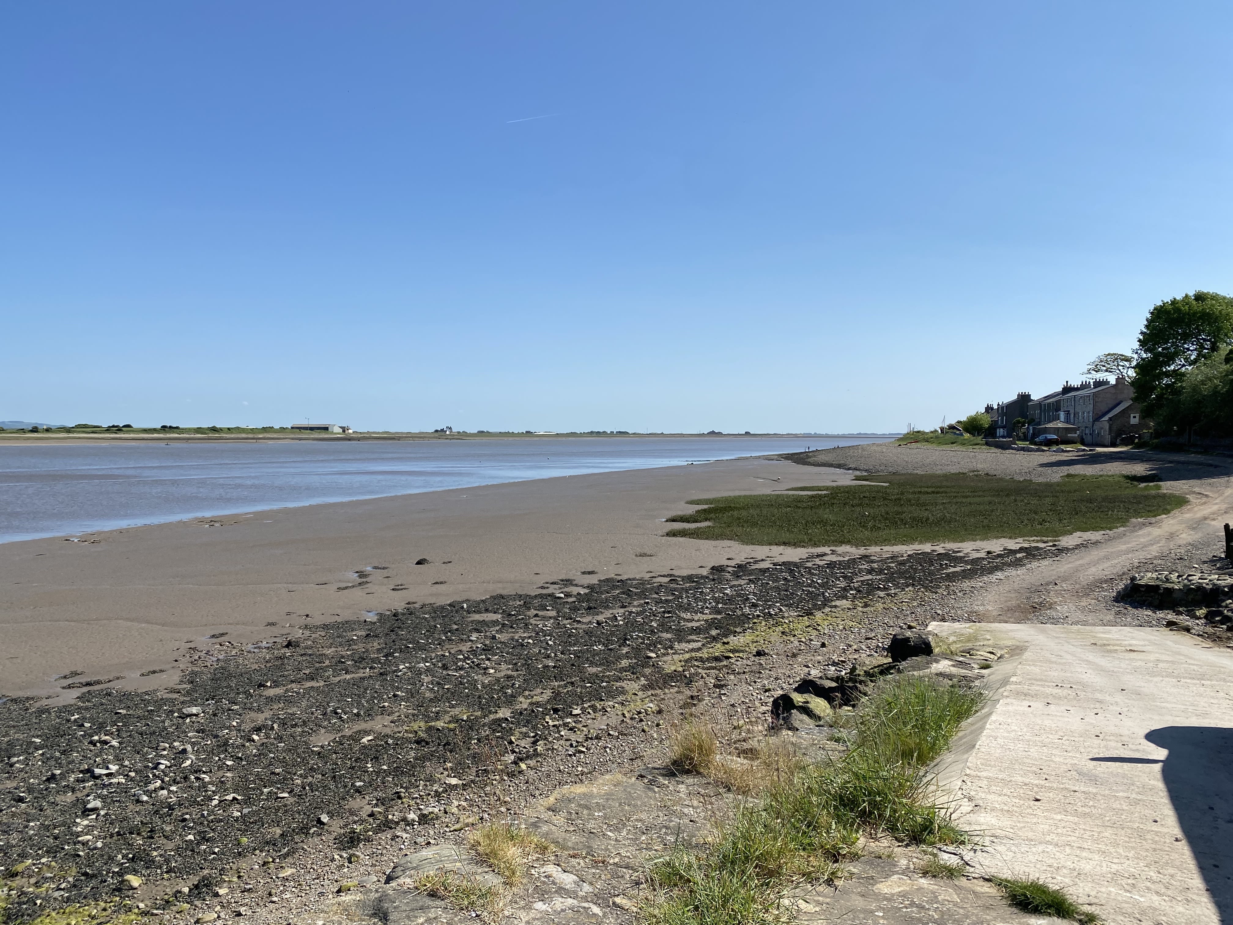
Mile 29 - The view from the causeway
Mile 30 - Sunderland Point


Approaching Sunderland Point.
Approaching Sunderland Point.
Shore by the Sunderland Point causeway.
Shore by the Sunderland Point causeway.
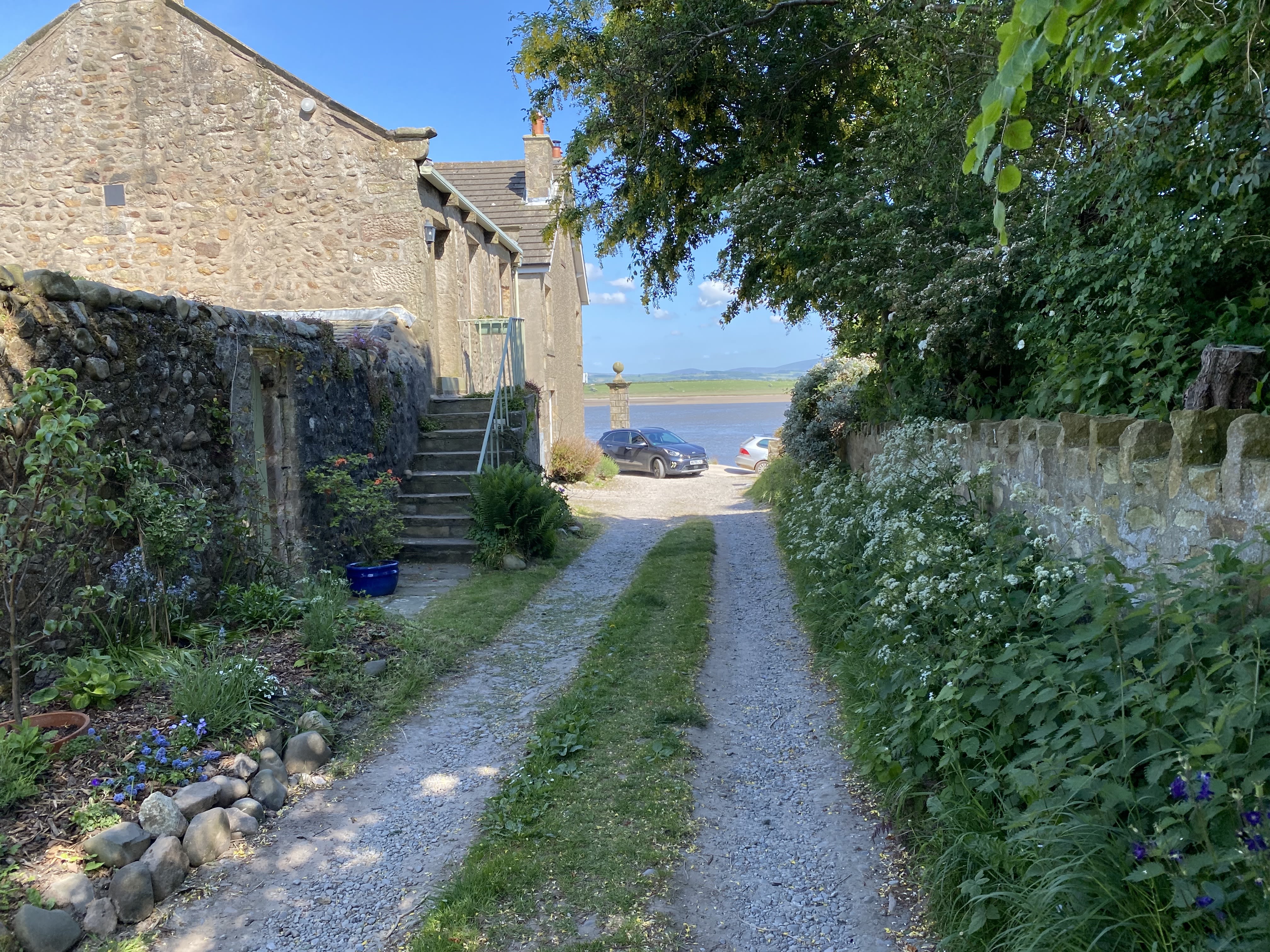
The Lane at Sunderland Point.
The Lane at Sunderland Point.
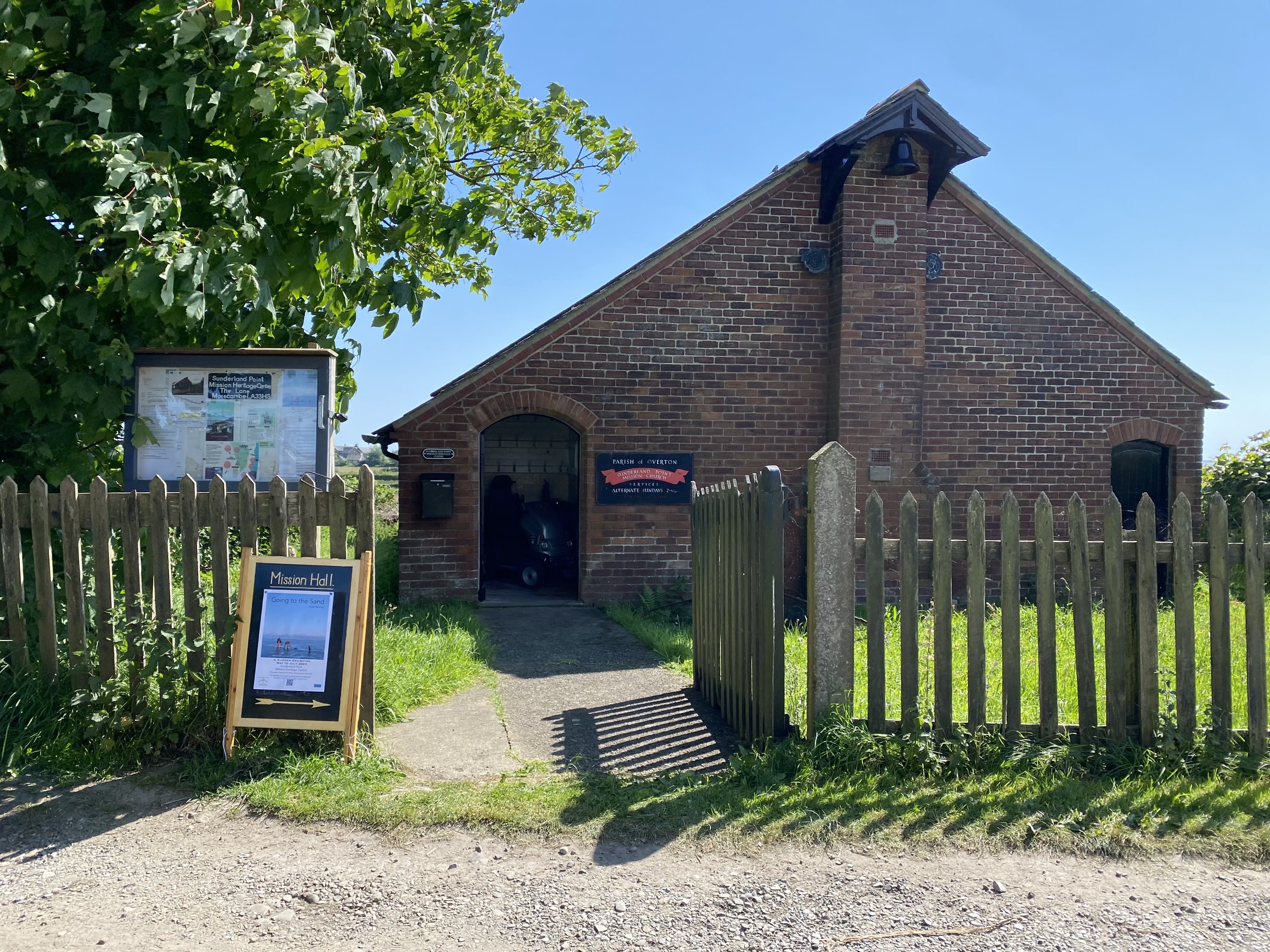
The Mission at Sunderland Point. With Tessa Bunney's exhibition 'Going to the Sands'
The Mission at Sunderland Point. With Tessa Bunney's exhibition 'Going to the Sands'
Mile 31 - Sunderland Point West Coast

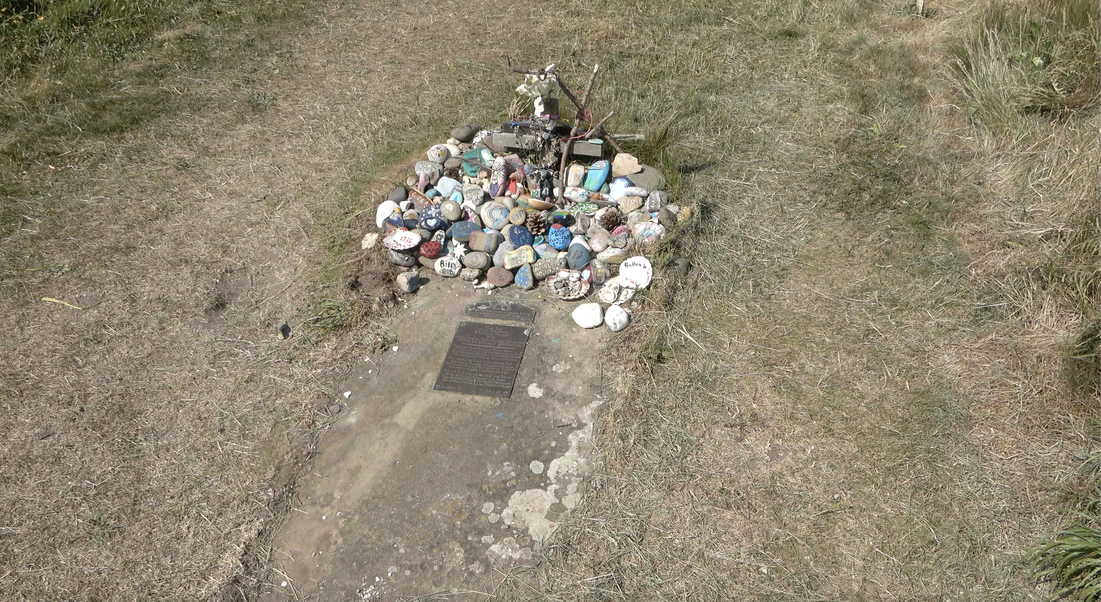
The African Boy's Grave
Imogen Taylor
On the west side of Sunderland Point, by the open sea coast, there is a place of pilgrimage marked on the map as 'Sambo's Grave'.
Professor Imogen Taylor from the Lancaster Black History Group, and a Sociology Lecturer at Lancaster University, and Professor Alan Rice, Director of the UCLan Research Centre in Migration, Diaspora and Exile, joined the walkers to explain the history.
'Sambo’s Grave is at the bottom of a farmer’s field metres by the sea at Sunderland Point. In 1822, around a century after he died, local journals reported that the African boy known as Sambo died around 1736 “attending his master from the West Indies, died on his arrival at Sunderland” .

He was servant to the captain of the ship and has sometimes been described as a cabin boy.
There were few Africans buried in marked graves in Britain in the eighteenth century and this site is unique, as it is isolated away from any other graves on the coast close to a slave port. The grave has generated academic interest and speculation, tourist visits, pilgrimage and artistic responses from at least the 1790s.

We know that when he arrived his master placed him with the landlord of the local inn (now Upsteps Cottage) at the centre of the Sunderland Point's maritime community “with the intention of remaining there on board wages til the vessel was ready to sail”. However, unable to understand English and worried that he was being abandoned he is said to have fallen sick, he refused food and died after only a few days there.
The account details how local residents conveyed his body “without either coffin or bier, being covered only with the clothes in which he died”) to the farmer’s field for burial as he was not a Christian so could not be buried in the Churchyard over the causeway in Overton. His burial and resting place might have been lost, but in 1796, the Reverend James Watson, (who was previously headmaster of the Grammar School and chaplain to Lancaster Castle) heard the story of the gravesite and determined to memorialise the African.

James Watson's impetus to do this might well have been spurred by guilt at the involvement of his brothers William and John as participants in the Lancaster Slave Trade.
He collected money from visitors to the Point over the summer and paid for a monument of a freestone slab and a brass plate onto which he placed a description and self-penned elegy. The language on the brass plate is consistent with the sentimental tone of much of the writing around enslaved Africans in the late eighteenth century describing, “Here lies poor Samboo, a faithful Negro”. The gravesite has continued to be a touchstone for a variety of responses ever since.
Painted stones, often with individual messages for Sambo, have been brought to the grave for decades sometimes by school parties as art projects; the grave is always a colourful site with these, flowers, tokens and children’s toys left to provide a touching site of memorialisation.'


Miles 32. Looking north along the coast to Heysham.
Miles 32. Looking north along the coast to Heysham.
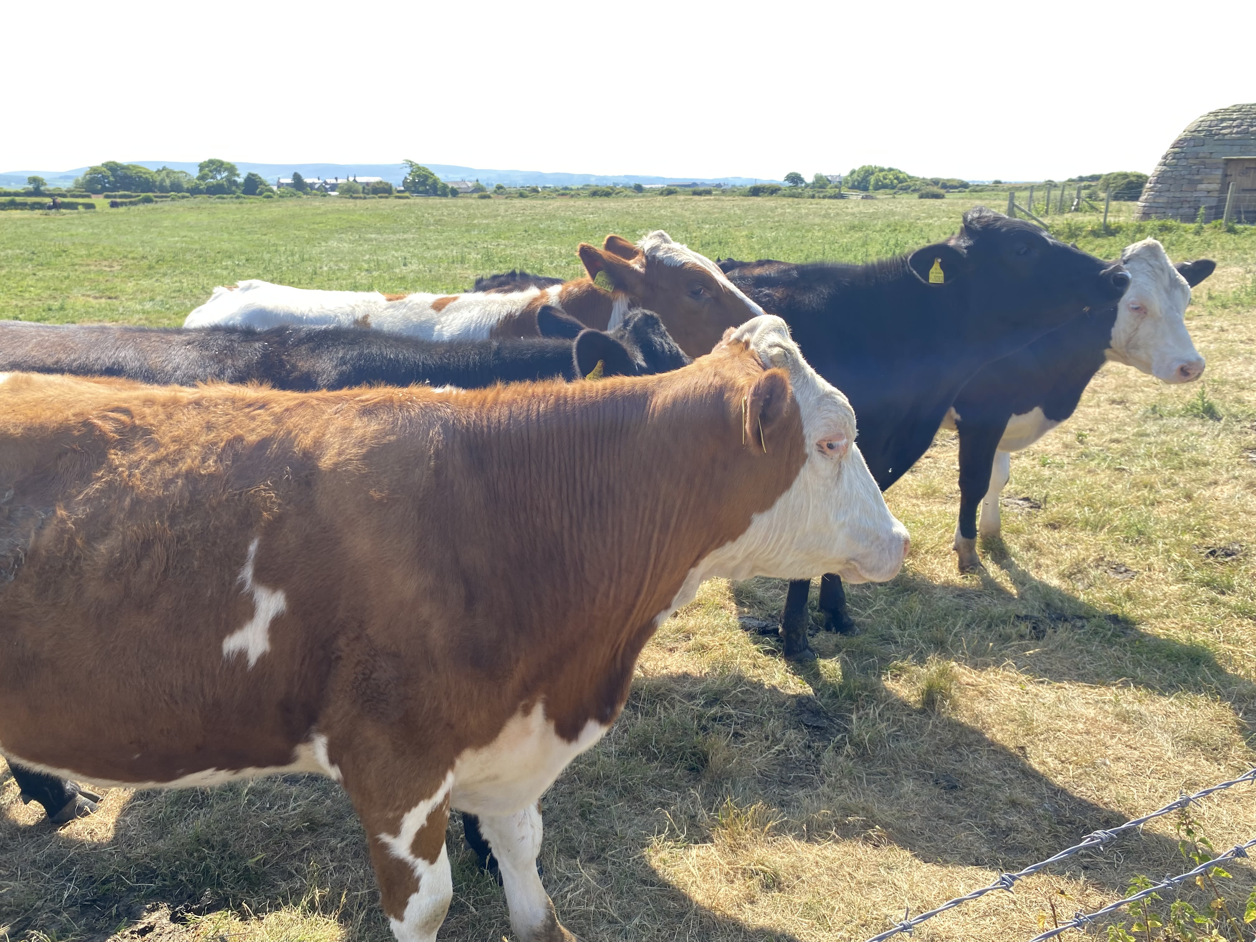
Mile 32. Salt marsh cattle at Sunderland Point.
Mile 32. Salt marsh cattle at Sunderland Point.

Mile 32. Walkers with Kinetika artists along the shore.
Mile 32. Walkers with Kinetika artists along the shore.
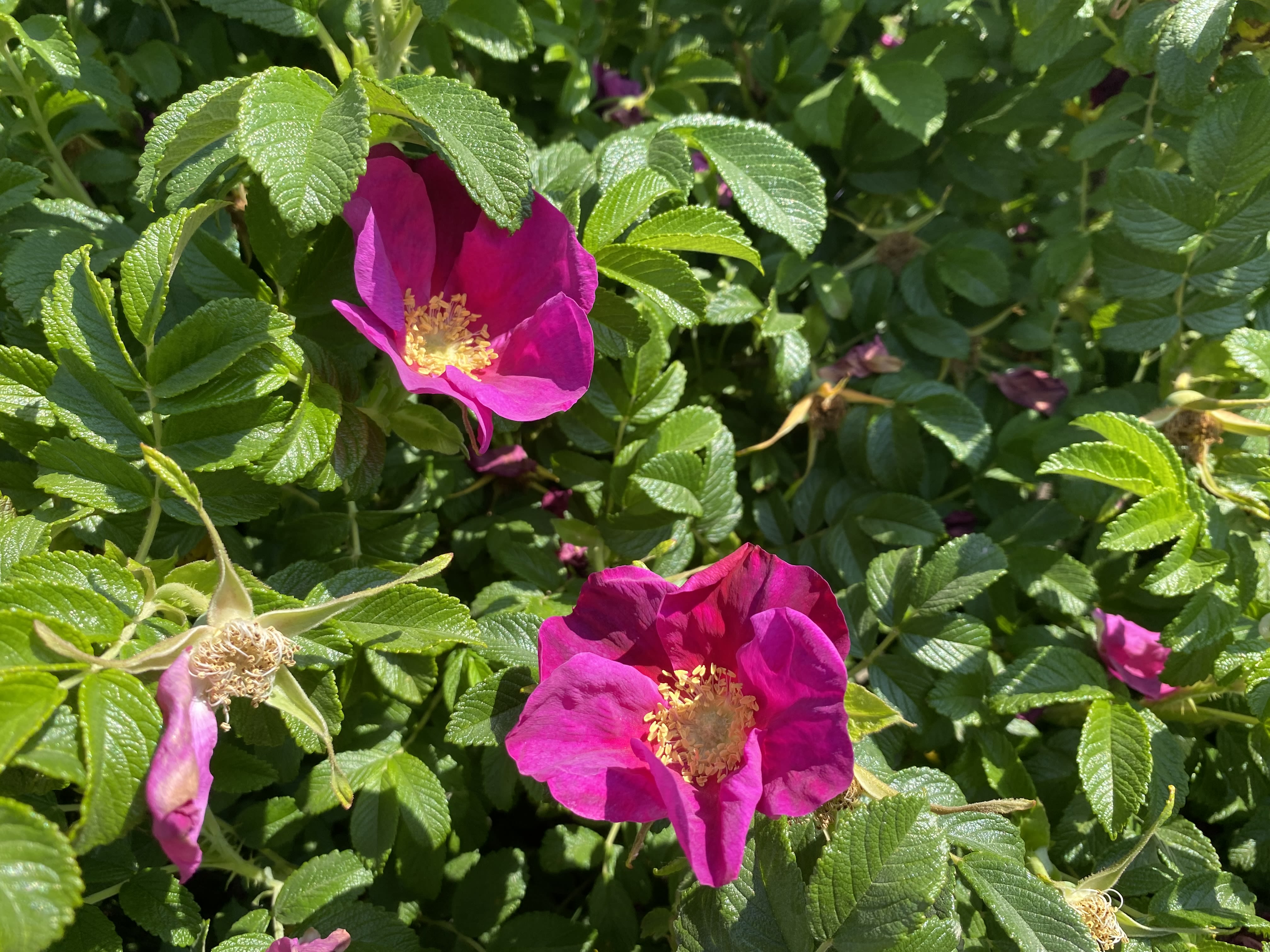
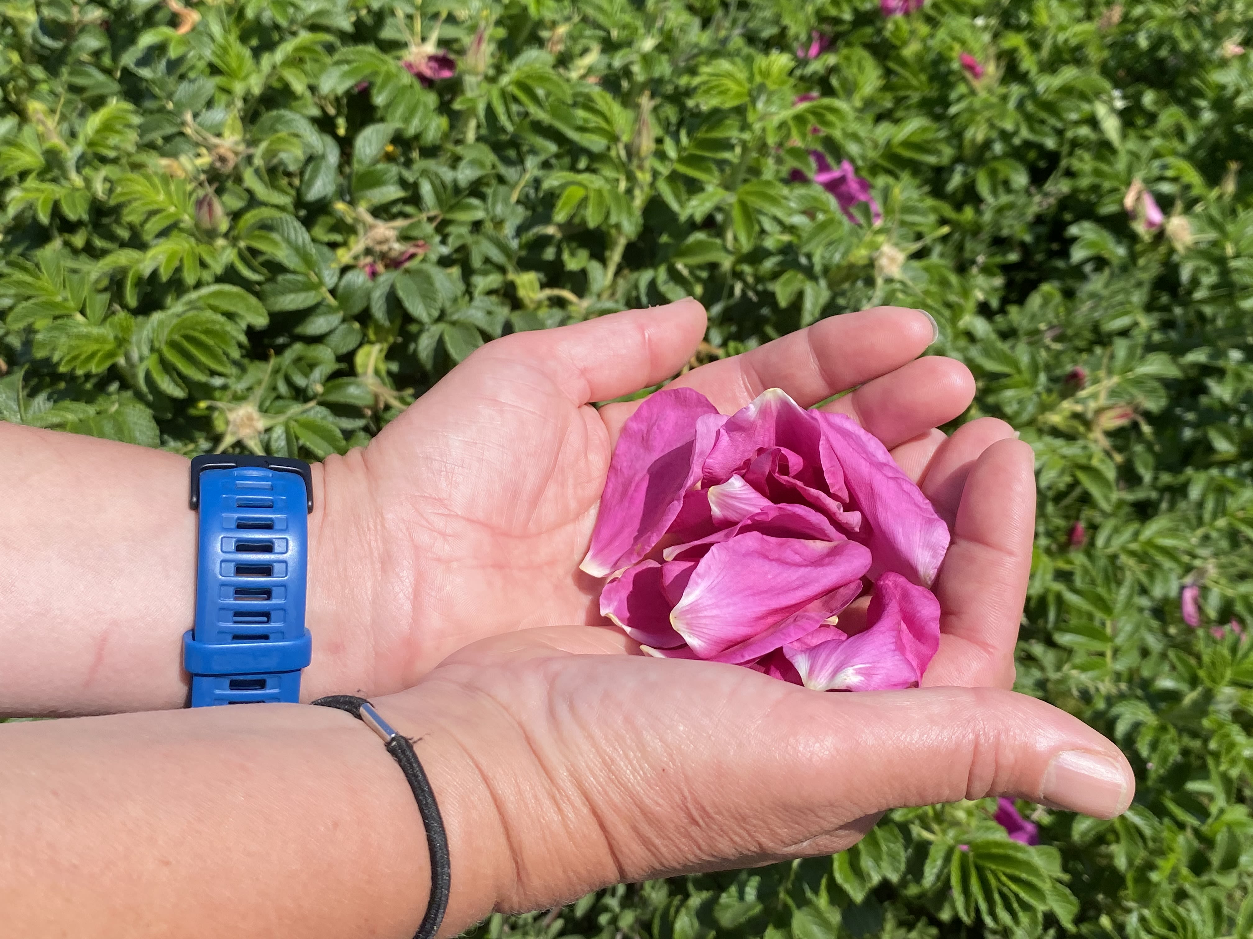
Mile 32. Rosa Rugosa.
Mile 32. Rosa Rugosa.
Japanese rose, Rosa Rugosa, grows plentifully along this coastline. Displayed by forager and walks leader Nicola Burgess.
Japanese rose, Rosa Rugosa, grows plentifully along this coastline. Displayed by forager and walks leader Nicola Burgess.

Approaching Heysham Port.
Approaching Heysham Port.
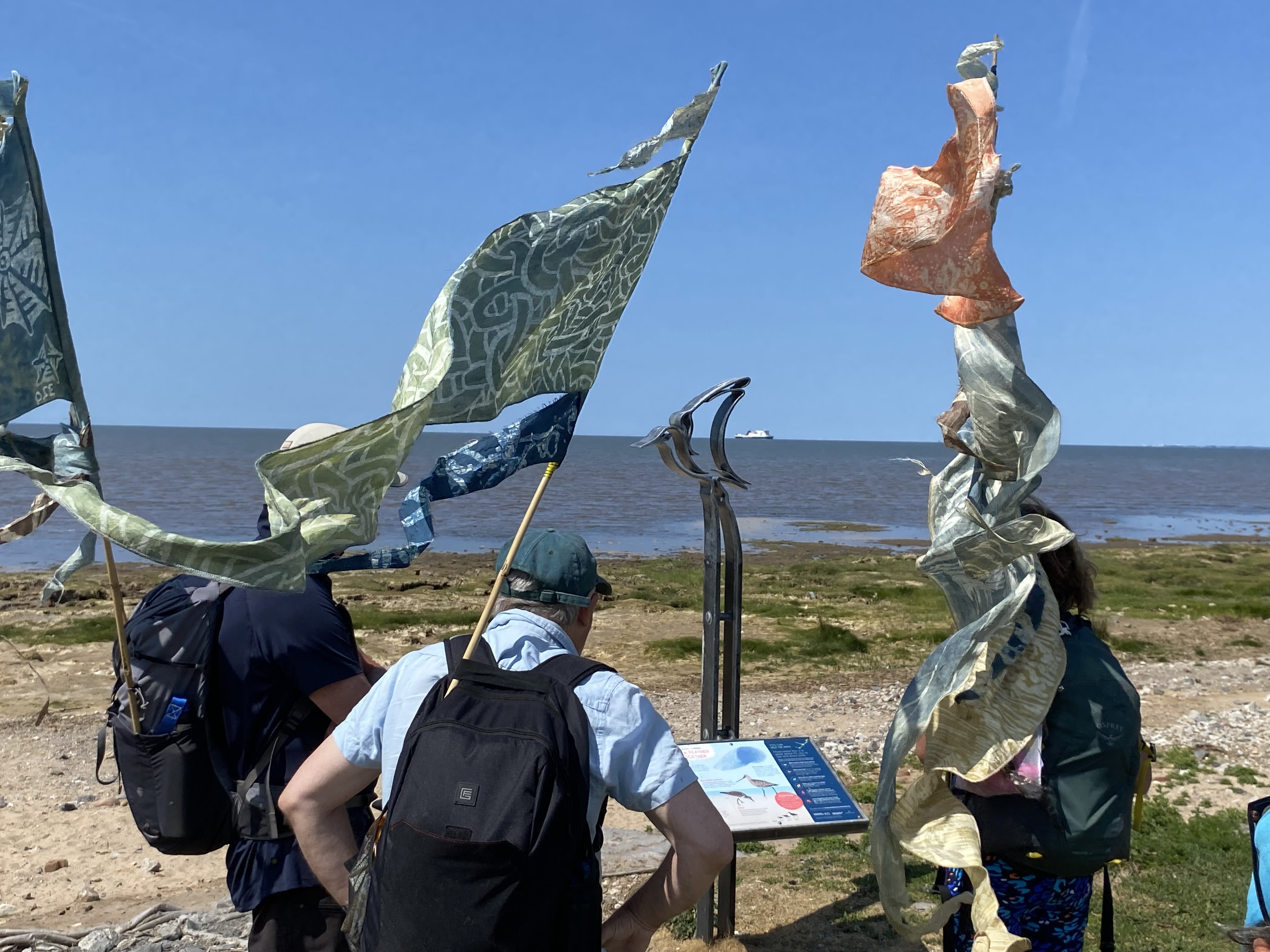
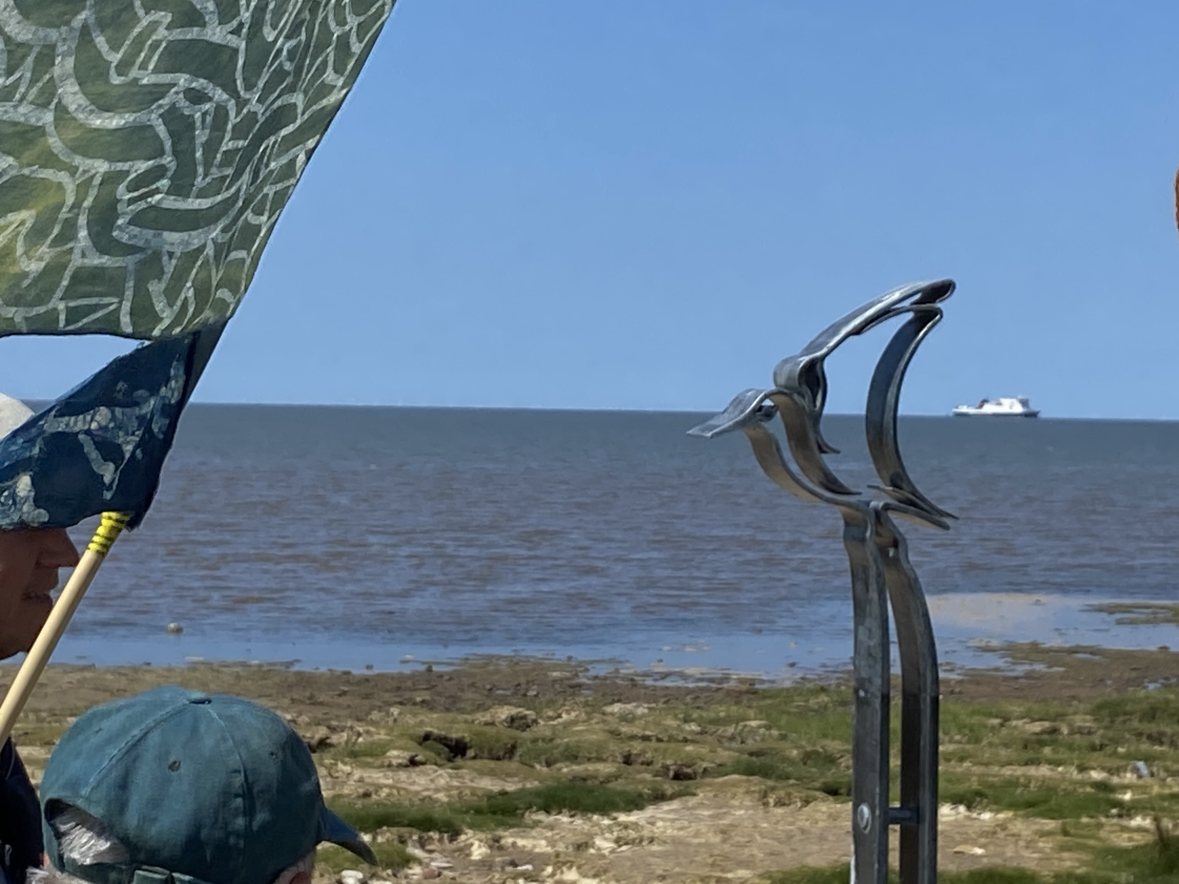
Mile 33 - Half Moon Bay
Sally Stephens
LOCKED DOWN ON THE MOON: In April 2020, the buzzword was 'the new normal', and we felt lucky amongst all the confusion: our small permitted ‘normal’ daily excursion with our 5 year old could take us to various sandy spots along the bay. We started nearer home, but the central beaches felt crowded (when crowded meant anyone else within your eyeline, basically), so gradually headed further south-west over the period of a week or so, and ended up regular beachcombers at Half Moon Bay. Some days we explored rocks and rock pools, other times we played football on the sand. In this photo, my son is getting ready to scratch greetings to grandparents and classmates, which we photographed and shared online. I like this way this photo shows the varying textures of the beach, as well as the sea and then, if you peer, the Cumbrian mountains. Living in Morecambe, we are used to these Lakeland hills appearing and disappearing with the weather. I even like my shadow ‘spoiling’ the picture, as it reminds me of the way we were all measuring out the space between people – so many metres, steps, breaths; but also so many days, weeks, months, since we’d met.
Sally Stephens
The close up, taken on Gathering Walk day, shows the contrasting lines and colours of the sand, sea, sky (sunnier and bluer this time) and the metal of Anna Gillespie’s SHIP sculpture. I love the beaches round our bay and hope that the shelter they give to the seasonal visitors (whether birds or tourists) can continue as climate change forces change on the bay itself.

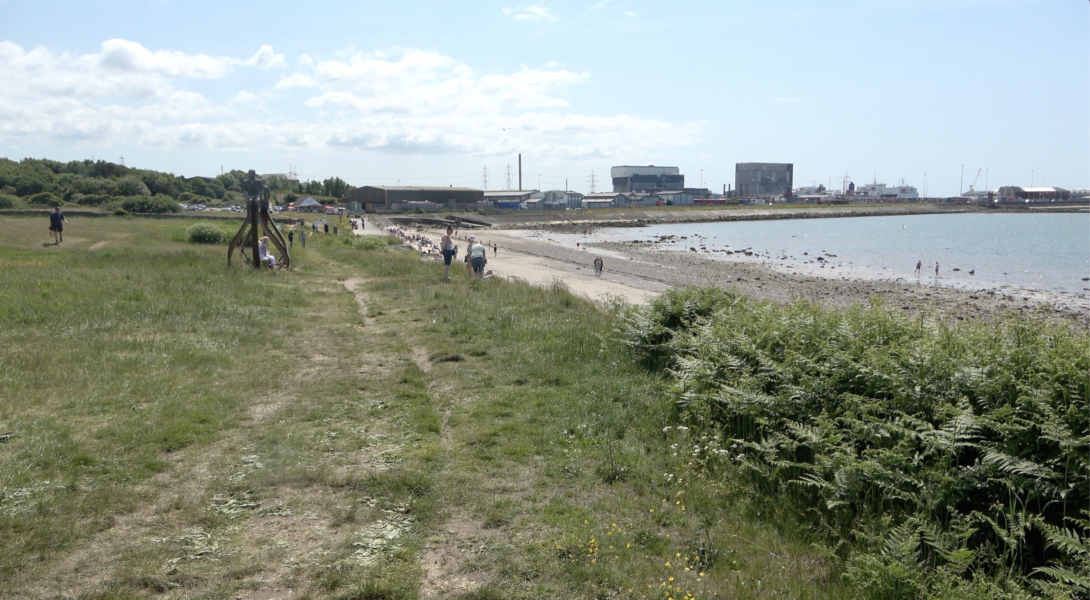

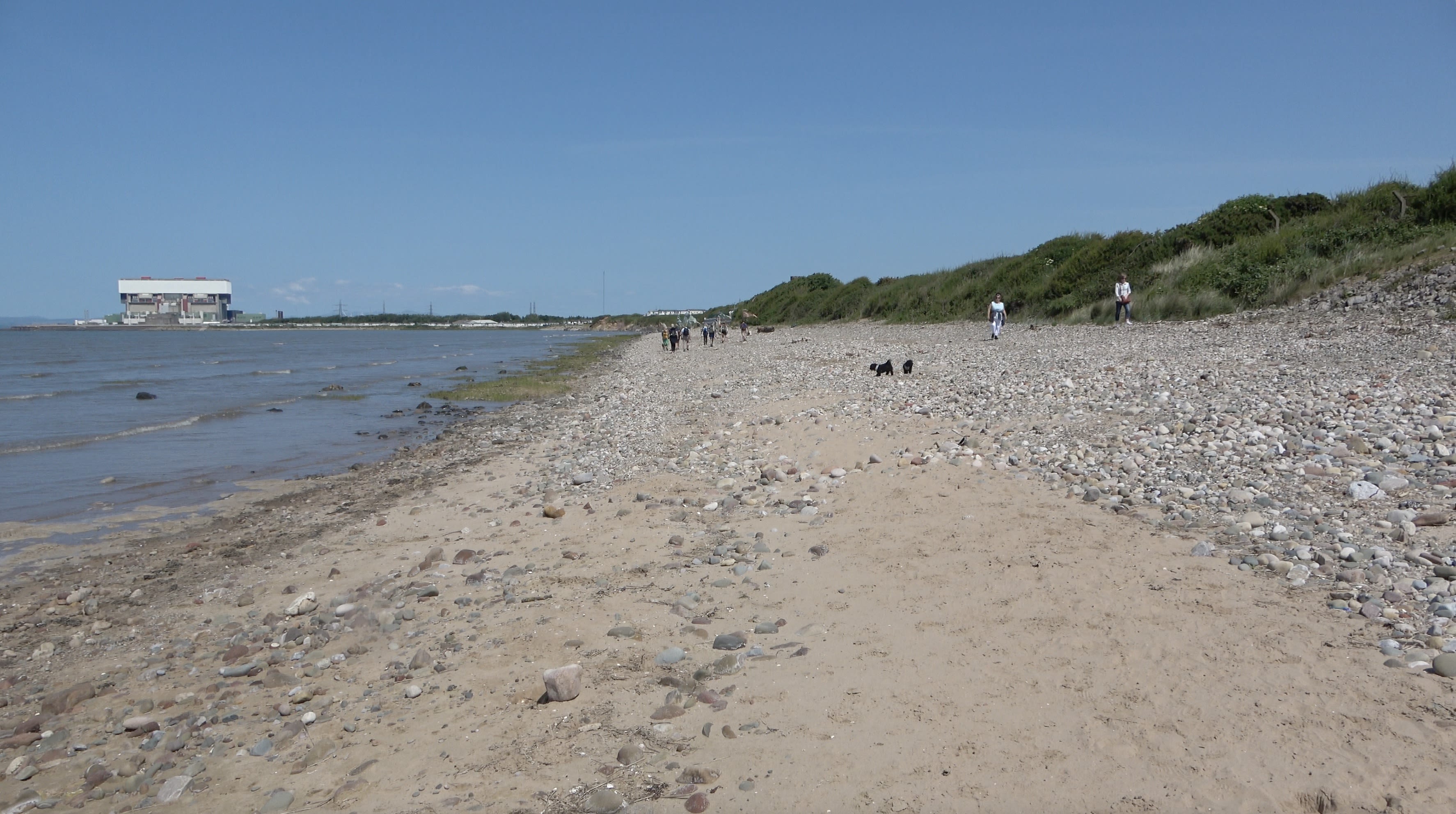
Looking south along the beach to Heysham power station and port.
Looking south along the beach to Heysham power station and port.
Miles 34 Heysham Head and Heysham Church
Heysham was a quiet fishing village until the port opened in 1904 changing the area forever.
The harbour helped establish new trading routes linking Lancashire with Ireland which saw cattle shipped across the Irish Sea. The Midland Railways' flagship Irish Mail service linked London to Belfast via Heysham until the 1970s.
Nowadays regular freight services frequently pass through the narrow harbour entrance to Warrenpoint and Belfast along with the Isle of Man Steam Packet ferry service to Douglas .
Overlooking the port, two nuclear power stations dominate the skyline while the power from a solar farm and offshore wind turbines are channelled into the national grid nearby.
Just north of the industrial site, rock graves said to predate the Norman conquest lie close to St Patrick's chapel high on Heysham Head.
The graves have reached a new audience when an image of them was used on the cover of rock group Black Sabbath's 'Best of' album.
Arguably the best view of the Bay can be enjoyed through the 8th century remains which have survived countless storms and the attentions of many visitors.
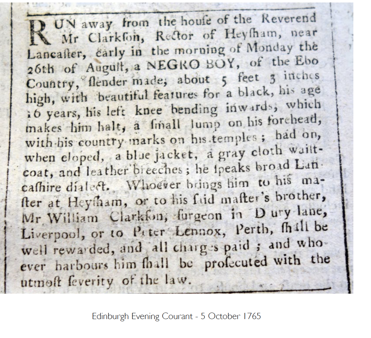
At Heysham Church, schoolchildren with Lancaster Black History Society have been investigating the links of the church and another African boy, given the name of Ebo Boy, who ran away from his master who was Rector of Heysham Church.
The boy's master Thomas Clarkson, was the rector of Heysham from 1756-1789. An advertisement was published in news journals detailing the ethnicity of the boy as being 'Ebo', an ethnic group from present-day Nigeria, and describes distinguishing marks from scarification that suggests he is African born. Such scarification marks were a symbol of prestige in Igbo culture and the fact that Ebo Boy had them suggests that he was not enslaved until after he had taken part in the ritual, which would have happened when he was six years old. Using the racist tone of language of the era, the description of the 'Ebo Boy' infers he had suffered from violent encounters.
".. about 5 feet 3 inches high, with beautiful features for a black, his age 16 years, his left knee bending inwards, which makes him halt, a small lump on his forehead, with his country marks on his temples; had on, when eloped, a blue jacket, a gray cloth waistcoat, and leather breeches; he speaks broad Lancashire dialect."


Mile 35 - Leaving Heysham
Mile 36 Morecambe West End
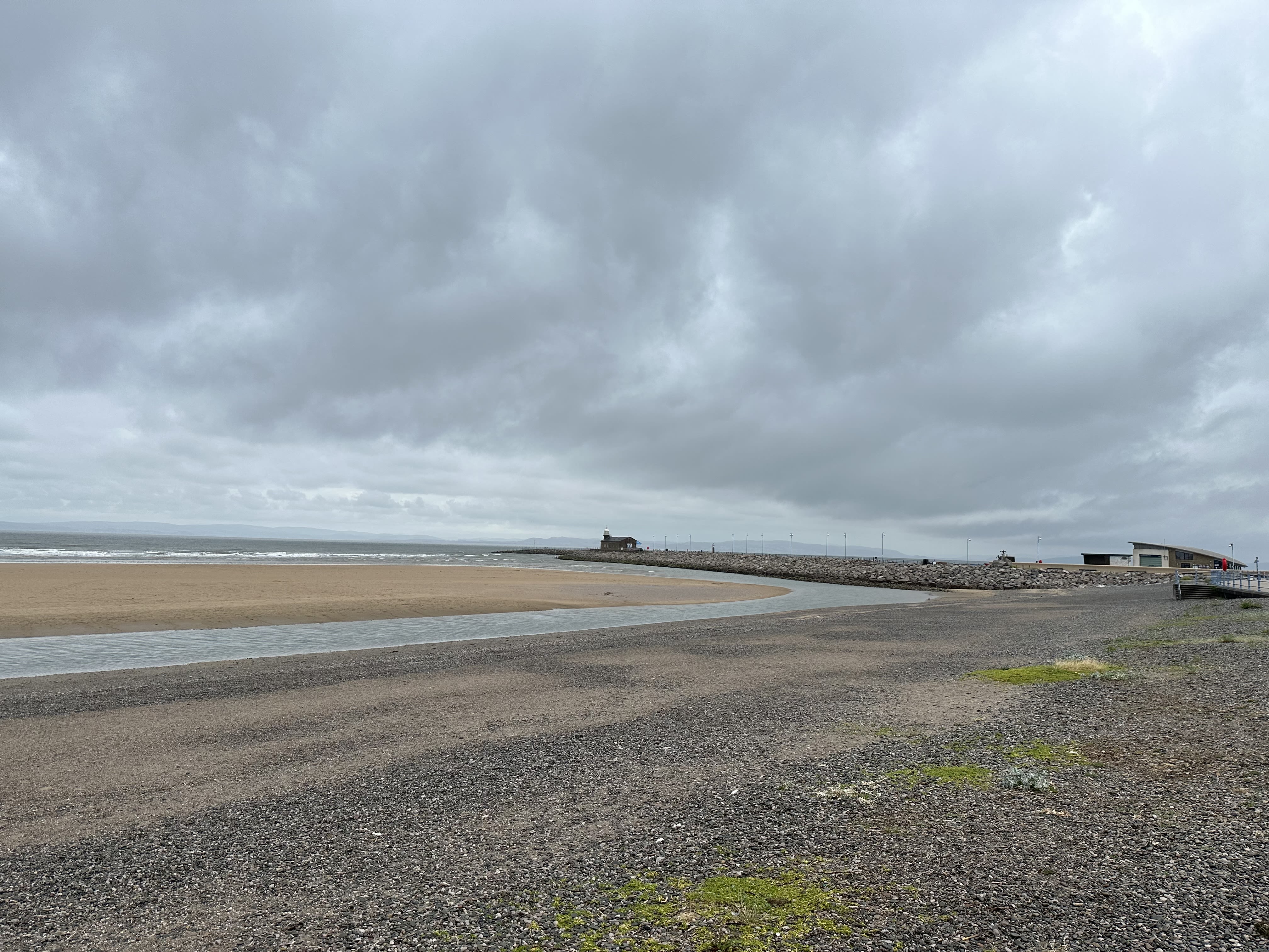
Mile 37 - Towards the Stone Jetty at Morecambe
Dawn Gosling


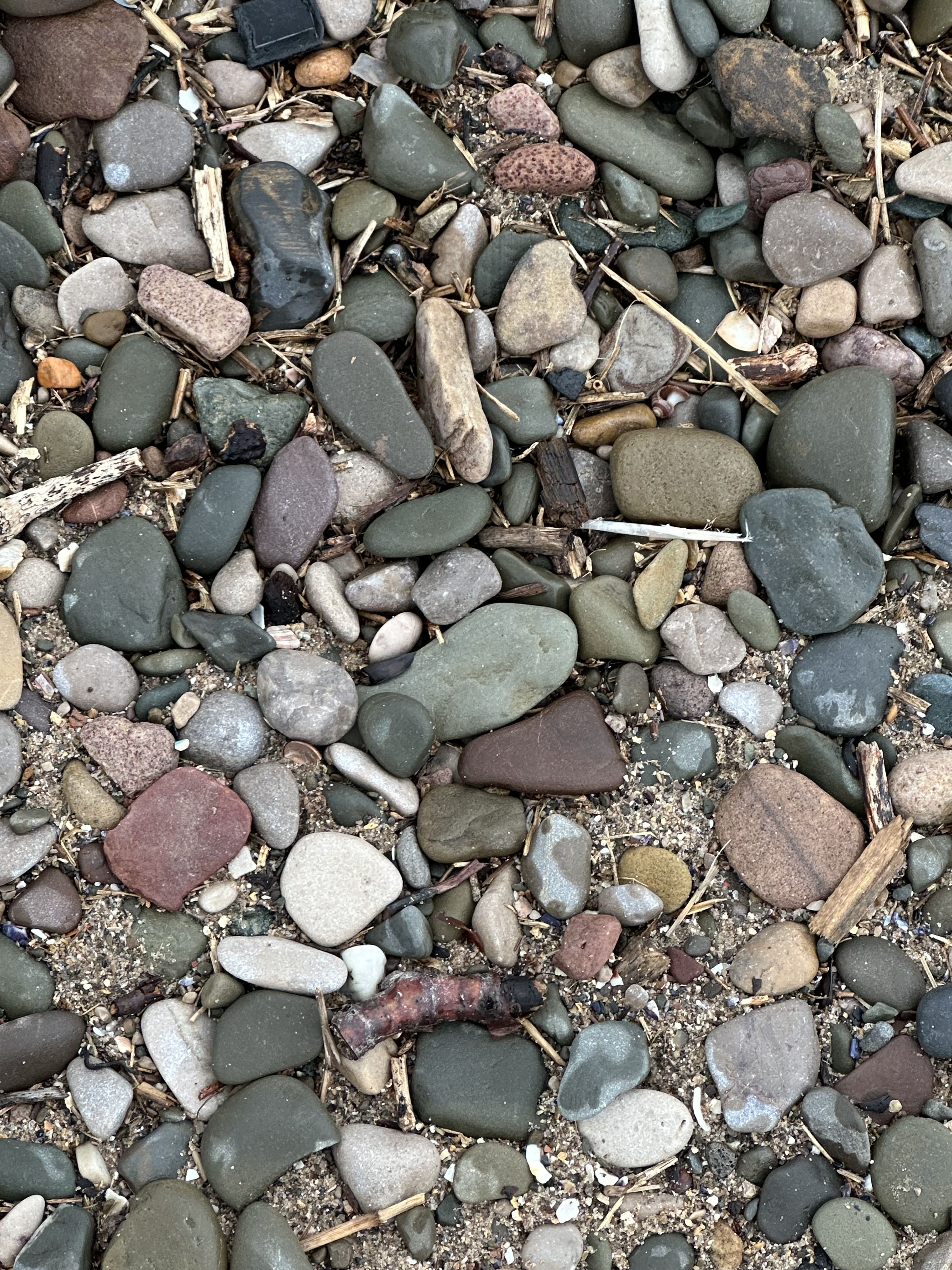

Beach Pebbles. Dawn Gosling.
Beach Pebbles. Dawn Gosling.
Mile 38 - More Music promenading with the walkers
Mile 39 - Morecambe Prom.
Greg Stephens
Stand outside the Winter Gardens now and look towards the sea. To your left, a short stroll to the Midland Hotel, Hercule Poirot territory. To your right, a couple of minutes along the prom and you'll get to Eric Morecambe: strike the pose, get a photo. In either direction you will pass many outlets for Fun and Frolics. Enjoy your Seaside Holiday.
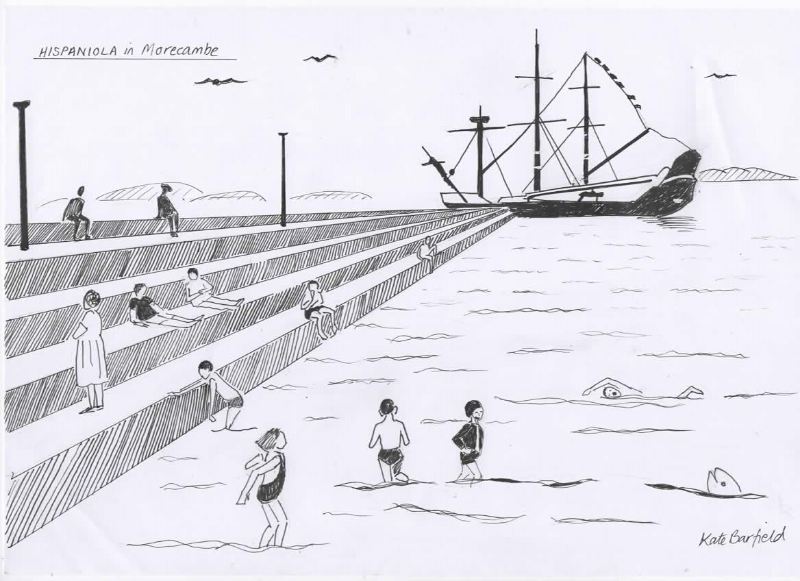
Greg Stephens - Drawing of the Hispaniola in Morecambe
Look straight ahead. A patch of grass, and a fun fair to your left. Now turn your mind back, back a little. Early summer 1970, that grass wasn't there, it was sea (when the tide was up). The Giant Steps stretch ahead on the left; in front, kids are playing, swimming, shouting, splashing. At the end of the steps is moored a magnificent three-masted ship.
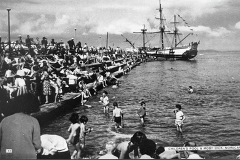
Greg Stephens - Mile 39 Morecambe promenade Swimmers Giant Steps by the Hispaniola
The Moby Dick she was called in 1970, but before that she was the Ryelands, built in 1886 in Glasson Dock just down the coast. Then she became a movie star, renamed Hispaniola, then Pequod. That beautiful ship sailed the Seas of Imagination in the wonderful films Treasure Island and Moby Dick. From the 60's she was moored here, one of the Attractions that we offered the world.
Alas, one night in June 1970 the boat burned out. She couldn't be saved. Soon, too, that bit of sea and beach was filled in, became dry land, the scene for other holiday fun.

Greg Stephens - Detail from the Promenade
That land will soon become the Morecambe Eden Project. Strange, because when the boat was a working schooner back in the day, before her movie fame, she traded in china clay. Sailing from Charlestown in Cornwall, loaded with clay dug from the very pit that the Cornwall Eden Project now sits in.
Greg Stephens - rocks on the promenade and the fells beyond
Life moves in mysterious circles, doesn't it?
But the Bay remains, the sea and the Cumbrian fells beyond.

Greg Stephens - Drawing of the Hispaniola in Morecambe
Greg Stephens - Drawing of the Hispaniola in Morecambe

Greg Stephens - Mile 39 Morecambe promenade Swimmers Giant Steps by the Hispaniola
Greg Stephens - Mile 39 Morecambe promenade Swimmers Giant Steps by the Hispaniola

Greg Stephens - Detail from the Promenade
Greg Stephens - Detail from the Promenade

Greg Stephens - rocks on the promenade and the fells beyond
Greg Stephens - rocks on the promenade and the fells beyond
Mile 40 - Bare, Morecambe
Lorraine Yuill
I chose this mile because a few months ago I moved into a house only a minute's walk from this part of the prom. I have just moved back to Morecambe after 35 years away. One reason for the move is to be near my young granddaughter. My husband and I are enjoying taking her for bike rides along the prom and to Happy Mount Park. The close-up shot is a part of the sea wall, where it opens to allow access from the prom to Happy Mount Park. My granddaughter loves the squirrels in the Park, just as I did at a similar age. I hope that in the future we prevent or mitigate the effects of climate change so that the sea wall will still be enough to protect the area, meaning her own granddaughter will enjoy the squirrels there too.
Lorraine Yuill
The wide shot is of the wiggly lines of the layers of the Lake District fells. It's the backdrop to a cycle or run along the promenade.
I'm halfway through the Couch to 5k and the views help to motivate me to get out and do it. I like to see how different it is each time.
I breathe the fresh air and feel thankful to be there, even when the run is tough.
Mile 41 - Towards Hest Bank
Valerie Shemilt
Popplewell and I went pebble stumbling on our designated stretch of Morecambe Bay.
Her with her sausage shaped body and enquiring nose, I with a ‘living in the moment’ attitude to life.

Beach pebble. Valerie Shemilt.
We were both familiar with our surroundings as we’d tripped and stumbled on these rocks before. More often than not we’d come across dismembered parts of boats; climbed up their fibreglass surfaces with a will to conquer all before us. We mostly did this alone.

View of the Lake District from the promenade. Valerie Shemilt.
Tonight, in the heat hot evening, we came across a washed up sign with the newly written words - MAY DAY. Almost immediately, I was greeted by a man, who appeared to be living in the rocks - just a little further away.
He proceeded to tell me about his desire to leave the country, to live anywhere; how he’d spent two years contemplating life and how to carve out a life that complimented his beliefs.
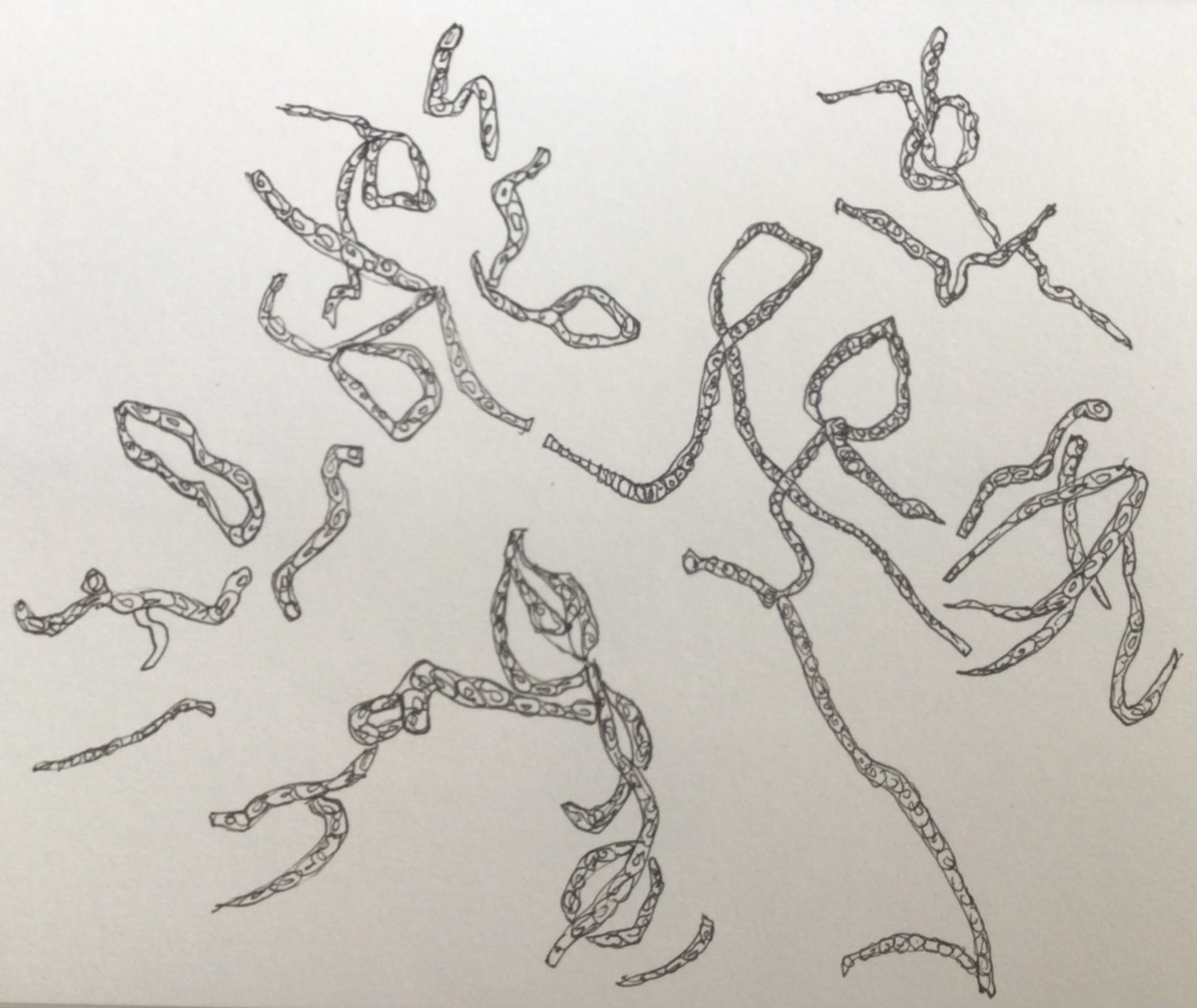
Line illustration for Mile 41 based on the pebble natural designs. Valerie Shemilt.
He told me he had lived in the rocks for two years as it was peaceful and allowed him to think.
I replied that it gave me that gift too.

Beach pebble. Valerie Shemilt.
Beach pebble. Valerie Shemilt.
View of the Lake District from the promenade. Valerie Shemilt.
View of the Lake District from the promenade. Valerie Shemilt.

Line illustration for Mile 41 based on the pebble natural designs. Valerie Shemilt.
Line illustration for Mile 41 based on the pebble natural designs. Valerie Shemilt.
Mile 42 Hest Bank- The Shore
Liz Withey
The sun beat down. It had been a stunning week filled with blue skies, crystal clear water in the Bay and an intense heat that we don’t often feel. That evening I had a vintage lens out on my camera- a Zeiss Jenna Tessar. Stupidly I had left the adapter for my modern lenses at home.
For a moment I thought about returning for it but then I thought here’s a challenge and perhaps a different way to look at the Beach of Dreams. Every shot manually focused, something I used to hate until recently, and testing different apertures, it felt like I was back in my days of film.
I had visited this shore so many times, in all weathers and tides. Priest Skear, still above the incoming tide, I paused to think of the Chinese Cockle Pickers so tragically lost to the sea. Much has been revealed this winter with the old jetty appearing from beneath the mud, now gleaming in the evening light.
I hoped the sands would be forgiving and that the jetty would stay with us for a while. I ventured out a little towards it, aware the tide was due within a couple of hours and the water was already lapping its edges. I didn’t stay.
The Shore was busy by this point. It was its usual eclectic mix of visitors. Someone asleep in their car, dogs of all varieties, partiers in their vans with the usual kind of music accompanying them.
That could have almost ruined things were it not for the song of the blackbird which reminded me nature is never too far away and that when all the folk have left this shore it would be reclaimed again, and peace would resume.
I turned again and faced the Bay, leaving people behind. I looked to Black Combe and the sun dipping towards the fells, a landscape full of life, memory and friends. I have walked many of those fells, swum in their waters and pottered round their valleys. I trace them all then my eye rests on Warton Crag, with Red Bank below, the one closest to home.
The mile photos and stories of Bay Lines - Beach of Dreams, 120 Miles of Morecambe Bay, continue on Section 3 - Hest Bank to Arnside and the Bay Walk.