Bay Lines -Beach of Dreams
Hest Bank to Arnside & the Bay Walk - Miles 43 to 59
Mapping 120 Miles of Morecambe Bay through photos, stories and drawings
Created for Morecambe Bay Partnership by Rosa Productions and participants from across the Bay.

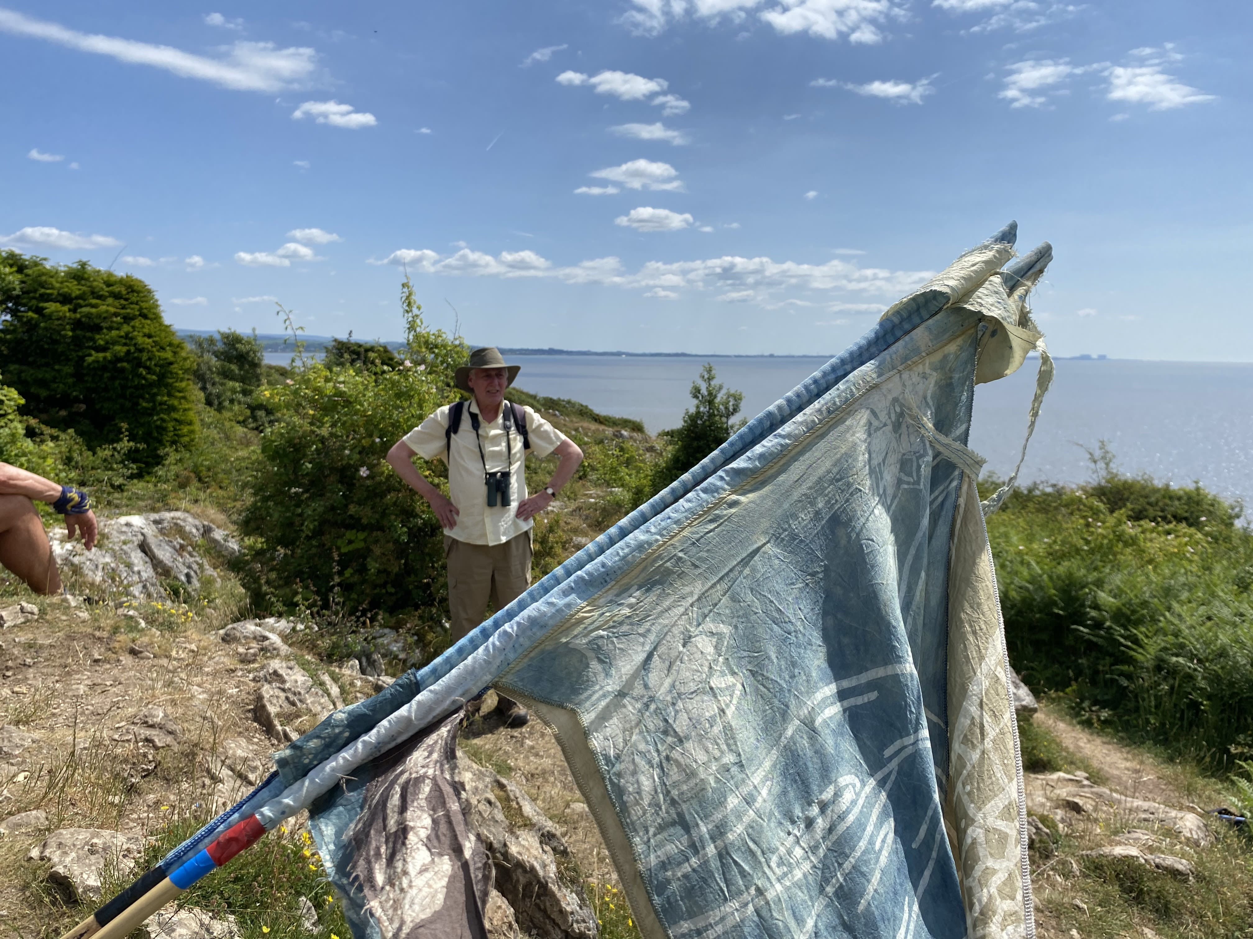
The Bay Lines - Beach of Dreams project maps 120 miles across Morecambe Bay. In June 2023 artists and walkers from the arts organisation Kinetika walked the whole route of 120 miles around Morecambe Bay carrying silk pennants representing miles of coastline. Their mission - to create 120 new silk pennants, one for each mile of the Bay, to be designed from the mile images and stories contributed by members of the public around the Bay and to be displayed as a coastal art installations at 4 locations across the Bay over August Bank Holiday weekend 2023. The project was commissioned by Ways Around the Bay from the Morecambe Bay Partnership.
Kinetika is working with Kendal-based Rosa Productions as part of a wider multi-year Beach of Dreams exploration of the UK and Ireland coastline.
The is the third of five sections - from Hest Bank to Arnside and Storth with the guided Bay Walk from Arnside to Grange-over-Sands. We walk and map the 120 miles of coastline of Morecambe Bay with photos, stories, and drawings from the Bay Lines, Beach of Dreams participants.
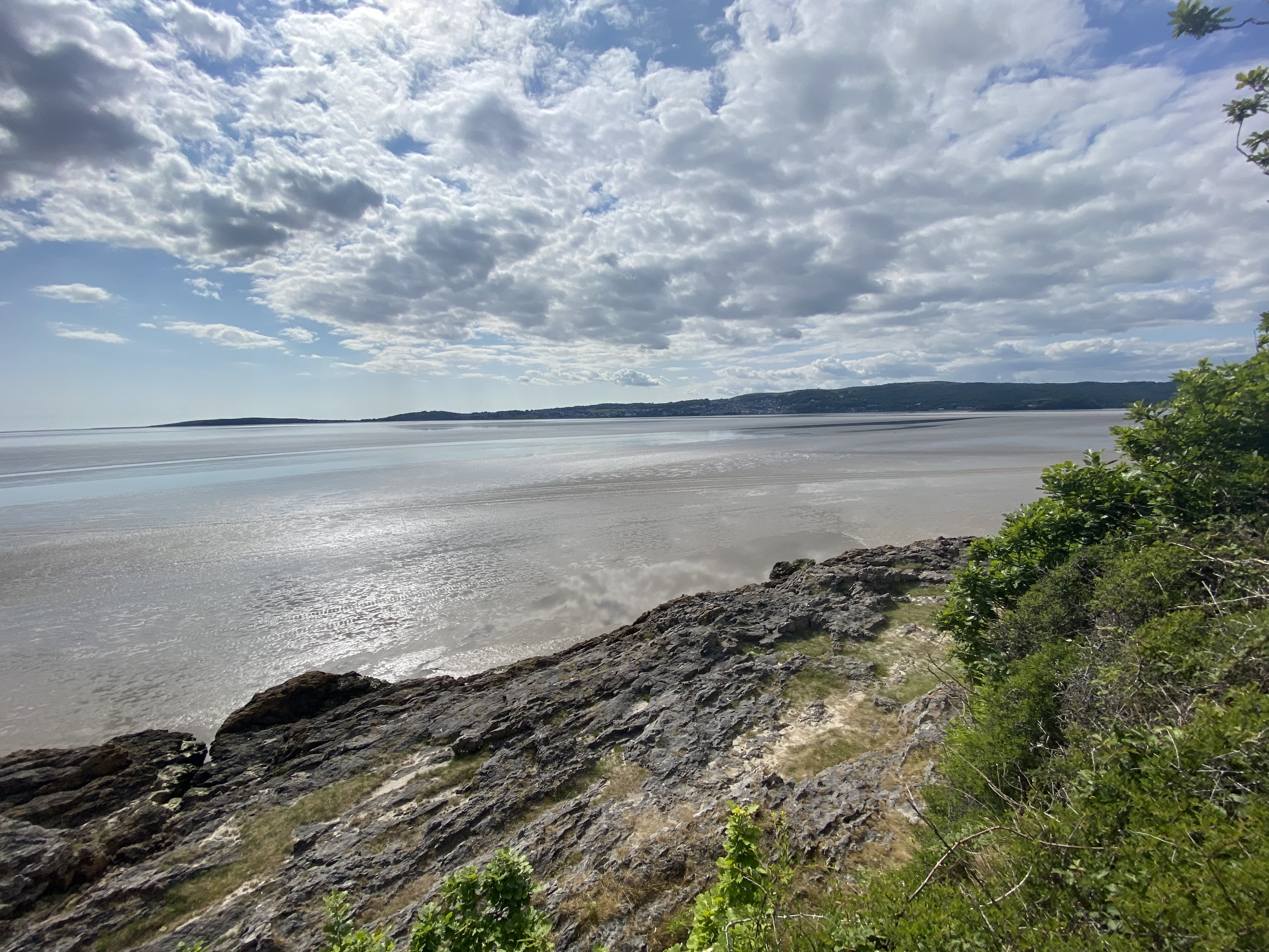
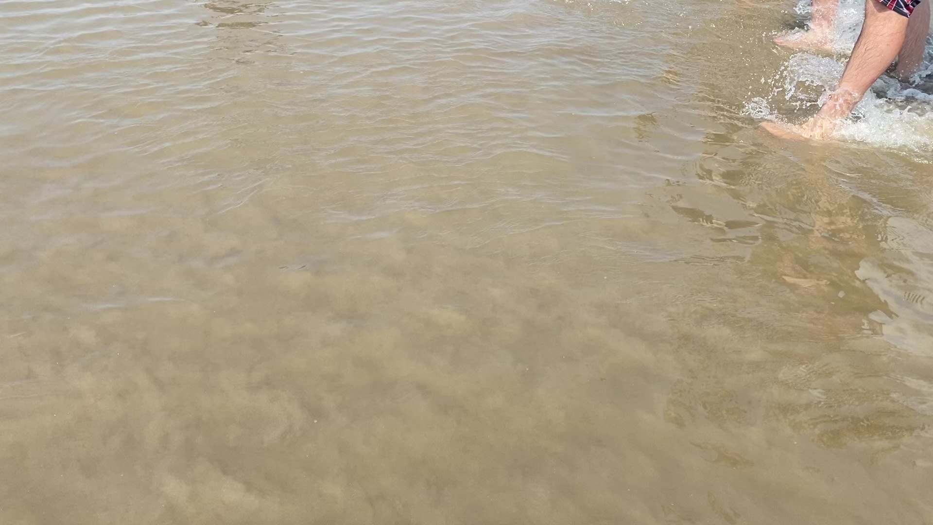
Mile 43 Bolton-le-Sands
Kim Sissons
I’ve walked the shore at Bolton-le-Sands since I moved here when I was 10 years old, over 40 years ago now! I remember when we first moved how amazing it felt to live somewhere where you could just walk to the beach.
At the time we had a little black Labrador who loved rolling in dead seagulls, swimming in the sea and digging out the stones from the shoreline. My dog walks provided the backdrop to my teenage years. First of all with family and then with friends, boyfriends and best of all on my own.
Kim Sissons
The landscape never gets old. Will the sea be licking at your toes or so far away you think it will never return? Can you see the wind turbines and Lakeland hills far in the distance or is the fog misting up your glasses?
Times move on and I moved away but eventually returned, this time with my own children, playing in the channels, jumping over the dykes in the salt marsh, covered in mud and sand. Now they’re nearly grownup I bring my own dog instead, a boxer, still rolling in seagulls but avoiding the water like it’s something alive, except of course when she tries to drink it, which never ends well!
Bolton-le-Sands doesn’t have a traditional beach. The salt marsh is rough, uneven and ever changing. The sea never seems to be deep enough to swim in, however far out you paddle; the sand can be muddy and spiky with broken cockle shells, the power of the wind can be enough to knock you off your feet but the views are breathtaking and two days are never the same. I wouldn’t want to live anywhere else. For me, it’s perfect.
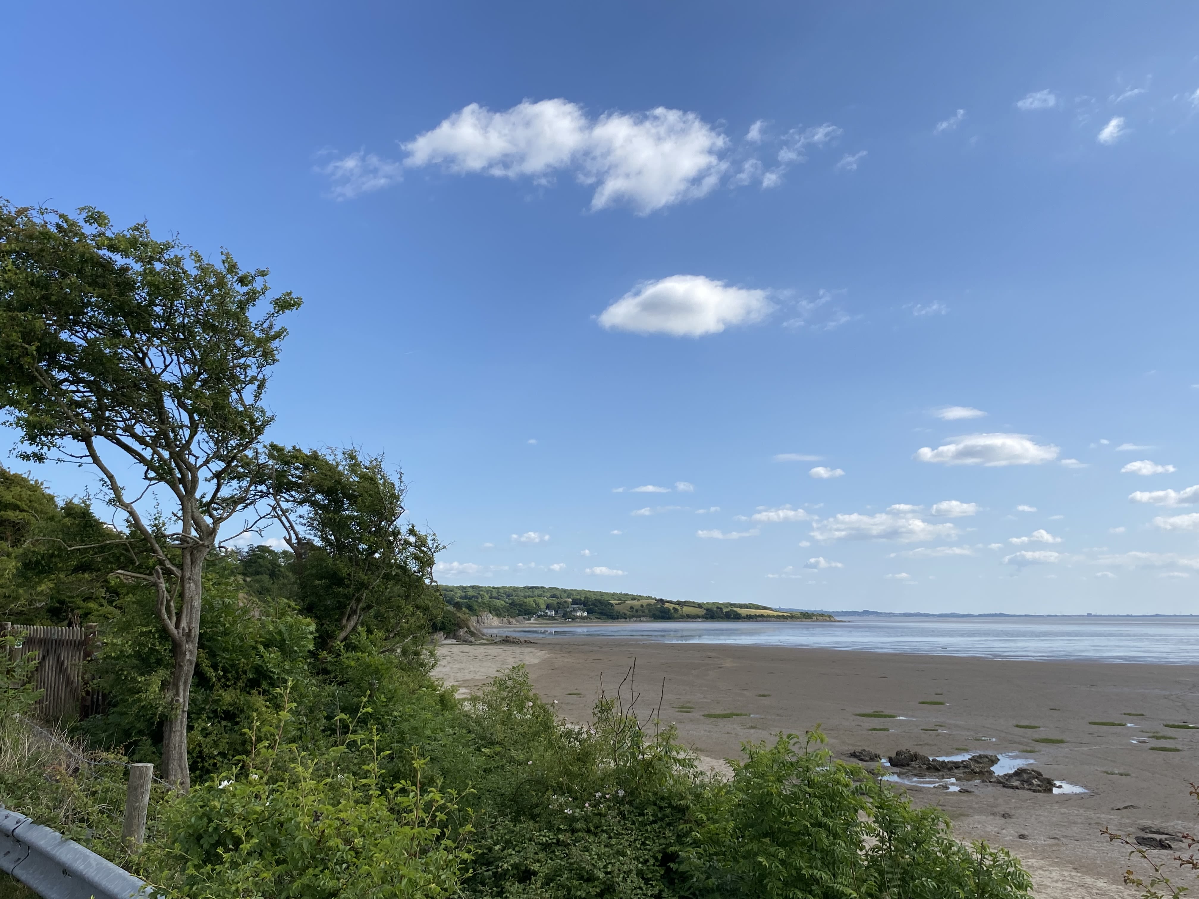
Mile 44 - Warton coastline
Joanne Hall
Dry, so dry the land looks; the cracked earth below our feet. The sun has parched the ground as we walk and take in the tranquillity of another mile together. All three of us live so close to this location, yet not one of us has walked this path, here. The surface has altered as we scrutinise the dried mud, grasses and divots surrounding us.

Salt encrusted beach plants. Joanne Hall.
What amazed us all was the ribbon-like mess of, what we believe to be a form of seaweed, unknown to all of us. As we scrutinise the look and the feel we still are unsure what the hard and dry thread like scene could be.
Mile 44. Line drawing of beach plants for pennants. Joanne Hall
So white and varied in thickness and shape. Whatever it is, it looks out of place.

Salt encrusted beach plants. Joanne Hall.
Salt encrusted beach plants. Joanne Hall.

Mile 44. Line drawing of beach plants for pennants. Joanne Hall
Mile 44. Line drawing of beach plants for pennants. Joanne Hall
Joanne Hall
As the land separates from the sea line we can see what it reveals in the layers of the earth down below.
How can the land just end in such a way to reveal the varied layered textures? Some smooth- but clearly visible layers, that strangely remind me of a lasagne being cut with a knife!
We chat about the banger racing that we can see over the rippled meander of water. We chat about the noise and, again, recall the few times between us we have seen the cars race around.
As we walk, we refocus on the ground. The gaping holes, where sods of earth used to sit. Have they just been lifted up to the heavens to reveal what is down below? Crab remains of legs and claws, but if you are quick you will catch the odd crab, still alive, seeking shelter in a hole.
Miles 45 – Beyond Bolton-le-Sands
Hannah Rutherford
Beyond the regularly visited shore at Bolton-le-Sands lies a stretch of grassy marsh land that leads us away from the tide line. On the day of our walk, it hadn’t rained for several weeks. Perhaps the reason it isn’t a more popular stretch, is for the meandering inlets and channels, usually boggy and filled with muddy water. The dried channel beds were solid underfoot, there was no danger of going ankle deep in smelly bog water today.
We eventually swap the firm footing of solid mud for a solid tarmac stretch of road often used as a 'rat run’. We are forced to share the route with vehicles, dipping into the side of the road to let them pass. As we meet the Lancashire Coastal Way, we cross over a channel and spot some ducks and ducklings about their business.

Railway. Hannah Rutherford
The feel is more industrial now as we are flanked by a metal fence allowing glimpses of the railway storage yard to our right and a tall hedgerow barrier of blackthorn, various brambles and dehydrated gooseberries. Over a stone bridge the railway line is clearly visible, no trains were spotted today - the line takes passengers from Carnforth Station out to ‘Sunny Silverdale - the loveliest spot on Morecambe Bay’ as the sign at the railways station boasts - a slogan with which I wholeheartedly agree.

Sweet peas - the prettiest spot on this mile. Hannah Rutherford.
The prettiest spot on this stretch of our walk is a host of colourful sweet peas growing over a stone wall in someone’s garden.
Railway. Hannah Rutherford
Railway. Hannah Rutherford

Sweet peas - the prettiest spot on this mile. Hannah Rutherford.
Sweet peas - the prettiest spot on this mile. Hannah Rutherford.
Mile 46 - Warton Crag
Hannah Rutherford
With the boxy silhouette of Heysham Power Station and the skyline of Morecambe visible on the horizon we begin to rise up gently following a footpath leading towards Warton Crag.
The exact path is difficult to find, with some sections overgrown and way markers obscured from view. We stomp through long grass, reminded of story time with our children when we all went on a Bear Hunt at bedtime. Swishing and swashing through the long wavy grass, we eventually make it out to the road.
The imposing limestone quarry is visible on the side of Warton Crag. We reminisce again about walks and picnics 'up the crag' with our children, now grown up and taking themselves off climbing and picnicking with their friends as companions.
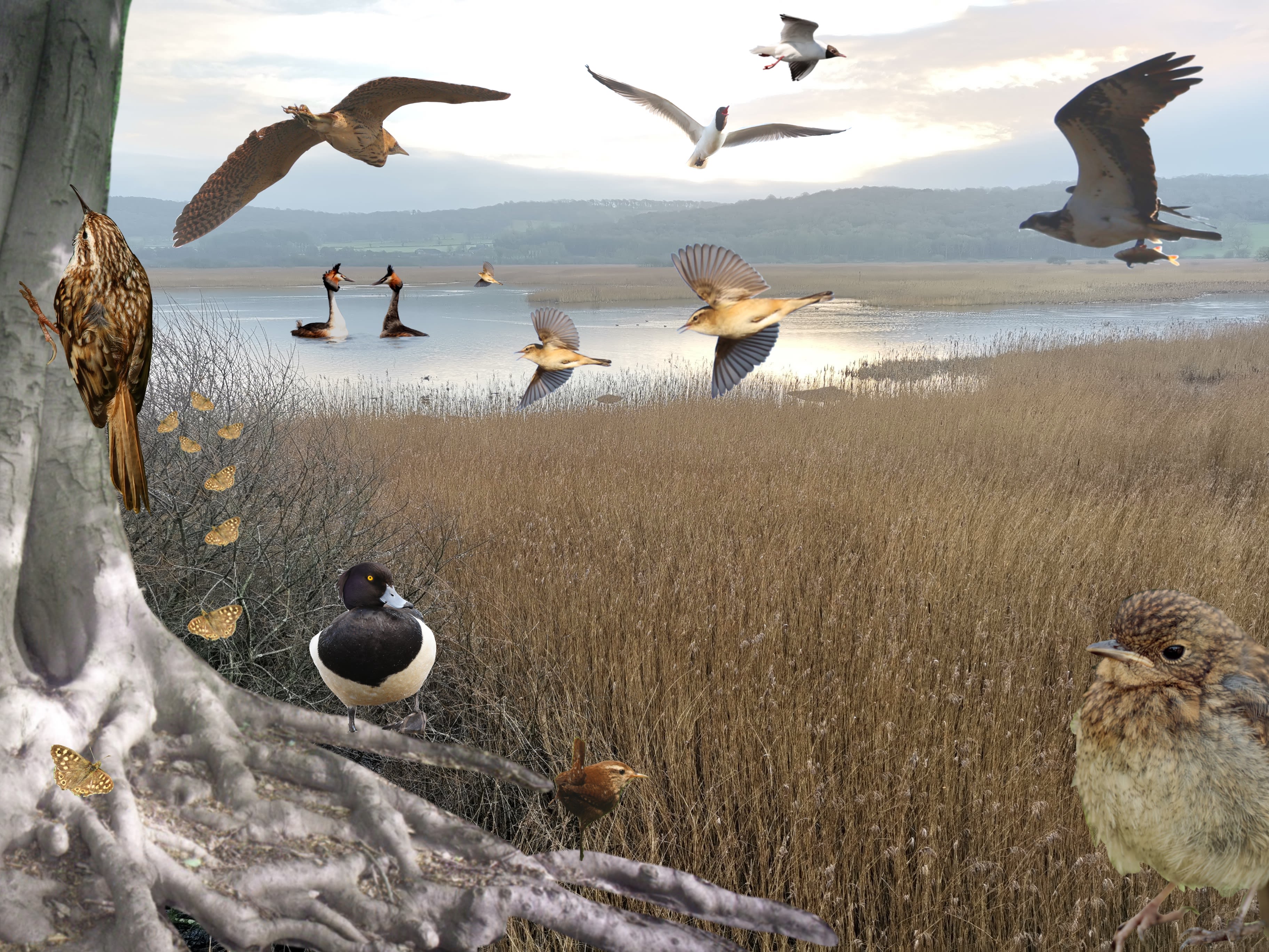
This stretch is elevated enough to see the houses of Warton and back across towards Carnforth.Looking out towards the coastline we can see the outer reaches of Leighton Moss. This is a land of reedbeds, mudflats, coastal marsh and saltwater lagoons, all set against the shores of the nearby Morecambe Bay.
But explore a bit further and you will also find pockets of woodland and limestone grasslands. The huge wetlands and the reedbeds which surround them are where to spot nationally important breeding populations of bearded tits, marsh harriers, reed warblers and bitterns. The reserve’s coastal marshes attract flocks of waders including avocet, oystercatcher, curlew, redshank and dunlin.
Mile 47 - Approaching RSPB Leighton Moss
Mile 48 - Leighton Moss Nature Reserve
Sue Burton

Nature Reserve
When I visit RSPB Leighton Moss, I like to arrive early on a mid-week morning and almost have the place to myself. So I am slightly downcast whenever someone has beaten me into Lilian’s hide; my solitude is incomplete and I can’t fully concentrate on the birds, water, sky and surrounding landscape. Only once the early bird has moved on can I exhale and settle in, absorbing the tranquillity of the purely natural sights, sounds and movements. Often, a breeze produces a wonderful woosh in the reed-beds all around. I sit for over an hour and feel entirely at peace, basking in the sunlight warming the wide South-East-facing windows and feeling at home with the winged creatures I fell in love with decades earlier.
I wonder what it is about birds that so many of us are attracted to? Their vast variety of colouring, size and type is surely a factor, for there are birds for everyone and it would take more than our lifespan to experience them all. As a shy teenager, they seemed reassuringly non-threatening: light, fleet, soft and surely delightfully weightless to hold. I identified with birds, somehow. Years later, a friendly colleague remarked that I reminded her of a chirpy sparrow hopping about the corridors! And one time I stared so intently at one of my favourites, a collared dove, that for a few unforgettable seconds I had the strangest sensation that I was that bird; there seemed to be no division between it and me .
There are other occasions at the reserve when I do relish the camaraderie in the hides. When a whisper of “osprey!!” goes up and we all crane to spot the Foulshaw visitor, or when a line of cameras whirr simultaneously as an otter breaks the surface of a Lower Hide pool, we are all caught in the same ripple of excitement. We are all one.
Perhaps this is the wonder of birds, and of wildlife in general? We can be individually moved by nature and, equally, we can feel collectively awestruck in its presence. Introverts, extroverts, and those of us in between, we all tend to become centred, uplifted and connected by paying careful attention to the natural world.

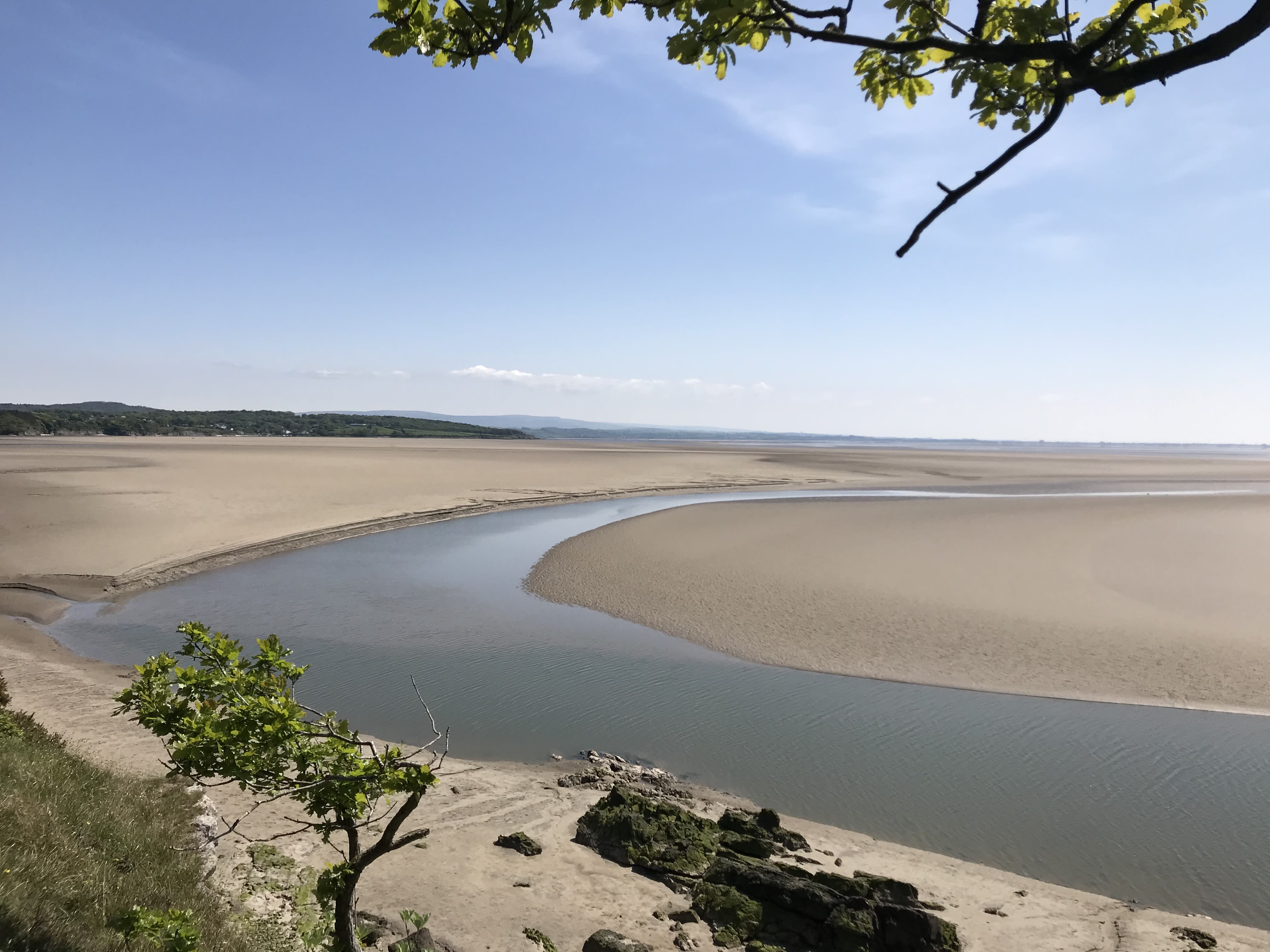
Mile 49 - Jenny Brown's Point
Simon Williams
At Jenny Brown's Point the Kinetika walkers meet local historian Simon Williams who relates the history of Jenny Brown's Point.
"Jenny Brown was born in Dyke House Farm. She was born as Jenny Walling in the early 17th century. She had a daughter who she named Jenny as well. So there were two Jenny Brown's here. She married a Brown.
We have no idea why her name stuck on this beautiful place, but there are fairy tales; she rescued some children from the sea; She waved her lover off in his boat, never to see him again; She kept pigs here; She kept a house of ill repute here.
There are lots of local stories. Probably none of them true.
And then there is the story of the chimney.
This was built by a Lord of the Manor of Yealand, Robert Gibson, around 1785, to 1790.
He built a copper smelter. It's a small scale chimney, it had a smelting equipment probably brought in by Welshmen who were the experts in copper in those days and materials would flow in and out on the high tide.
A lot of the time this is just a muddy creek. But at high tide you could bring a sizeable boat.
There was a little bit of copper, but not enough to feed a big smelter like this.
The real short answer to what happened here is that it was built in a really bad place. This tide can actually swim right round the chimney. IN the end it failed. There wasn't enough copper.
This was a hobby level project, not an industrial level project.
And Robert Gibson died. So it only had a lifespan of two or three years."


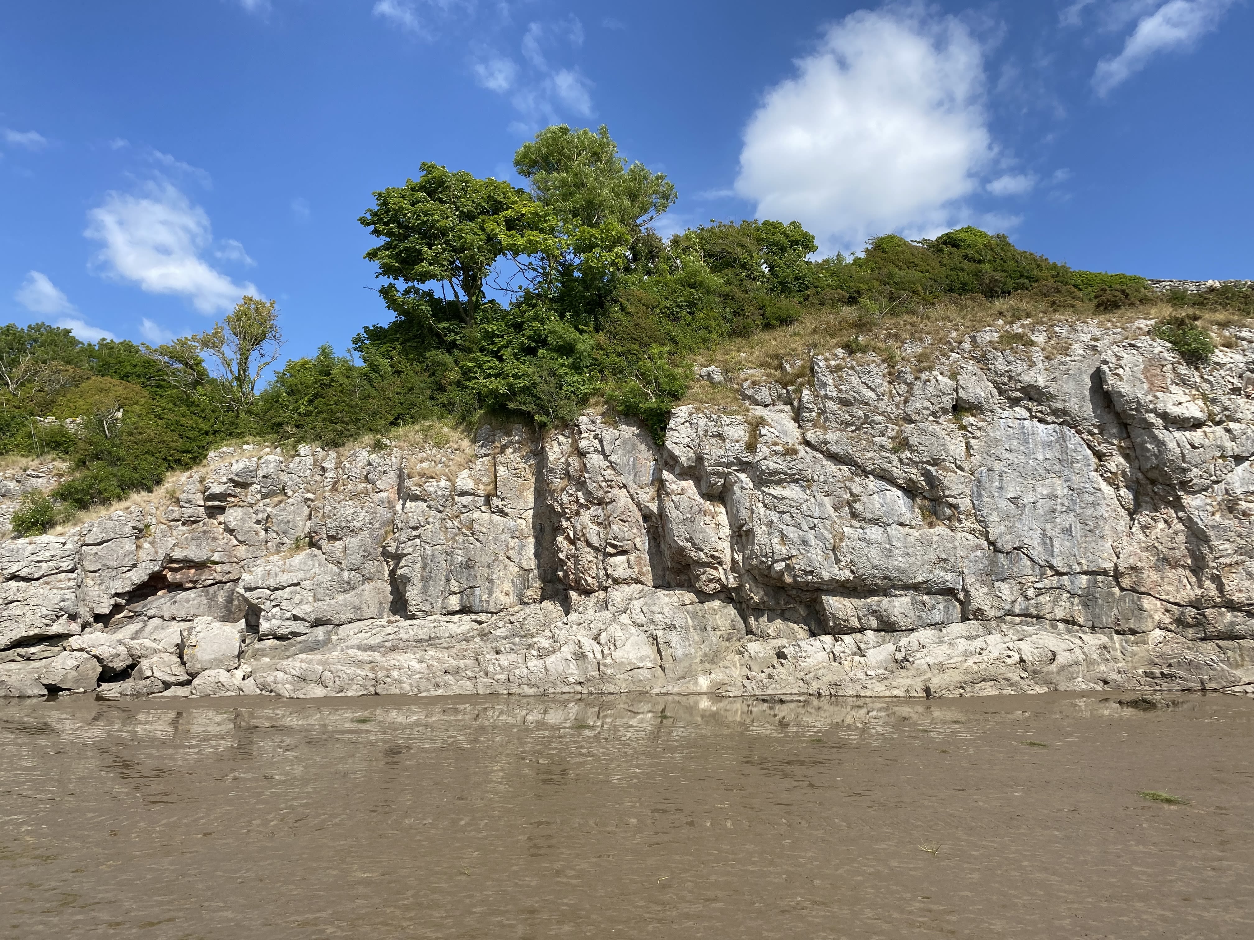


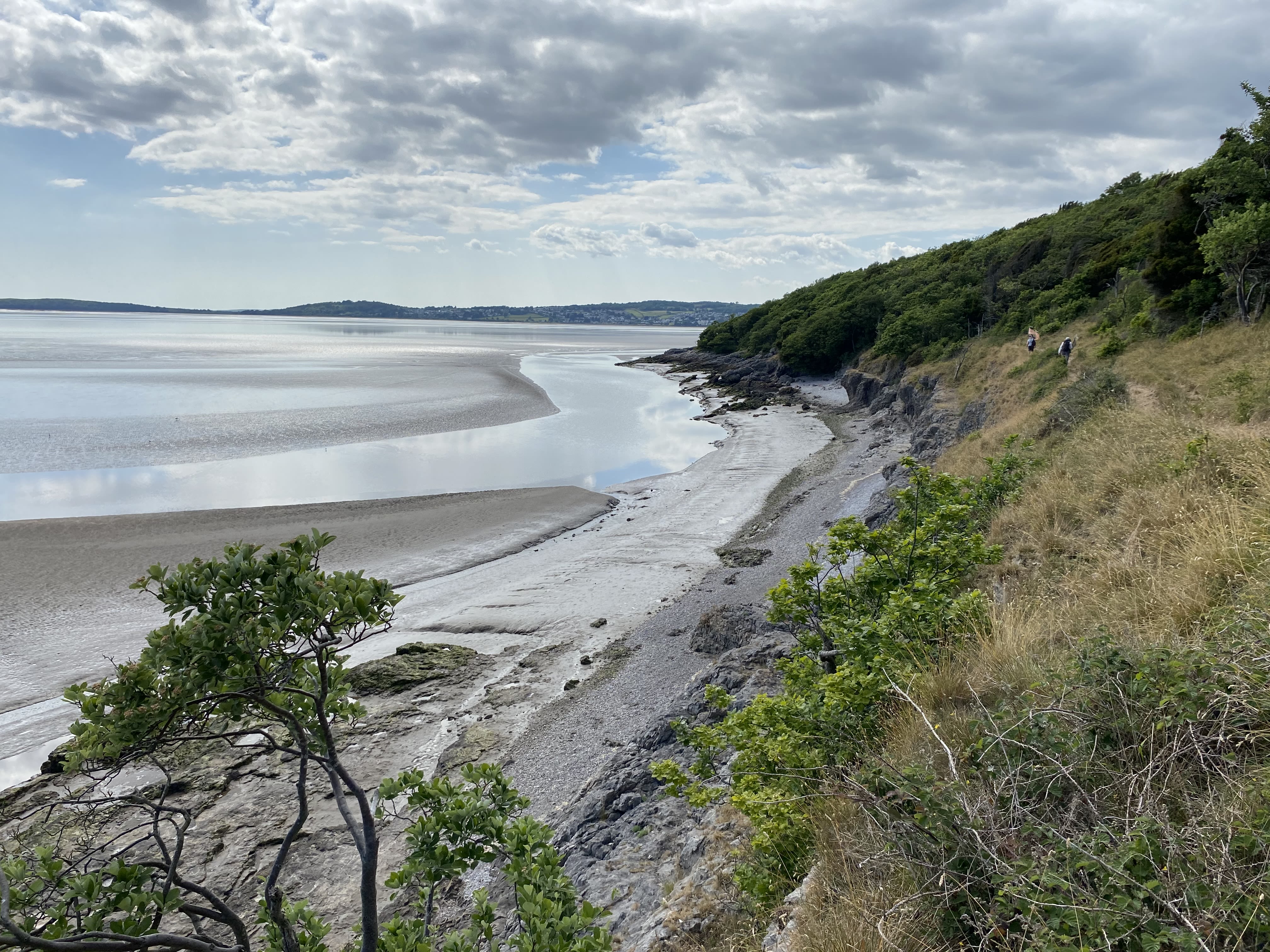

Mile 50. Silverdale.
Mile 50. Silverdale.
Mile 50. Crag at Silverdale.
Mile 50. Crag at Silverdale.
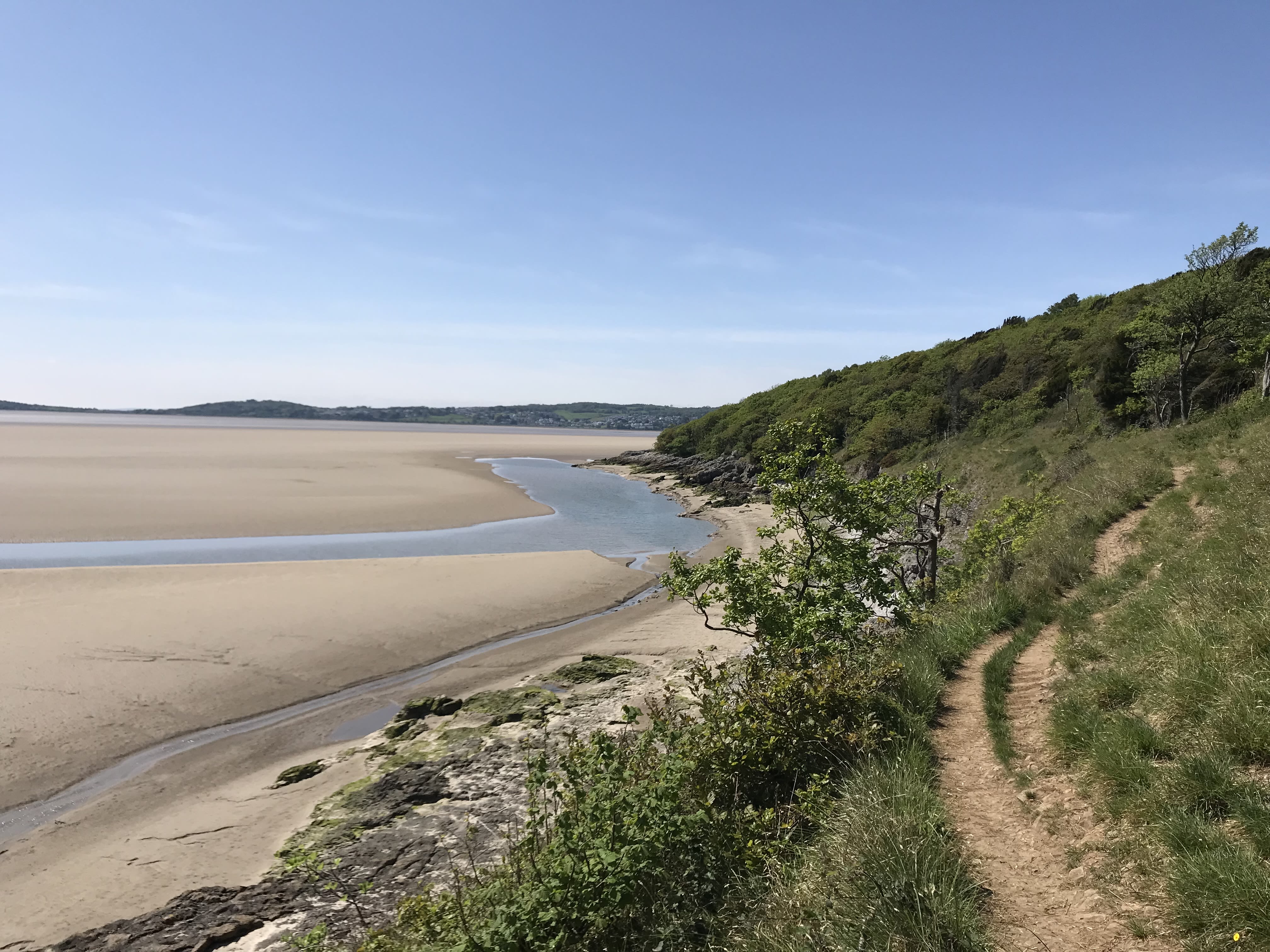
Far Arnside.
Far Arnside.
Far Arnside.
Far Arnside.
Far Arnside.
Far Arnside.
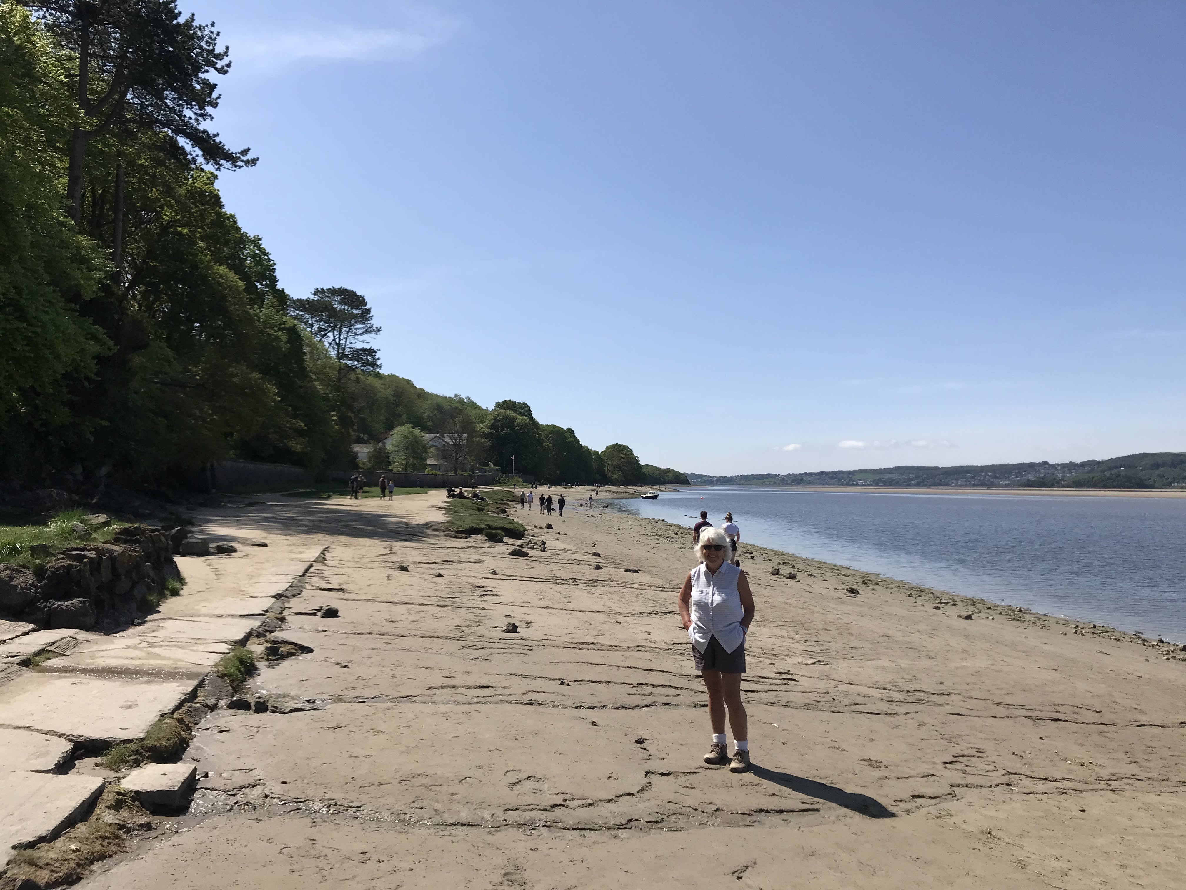
Miles 51 and 52
Angela Horsley MBE
I have been walking along this stretch of beach for many years and I have been visiting this area for nearly 60 years.
The area is timeless and the only indication that time is moving on is evidence of the erosion or formation of new water channels.
Mile 51. Angela Horsley.
As a child I remember swimming in the channels with my siblings when visiting an aunt and uncle who lived in Lancaster and we came here during the school summer holidays.

Mile 51. Angela Horsley.
At times it is possible to walk on the sands and the only sound that you can hear is either the call of the Oyster Catchers or witness the chatter of the Curlews as you are walking along. A real mindfulness moment that helps take away any thoughts or worries of the world whilst embracing the beauty the coast.
Mile 52. Angela Horsley
I love to see the trees that line the coastal cliff path. Trunks that ordinarily grow straight have been shaped by the power of the wind and force them to lean inwards, reminding me of the power of nature. I also love to hear the eerie sound of the siren alerting people that the bore of the wave is on its way . The sound of the gush of the tide is evident at certain times of the year depending on the height of the tide and where you are, on your journey along the coast.
Mile 52. Angela Horsley
I love this coast and share my enthusiasm for it with friends and family, mindful that too many visitors to this coast at the same time may give it quite a different feel.
Mile 51. Angela Horsley.
Mile 51. Angela Horsley.
Mile 51. Angela Horsley.
Mile 51. Angela Horsley.
Mile 52. Angela Horsley
Mile 52. Angela Horsley
Mile 52. Angela Horsley
Mile 52. Angela Horsley
Mile 53 - Arnside Bore
Margaret Parker
Arnside Bore is strong and powerful,
transforming the bay in magical moments.
I particularly enjoy the sound and sights of the
turbulence as the bore travels along the shore.

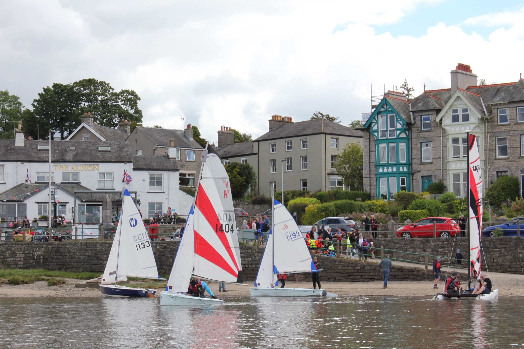
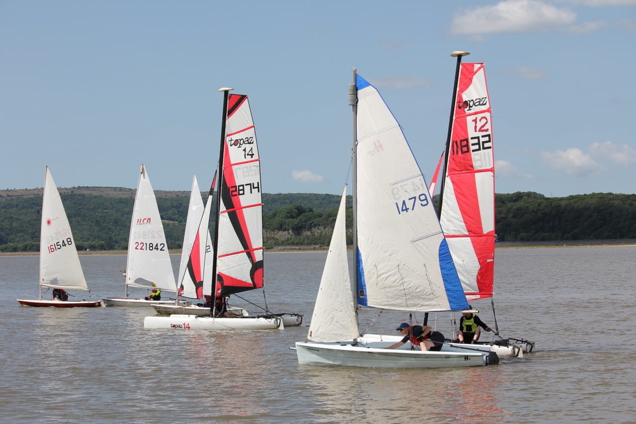
Mile 54 Arnside Sailing Club

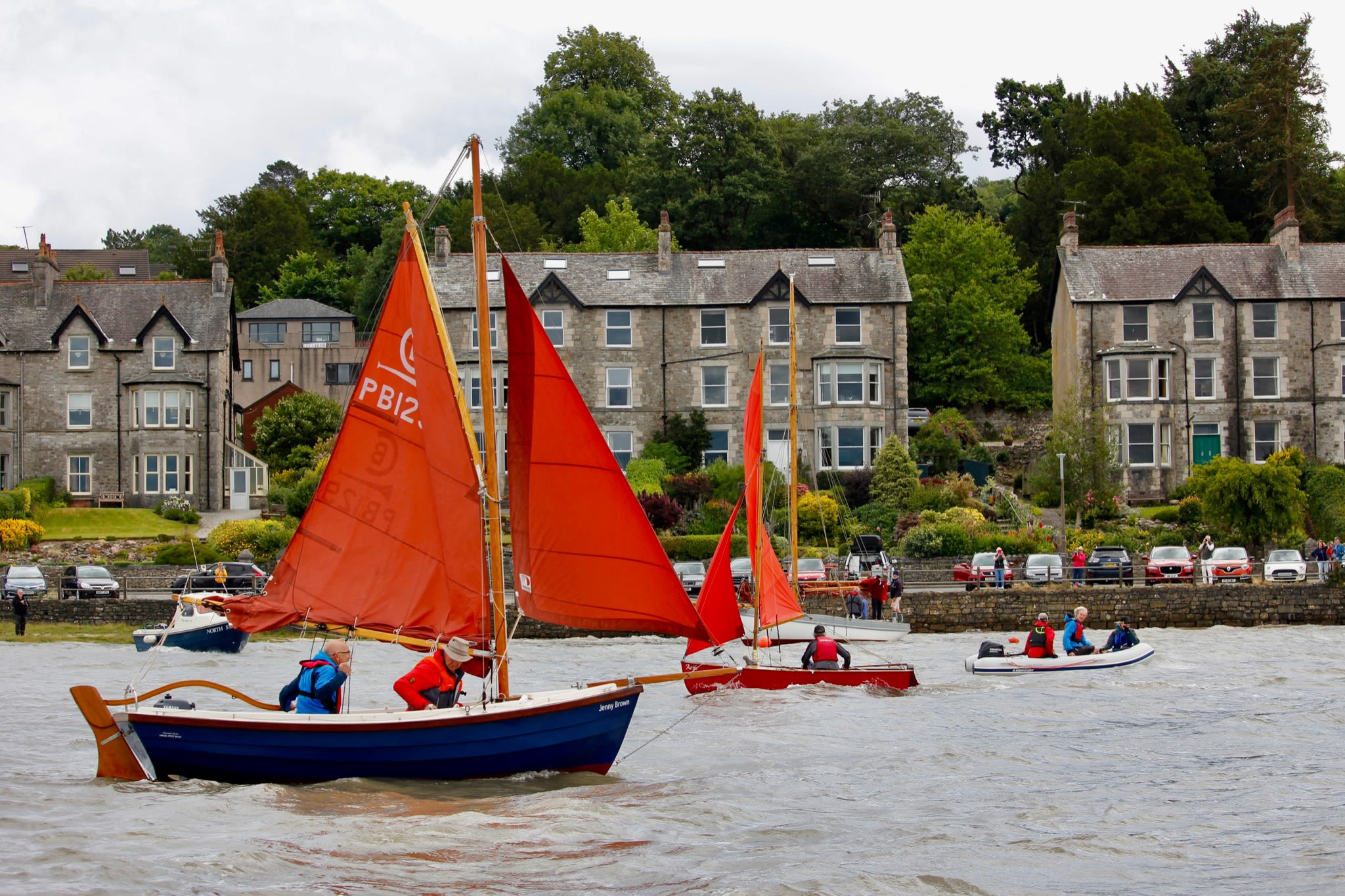
Mile 54 - Arnside
Arnside Sailing Club
Arnside has a long sailing history.
Arnside Sailing Club
When the tide is in Arnside is a great place to sail. The clubhouse overlooks the estuary in the historic Old Customs House near the pier, from the days when the estuary acted as the port for Kendal, and the boatyard lies out beyond the Coastguard along the beach.
Arnside was a place of maritime trade and leisure in the nineteenth century. The Victorians held regattas. The boatbuilders, Crossfields of Arnside, made Morecambe Bay Prawners, yachts and dinghies (including Arthur Ransome’s Swallow) from the 1840s to 1940s.

Arnside Sailing Club
Shipping on the estuary changed completely when the viaduct was built in 1857 for the Lancaster to Ulverston railway. Ships could no longer sail up the estuary to Sandside and Milnthorpe to unload.
Arnside Sailing Club
With the estuary leading out into Morecambe Bay and views to the Lakeland Fells Arnside offers a scenic place to sail, kayak and paddleboard.
One of the most unusual features at Arnside is the Bore and it is one of only around 20 places in the UK to have a tidal bore - the Arnside Bore is a wave which arrives with high Spring tides. Sirens are sounded 20 minutes before its arrival in Arnside.

Arnside Sailing Club
Arnside Sailing Club

Arnside Sailing Club
Arnside Sailing Club

Arnside Sailing Club
Arnside Sailing Club
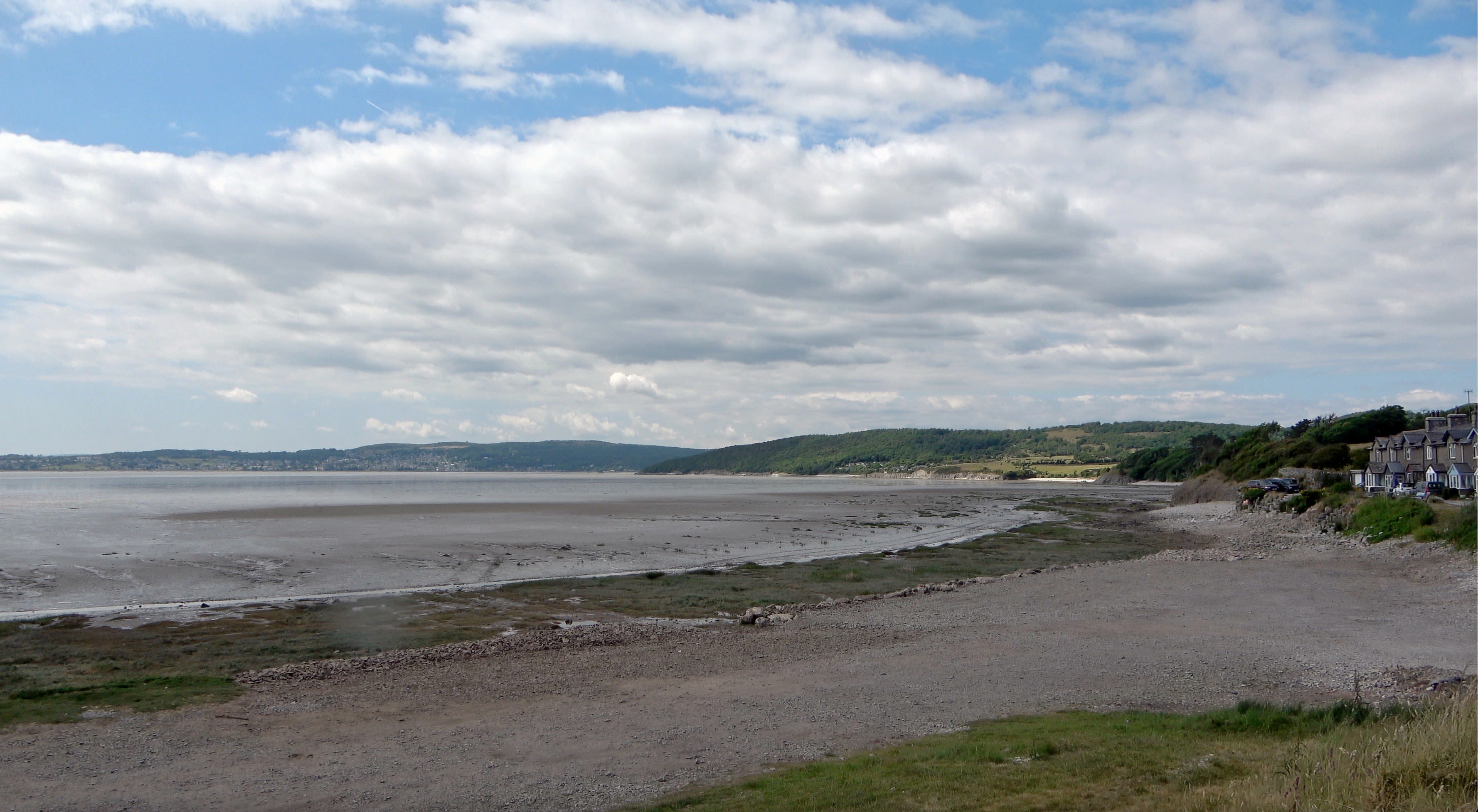
Mile 55 - Sandside
Nigel Thompson
During lockdown this beach was a lifesaver! Unable to walk more than a few miles in the time permitted during government Covid restrictions the beach at Sandside became 'our' beach. Every day the view was different and while the tides came and went, the feeling of peace plus the amazing view across the River Kent offered hope of better times to come.
The Kinetika walkers reach Storth, led by walks leader Tina Codling.
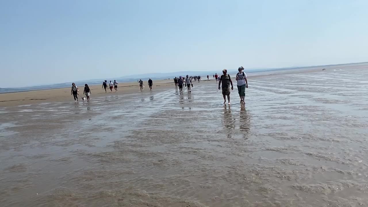
Our journey now takes us to Miles 57 to 59 - the Bay Walk. Most weekends of the summer, the Official King's Guide to the Sands, Michael Wilson, takes groups across the Bay over the sands, following ancient routes on ever shifting sands from Arnside to Grange-over-Sands.
Michael has worked as a fisherman on the sands for all his adult life, and was appointed to the position of King's Guide in 2019.

Bay walkers gathering at Arnside in preparation for the Bay Walk.
Bay walkers gathering at Arnside in preparation for the Bay Walk.

The King's Guide, Michael Wilson, giving instructions to the walkers as they set out for around 6 to 8 miles across the Sands - the length depends on the route.
The King's Guide, Michael Wilson, giving instructions to the walkers as they set out for around 6 to 8 miles across the Sands - the length depends on the route.

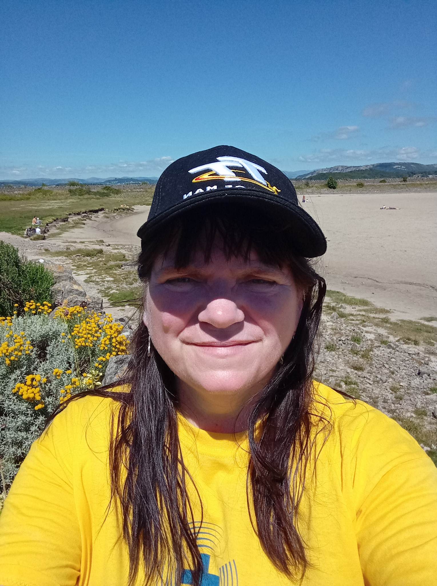
Sue Lancaster.
Sue Lancaster.

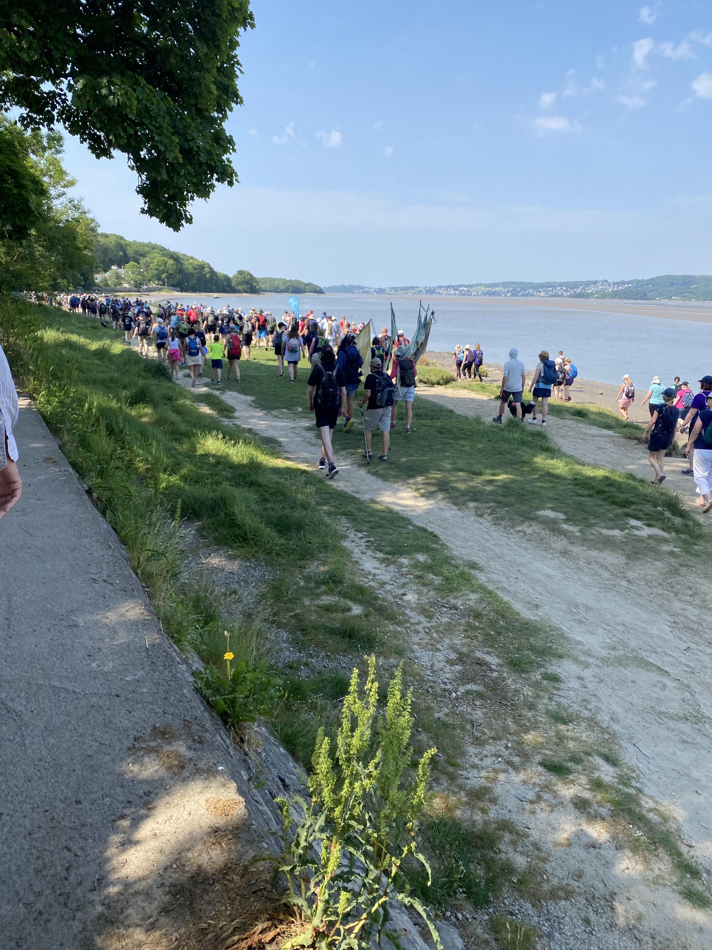
The walkers departing from Arnside.
The walkers departing from Arnside.
Mile 57 - Leaving Arnside
Sue Lancaster
I took part in the Cross Bay Walk with Michael, the Kings Guide, to raise funds for the Air Ambulance.

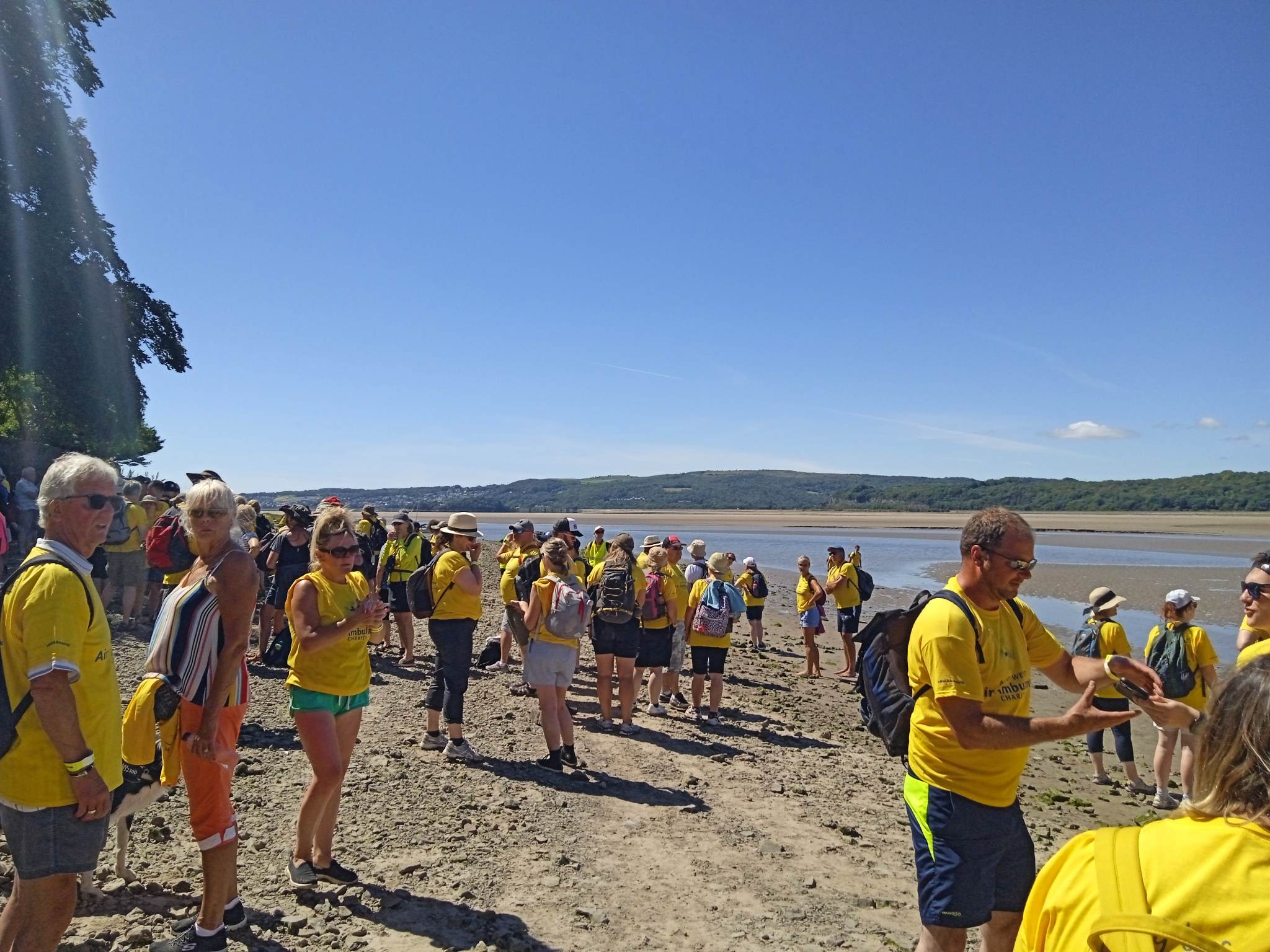
Sue Lancaster - Air Ambulance Bay Walk
Sue Lancaster - Air Ambulance Bay Walk
Bay walkers gathering at Arnside in preparation for the Bay Walk.
We all started out at Arnside and walked down the coast to cross over to Grange-over-Sands. It was a hot day and felt like a long walk, but we kept stopping so everyone could catch up.
The King's Guide, Michael Wilson, giving instructions to the walkers as they set out for around 6 to 8 miles across the Sands - the length depends on the route.
I had seen in the City Museum all about the crossings in coaches and the ships that had run aground from at least the 17th century. I felt it fascinating and something I really wanted to do. I talked my friend into doing it too.
The walkers departing from Arnside.
It was like going on a mission, to capture social history, raise funds for a really worthy cause, and see more of the beautiful bay. There were some fantastic views and it was like a line of bees crossing the sea as we all had yellow t-shirts.
It was very undulating land. We climbed over rocks, tree branches, water channels, sand, reeds, more sand, more rocks. People of all ages and from all different backgrounds, experienced walkers and novices alike. We each had our own reasons for doing it.
Miles 58 and 59 - From the middle of the Bay to Grange
Luca Hales, Bay Walk steward
Luca is a regular steward on the Bay Walks and his family are central to the tradition. He tells us about the role and responsiblities.
"My Dad’s the Guide, he’s been fishing for many years, since he was 17 or younger.
Every Friday me and my Dad come to mark out the route. And we see whether the conditions are good or not.
We see the sand and how deep the channel is - because sometimes we’ve had the edge of the channel up to the waist.
And so we need to make sure it's all safe. On the last walk we had to go further down because the sand had created banking with the tide. Because there has been a low tide it's washed some of that out."
Luca Hales
"First we cross two pools of water and then we get to the channel, and then cross the channel, and then make our way back to the Grange.
The tractors are here as an emergency vehicle if someone gets tired or somebody falls. The tractors mean we can get them out faster."
Luca Hales
We use ‘brobs’ (laurel branches) to mark which way we go – there are brobs before the water and after the water and it indicates where to walk through and not to go to the left or right of them. The brobs have been used for years and years.
The stories of the miles on the northern coast of the Bay continue in Section 4 - the Kent and Leven Estuaries.