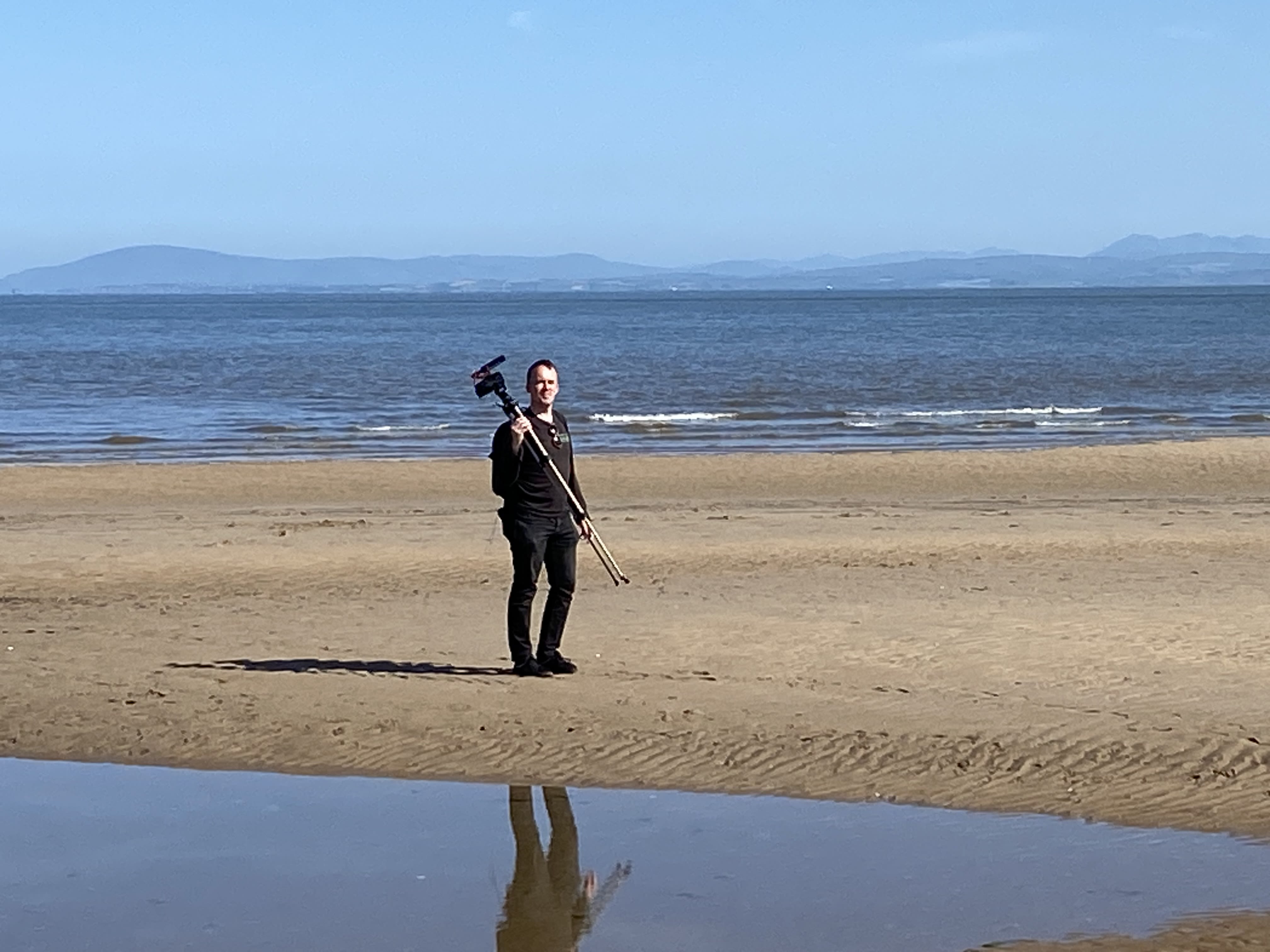
Bay Lines -Beach of Dreams
Fleetwood to Lancaster - Miles 1 to 22
Mapping 120 Miles of Morecambe Bay through photos, stories and drawings


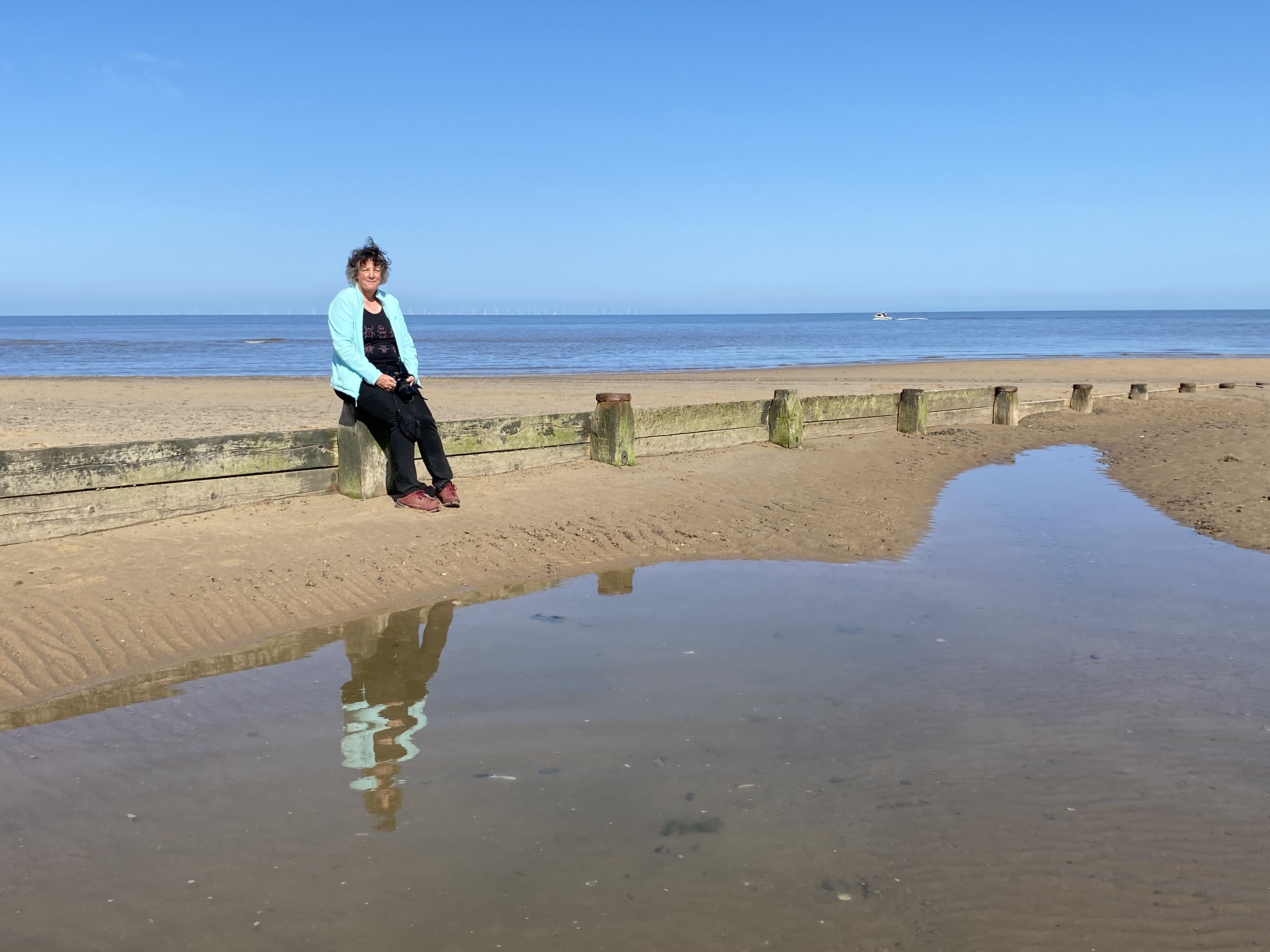
Mile 1 - Fleetwood Rossall Point to the River Wyre
Tessa Bunney
It was shrimping that first brought me to Morecambe Bay back in 2018, I was immediately captivated by the landscape - that ‘not quite land, not quite sea’ place often described by fishermen as the ‘wet sahara’.
Since then I have spent hours standing in muddy estuaries and travelling miles out onto the Bay to document the working lives of fishermen as they shrimp, cockle, mussel and fish with all kinds of net.
Mile 1 is where I have experienced two kinds of fishing for shrimp. On the very edge of Morecambe Bay, where it meets the Irish Sea, I met Steve who is one of a handful of fishermen who use a push net to gather shrimp.
“It’s what I do. Shrimping in the Spring and the back end. It’s one of the few public fisheries remaining. Push netting is complicated, it’s the time of year, direction of the wind and the height of the tide. And an educated guess as to where the shrimps are going to be, it’s local knowledge and that’s hard earned.”
Steve Brown, ex trawlerman and fisheries officer, Fleetwood
At the other end of my mile, at the river Wyre Estuary, this is where I joined Skip and Daryll on board their boat Orion FD10 trawling for shrimps Lancashire style.
Unlike the tractor shrimpers on the Cumbrian side of the Bay who boil their shrimps at home in fresh water, the boat shrimpers boil theirs live in sea water on board and the fishermen on each side of the Bay will never agree which are the tastiest!
Morecambe Bay is unusual and special in the variety of ways of catching fish and shellfish and my hope for the future is that it can continue in a sustainable and viable way for future generations of fishermen.


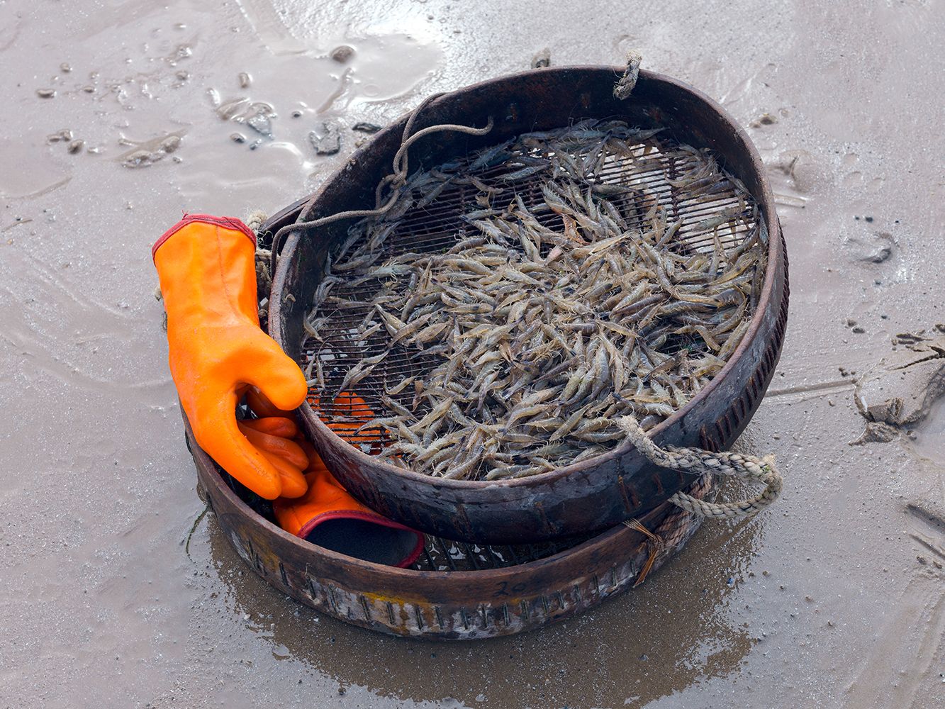


Mile 1 Shrimps. Tessa Bunney Fleetwood
Mile 1 Shrimps. Tessa Bunney Fleetwood
Mile 1 - River Wyre at Fleetwood. Tessa Bunney
Mile 1 - River Wyre at Fleetwood. Tessa Bunney
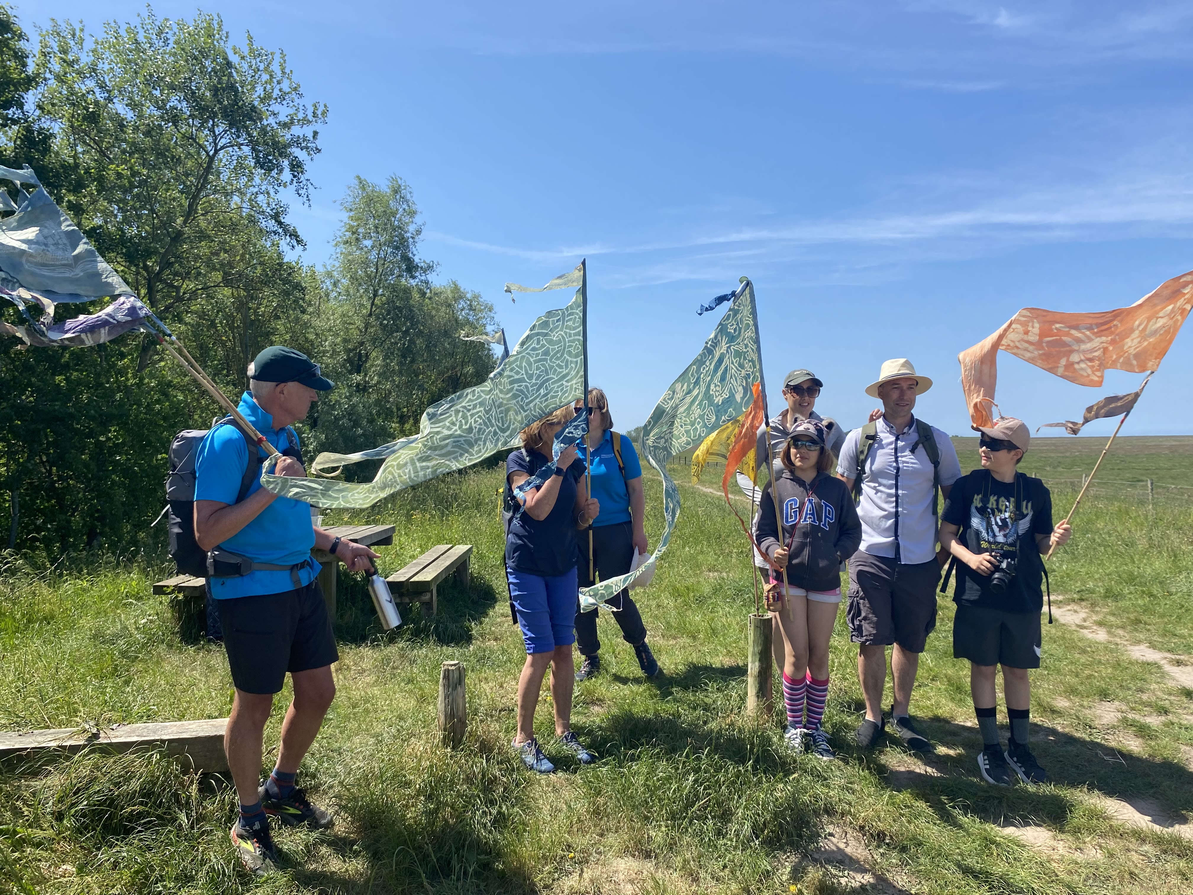
The Bay Lines - Beach of Dreams project maps 120 miles across Morecambe Bay. In June 2023 artists and walkers from the arts organisation Kinetika walked the whole route of 120 miles around Morecambe Bay carrying silk pennants representing miles of coastline. Their mission - to create 120 new silk pennants, one for each mile of the Bay, to be designed from the mile images and stories contributed by members of the public around the Bay and to be displayed as a coastal art installations at 4 locations across the Bay over August Bank Holiday weekend 2023. The project was commissioned by Ways Around the Bay from the Morecambe Bay Partnership.
Kinetika is working with Kendal-based Rosa Productions as part of a wider multi-year Beach of Dreams exploration of the UK and Ireland coastline.
The is the first of five sections - from Fleetwood to Lancaster -where we walk and map the 120 miles of coastline of the Bay with photos, stories, and drawings from the Bay Lines, Beach of Dreams participants.
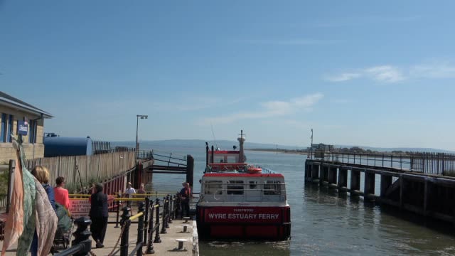
Knott End Ferry
Mile 2 - Knott End
Cat Smith MP Lancaster and Fleetwood
Morecambe Bay is incredibly special. I was born and bred in Barrow and now as the MP for Lancaster and Fleetwood I take in the other parts of the Bay. Whatever is going on in your life and no matter how stressed you feel if you come to Morecambe Bay, you cannot look out across those sands and feel anxious and stressed. For me this is the place where I’m calm and collected – my happy place.” I love the shelters on the Promenade - just seeing people take in the view. People and nature together.
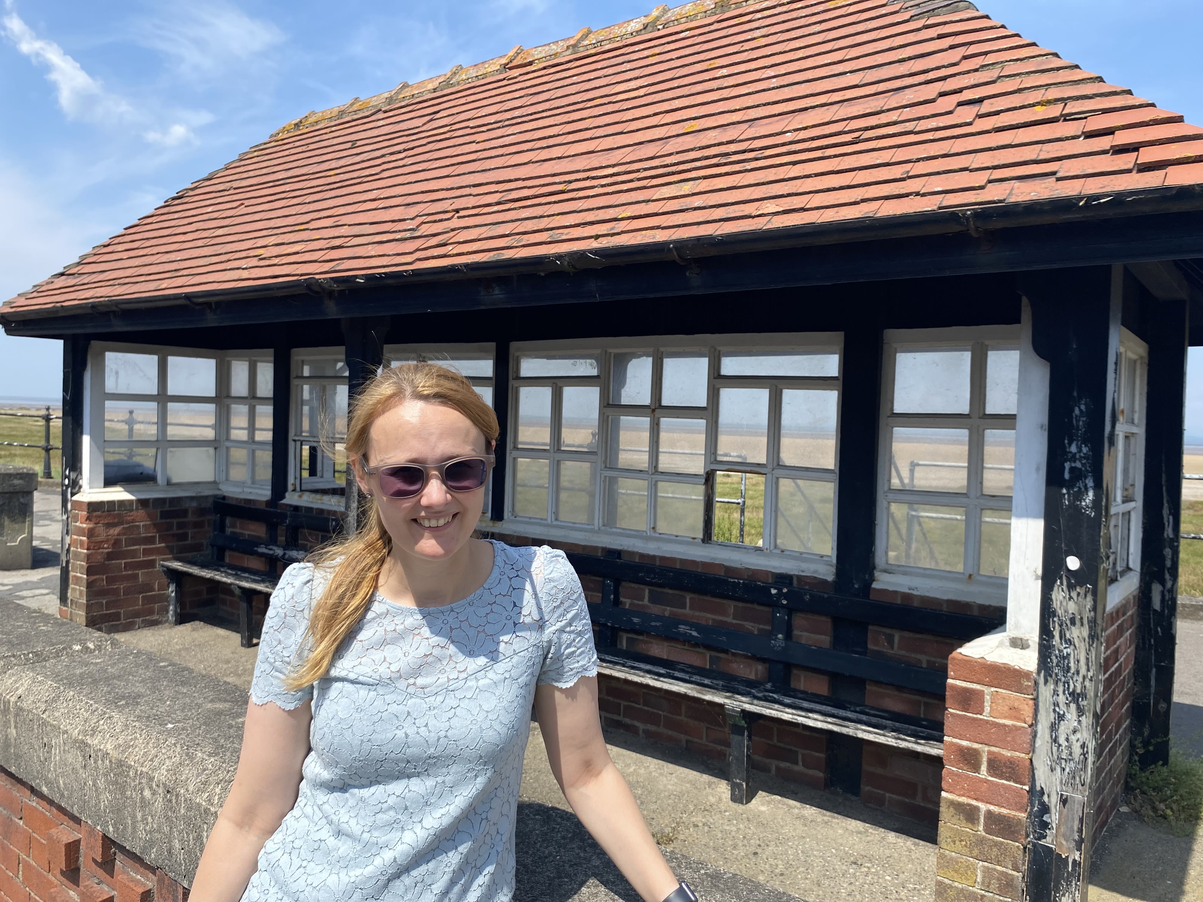
Cat Smith at the promenade shelters Knott End. Photo by Nigel Thompson.
Cat Smith at the promenade shelters Knott End. Photo by Nigel Thompson.
Mile 3 - Preesall Village
Dr Sarah Hopkins
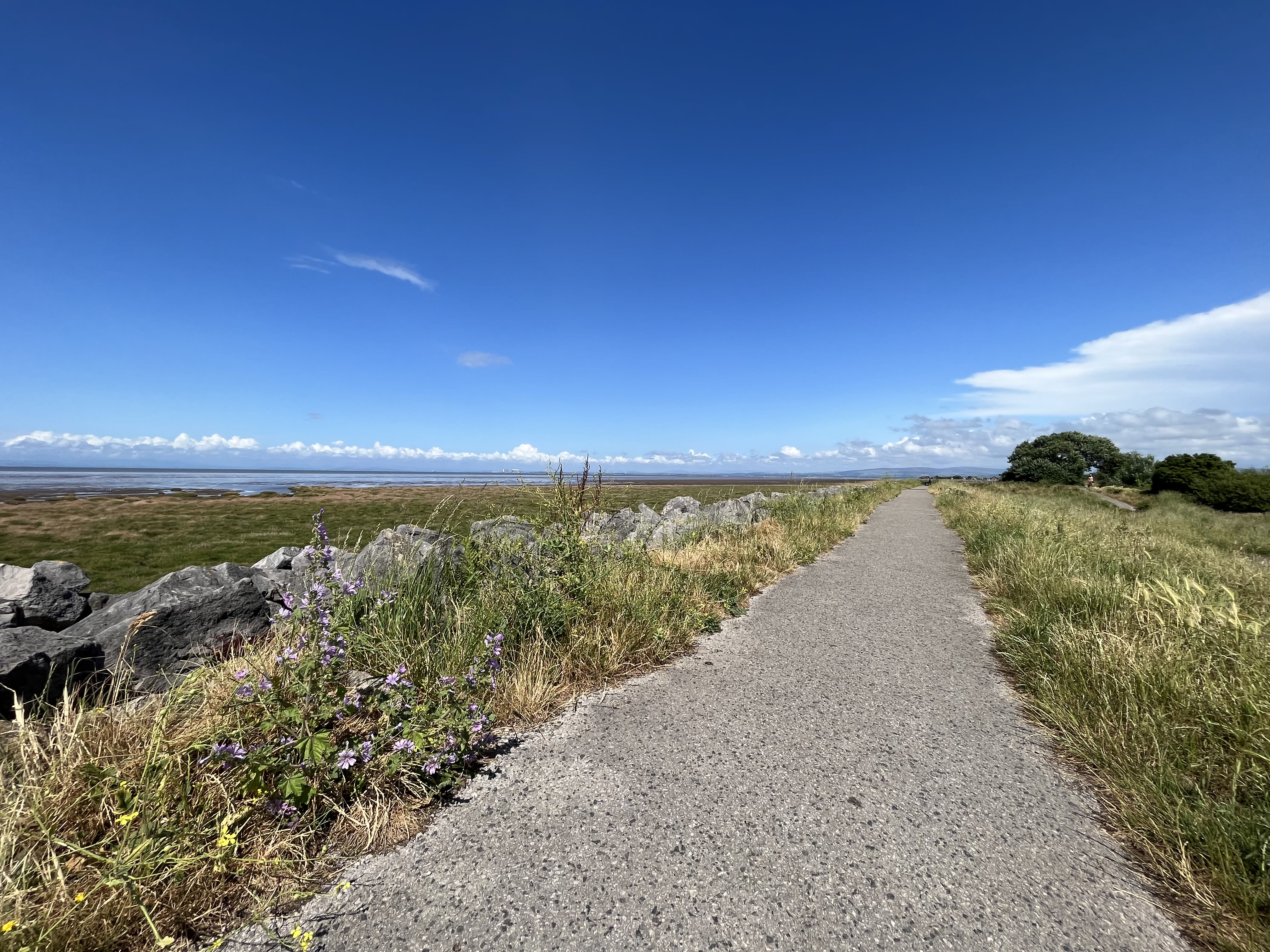
This mile of coastline follows along the top of a sea wall built from big, jumbled blocks. It is quite a straight section of path with grass verging and private gardens to one side and expansive views of the Lake District across Morecambe Bay to the other.
Mile 3 Dr Sarah Hopkins
The sea tends to be far out but can occasionally come right up to the sea wall on a big spring tide. When the tide is out there is a huge expanse of golden sand, big enough that people can fly small bi-planes from it and gallop horses along it.
I chose this mile because I am one of the GP’s that work in the medical centre at Preesall. Being by the sea means a lot to us here. Being connected to nature and exercising outdoors are both well recognised to boost wellbeing.
We have experienced the drama of a Dolphin rescue and sightings of seals plus the annual antics of the nesting Herring Gulls on the medical centre roof.
It is easy to pop up onto the sea wall path from work either for a quick lunch break or to walk to a visit rather than using the car. Depending on the time of year it is possible to catch the stunning sunsets during an afterwork de-stressing stroll or jog.
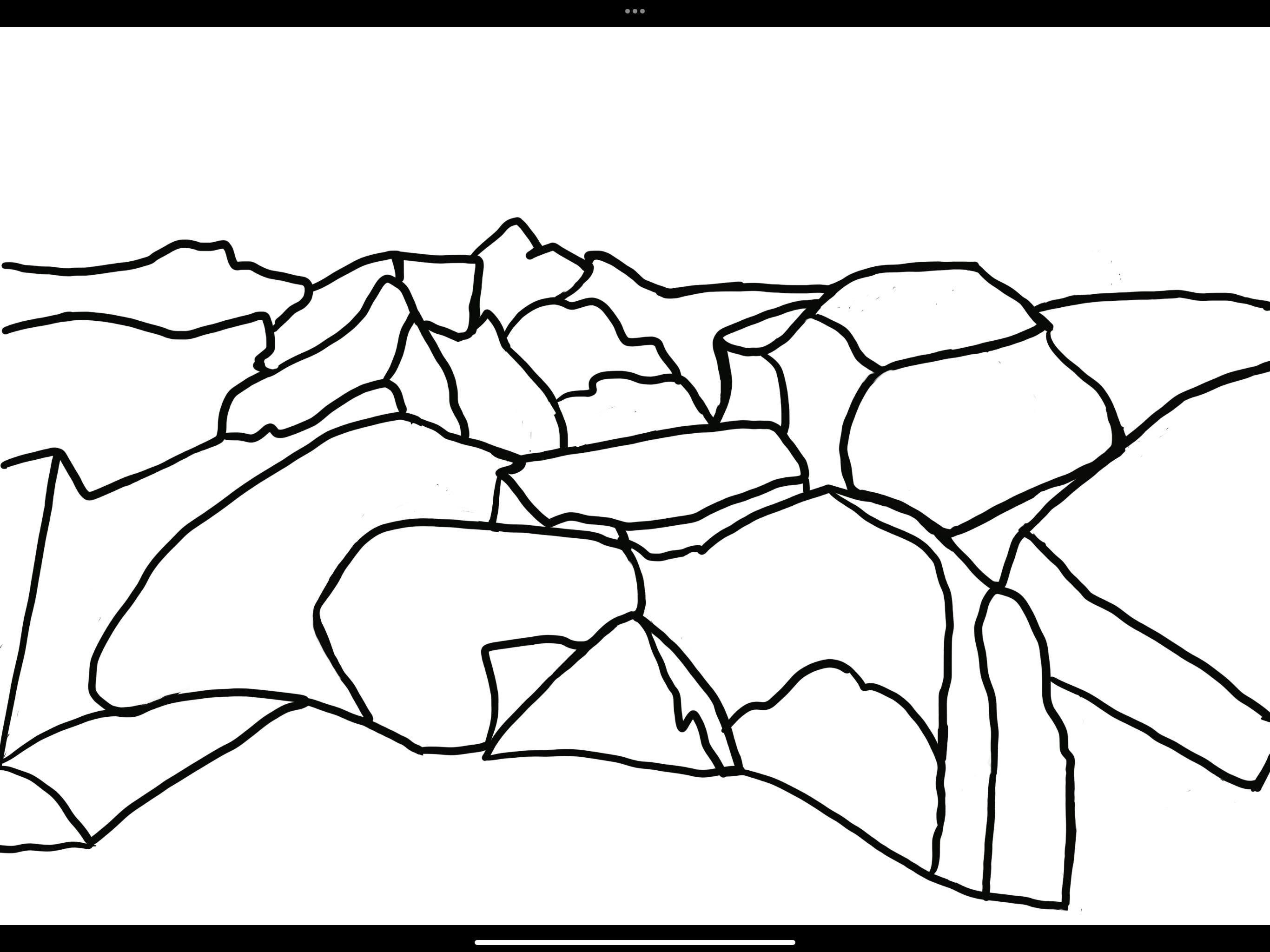
Mile 3 Illustration for silk pennant. Line drawing of sea wall. Dr Sarah Hopkins
With social prescribing becoming more popular we hope we can harness this natural resource for more and more people to access the benefits of connecting with nature and exercising outdoors. Fleetwood has its own parkrun by the coast for example and we have had interest in using the beach and coastal scavenging for art therapy sessions in our “Front Room” which is our social prescribing hub
Mile 3 Dr Sarah Hopkins
Mile 3 Dr Sarah Hopkins

Mile 3 Illustration for silk pennant. Line drawing of sea wall. Dr Sarah Hopkins
Mile 3 Illustration for silk pennant. Line drawing of sea wall. Dr Sarah Hopkins
Miles 5 - Near Fluke Hall, Pilling
Andrew Bell
This is near where I live and I often come here for a walk. As this is already a coastal footpath along the top of the sea wall defences, I hope that access will be preserved so that people can enjoy the view across to the Lune Estuary.
Mile 6 Andrew Bell
My regular evening walk takes in this path (when it is open) and I hope that in the future it may become a public footpath open all year rather than a permissive path with no access between Boxing Day and Good Friday as at present.
Mile 7 - Pilling
Katrina and Andrew Bell
Pilling is a great place to view Morecambe Bay in all its seasons.
Katrina and Andrew Bell
Also a good place for wildflowers, butterflies and birds.
Miles 8 to 13
Continuing north along the coast and sea wall in the direction of Glasson Dock the Kinetika walkers were joined by locals and specialists to explore the environment of the Bay, the beauty of the countryside and coast, and the challenges the area faces as it looks towards the future.
Andy Bradbury joined the walk with his family between Pilling and Glasson Dock, and shared his memories of this area where he grew up. Andy is a Marine Pilot, with specialist knowledge of the seas on this coastline. His role is to guide and pilot shipping into harbour.
Andy Bradbury
" I'm a Harbour Pilot at Heysham and Glasson Dock.
I grew up in Knott End and all my friends at that time lived in Pilling so quite often I used to cycle along the sea wall here to go and see them. I know the area very well in this south part of the Bay.
I'm half an hour from my house here, and it's very quiet, there's nothing except birds and sea life. It's absolutely full of bird life.
It's a great place to get away from it all. It’s a special part of the Bay.
I remember when I went to primary school in Preesall my school backed up to the sea wall.
And I remember them building the sea wall, the sea defences.
One of the notable things since then is that the trees have grown up. But it's only improved I'd say. And I think looking at the Bay, the marsh has grown out a lot more.
The sea is very dynamic, and it's always changing and today we can see the high mountains in the Lake District. It’s really good visibility.
I grew up playing about on the River Wyre and watching the ships coming in and out.
And in those days there were a lot of fishing boats and quite a bit more shipping coming into Heysham and Glasson Dock.
I think that of course that influenced my choice of career."

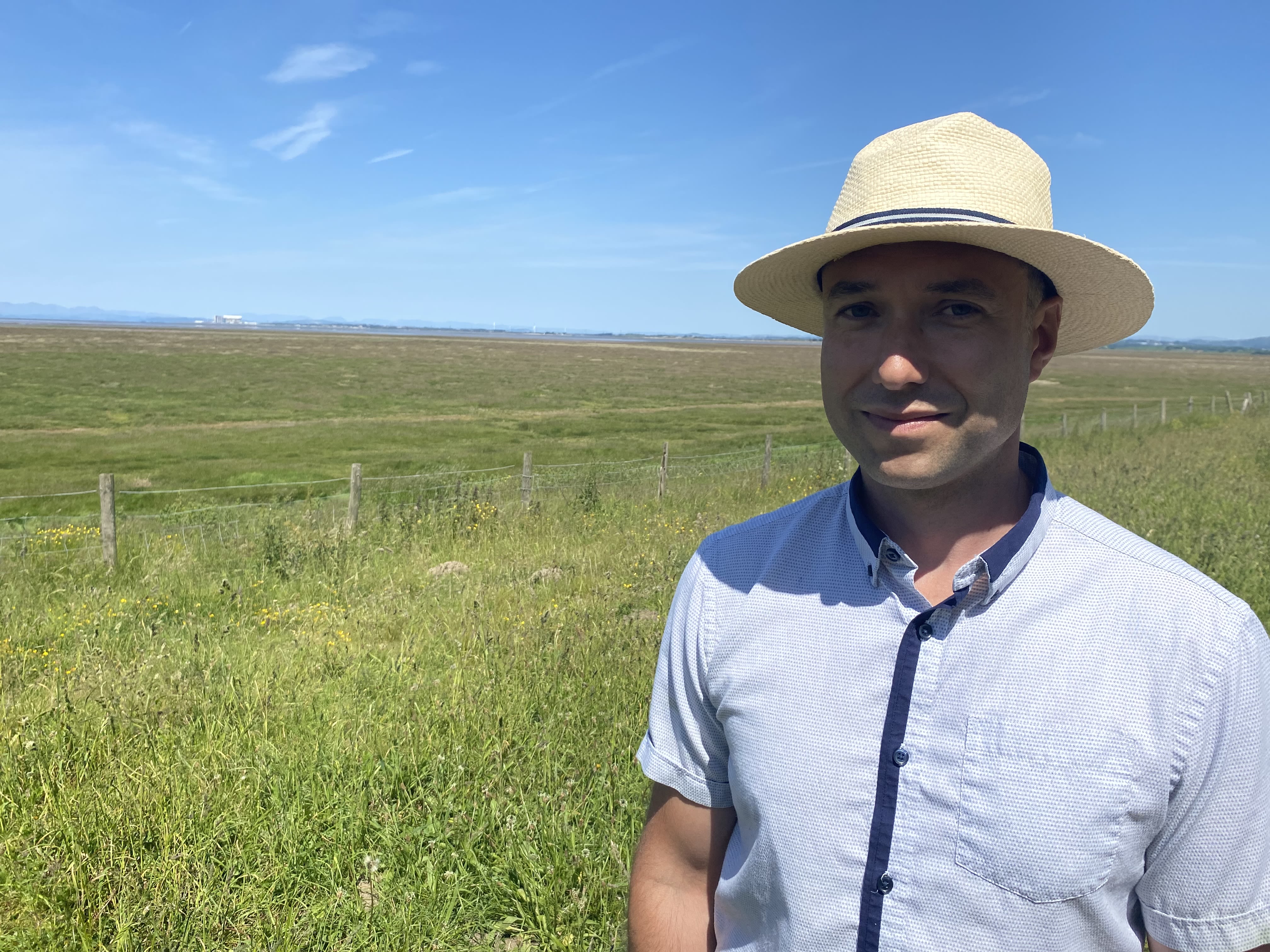


Andy Bradbury, Marine Pilot for Heysham Port, joined the walk with his family from Pilling to Glasson Dock. Photo Nigel Thompson.
Andy Bradbury, Marine Pilot for Heysham Port, joined the walk with his family from Pilling to Glasson Dock. Photo Nigel Thompson.
John Offord, one of the Rosa Productions media crew accompanying the walkers. Photo Nigel Thompson.
John Offord, one of the Rosa Productions media crew accompanying the walkers. Photo Nigel Thompson.
Andy Bradbury and family with Kinetika and other walkers. Photo Nigel Thompson.
Andy Bradbury and family with Kinetika and other walkers. Photo Nigel Thompson.
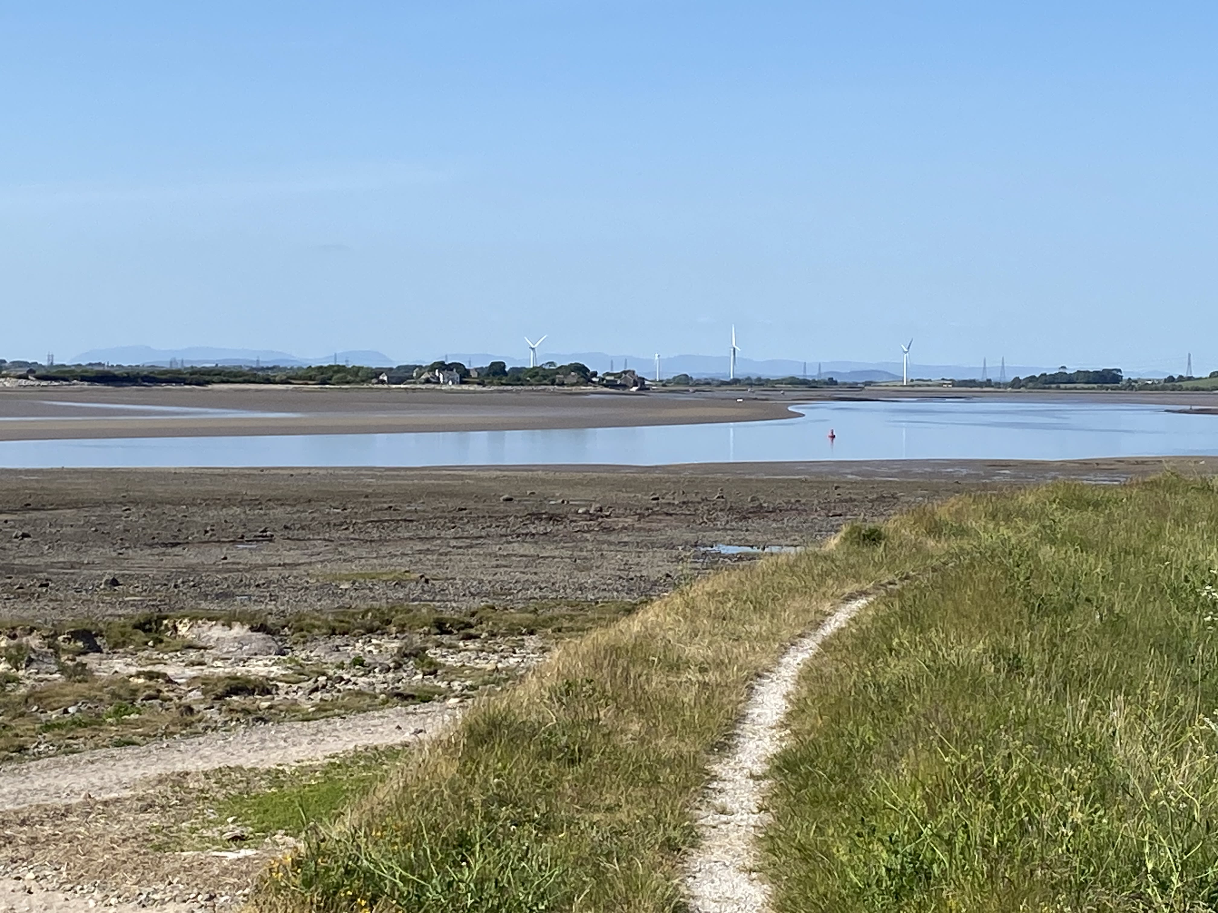
Mile 14 - Cockersands Abbey and Lighthouse
Fiona McKean
We often visit this part of the coastline to watch the bird life in the bay and the scenery changing with the tides. This photograph captures some of the history of the Bay with part of the 12th Century Cockersands Abbey and the Plover Scar Lighthouse at the mouth of the Lune framing a ferry heading towards Heysham and the next image shows bird-life at the low tideline.
Mile 15 Thurnham Shore - Sarah Hymas
I have lived at the lighthouse keeper's cottage for the last 13 years.
The house and this small cove have my heart in theirs. I hope the birds and hares and grasses and moss and sedums and thrift and lichens and (occasionally!) deer will continue to have a home here alongside the humans.
I don't know for how many more years the seawall will be repaired, keeping the sea from the road and the houses.
Because I can't imagine it will, I can't hope for that.


Mile 15 - Katrina Bell
This part of the coastline at Plover Scar Lighthouse was an ancient Christian site and is now an area of outstanding natural beauty.

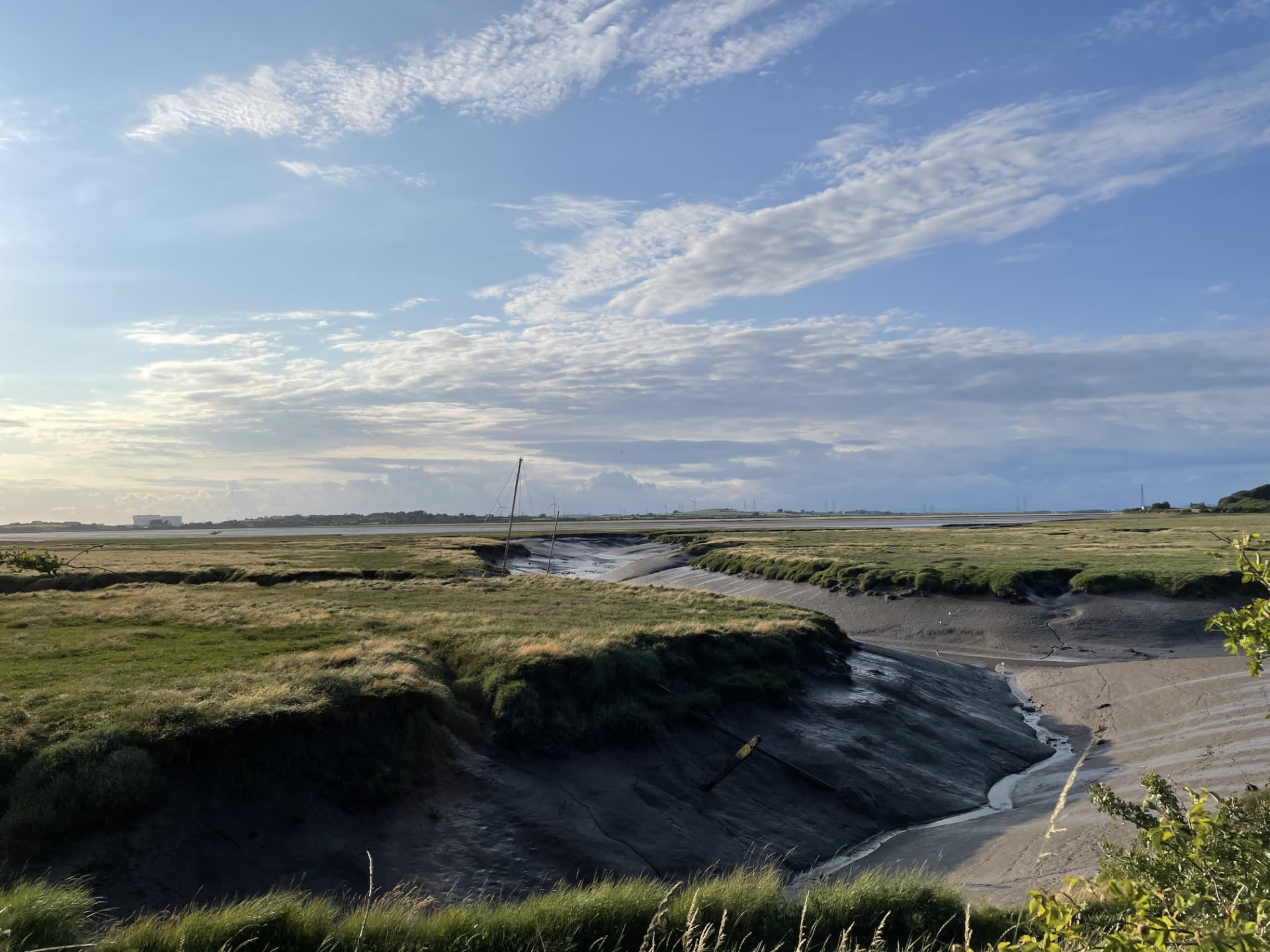
Mile 16. Looking towards Sunderland Point.
Mile 16. Looking towards Sunderland Point.
Mile 16 Glasson Dock - Greg Stephens
Glasson Dock can seem a bleak remote inaccessible place from some angles, on this tidal stretch of the Lune estuary. But it's also a snug little spot: pub, boats and people jostling together. 250 years ago it became important, and helped connect Morecambe Bay to the rest of England, and the world. Lancaster Port was silting up, so they dug a new port at Glasson. Navvies, adept at digging as they were, soon had the port connected via the Lancaster canal to all parts. Boats and cargoes came in by sea and headed for Kendal, Preston and beyond.

Mile 16 Glasson Dock with Black Coombe in background. Greg Stephens
Glasson built wooden sailing boats. One, the trading schooner Ryelands, achieved international fame. After coastal trading for 60 years she was bought by a film company and rerigged as a three-masted square rigger. She starred as the Hispaniola in Disney's Treasure Island, then as the Pequod in Moby Dick. To this day, pirates go around saying "Aharrrgh", since Robert Newton's Long John Silver started the fashion in Treasure Island. The ship, alas, ended her days back home in the Bay; she sadly burned opposite Morecambe's Winter Gardens in 1972.
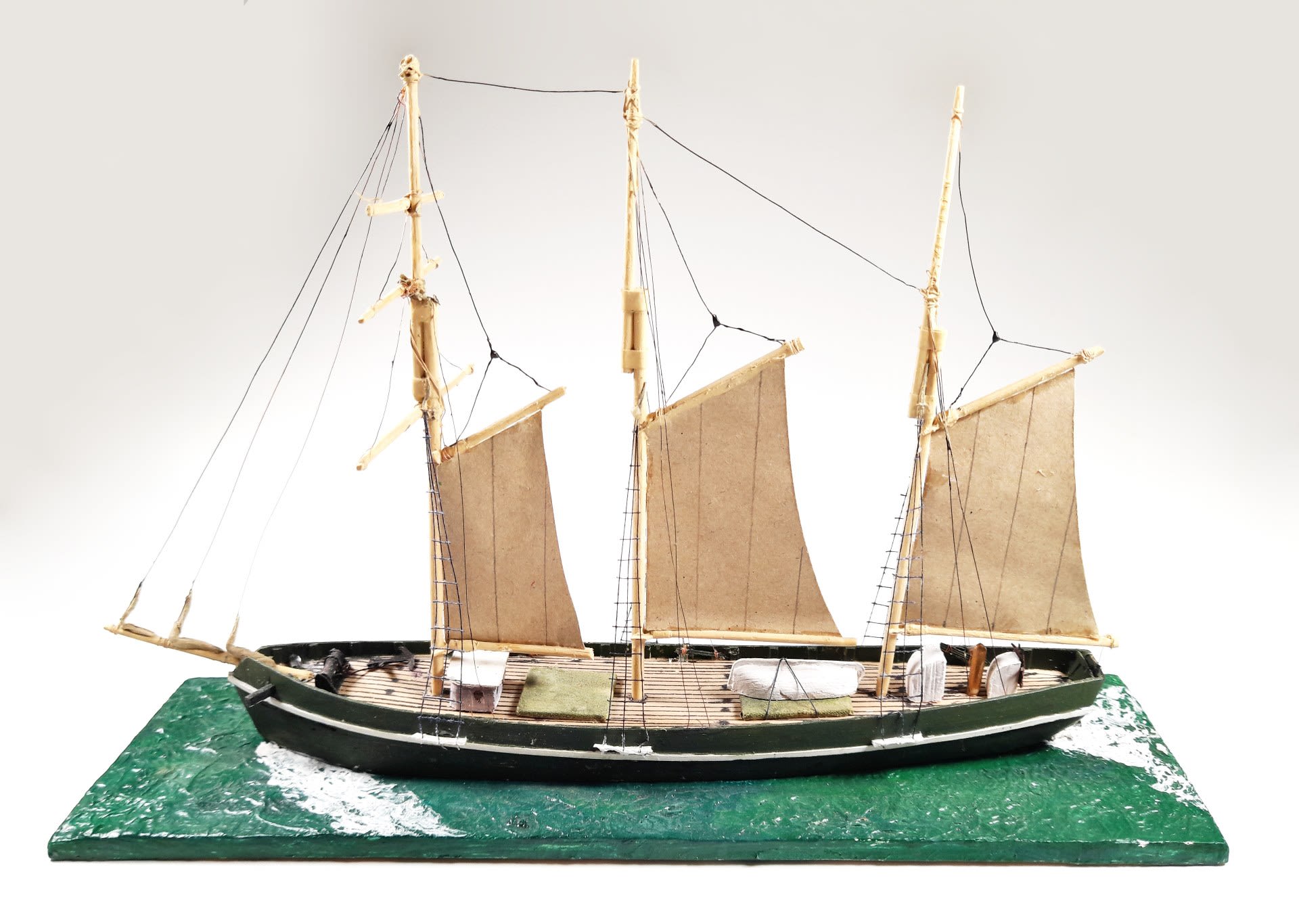
Mile 16. Ship owner's model of Ryelands, a schooner built in Glasson Dock in 1886. Greg Stephens.
Connections with the arts continued. In 1989 the Boat Band fitted out an ex-admiralty launch in Glasson and started their piratical raids on Scottish islands. In 1992 John Wassell and Liz Pugh bought a Norwegian ferry, re-renamed her Fitzcarraldo, and re-fitted her in Glasson as a theatre ship. For years she toured shows round the British Isles. They called the company Walk the Plank, to this day one of Britain's leading outdoor arts companies. Nationally and internationally they create the most spectacular happenings, visually stunning events with roots in Glasson Dock's fireshows back in the 90's.
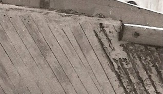
Mile 16. Wooden planking on boat at Glasson Dock. Greg Stephens.
What's going to be next out of Glasson? Time will tell. It will be surprising.
Mile 16 Glasson Dock with Black Coombe in background. Greg Stephens
Mile 16 Glasson Dock with Black Coombe in background. Greg Stephens

Mile 16. Ship owner's model of Ryelands, a schooner built in Glasson Dock in 1886. Greg Stephens.
Mile 16. Ship owner's model of Ryelands, a schooner built in Glasson Dock in 1886. Greg Stephens.

Mile 16. Wooden planking on boat at Glasson Dock. Greg Stephens.
Mile 16. Wooden planking on boat at Glasson Dock. Greg Stephens.

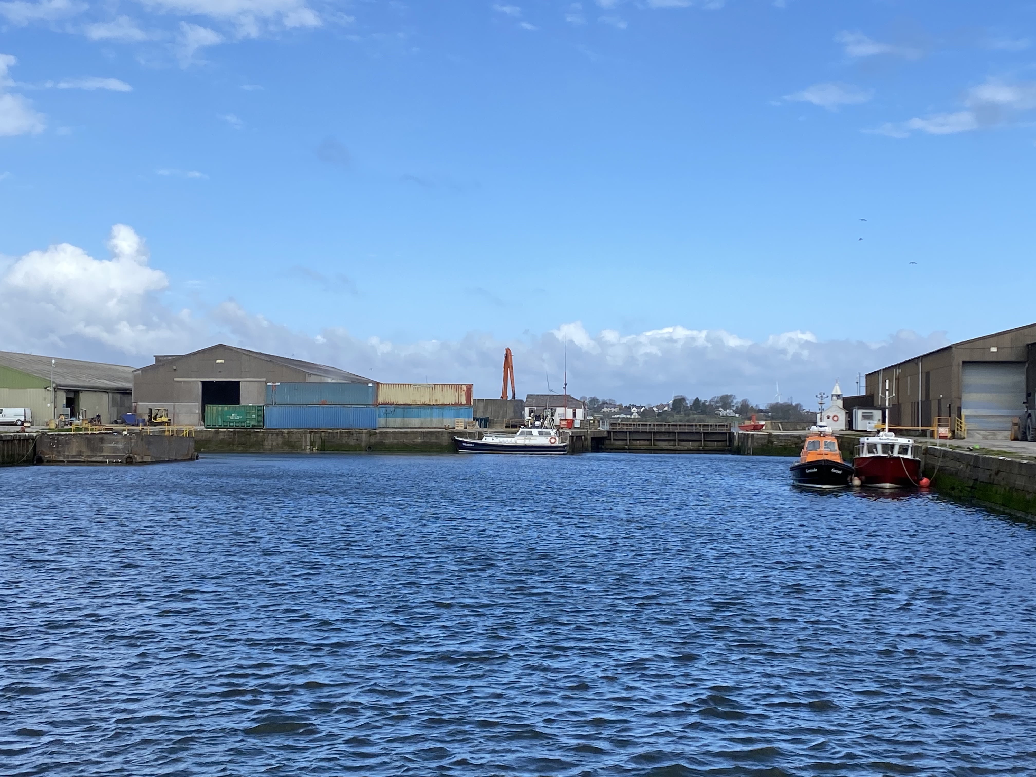

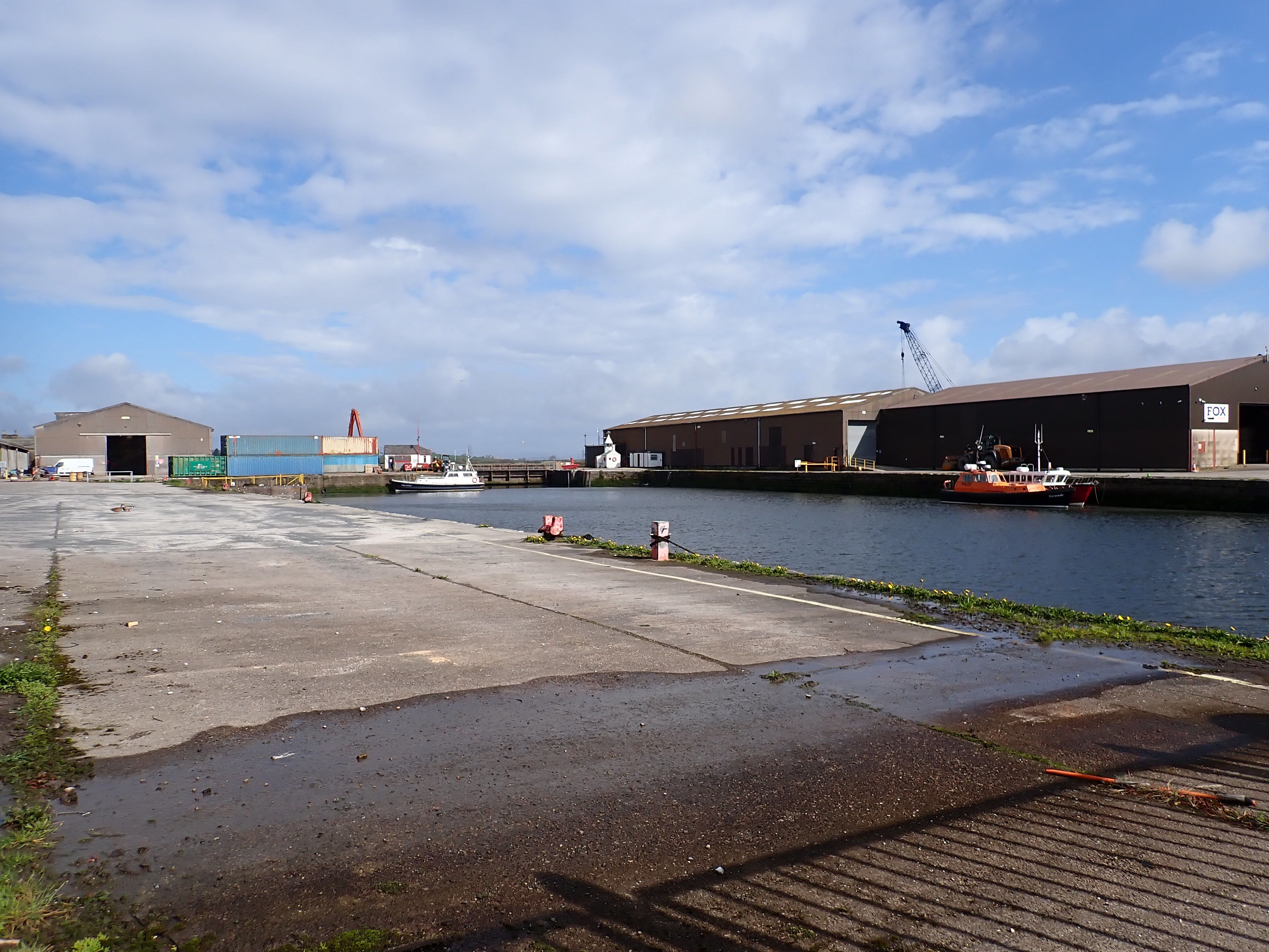


Glasson Dock
Glasson Dock
Glasson Dock
Glasson Dock
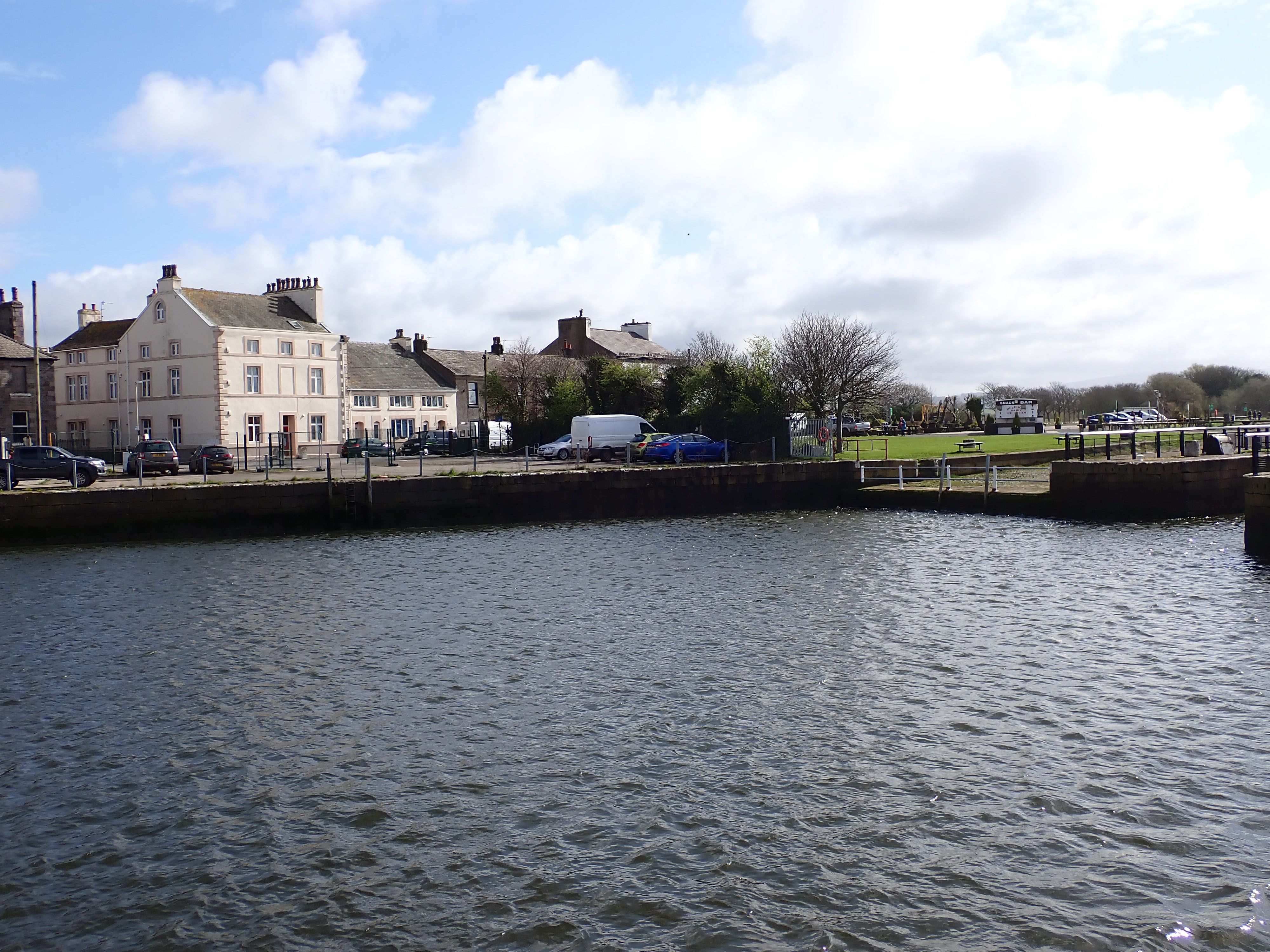
Victoria Inn at Glasson Dock
Victoria Inn at Glasson Dock
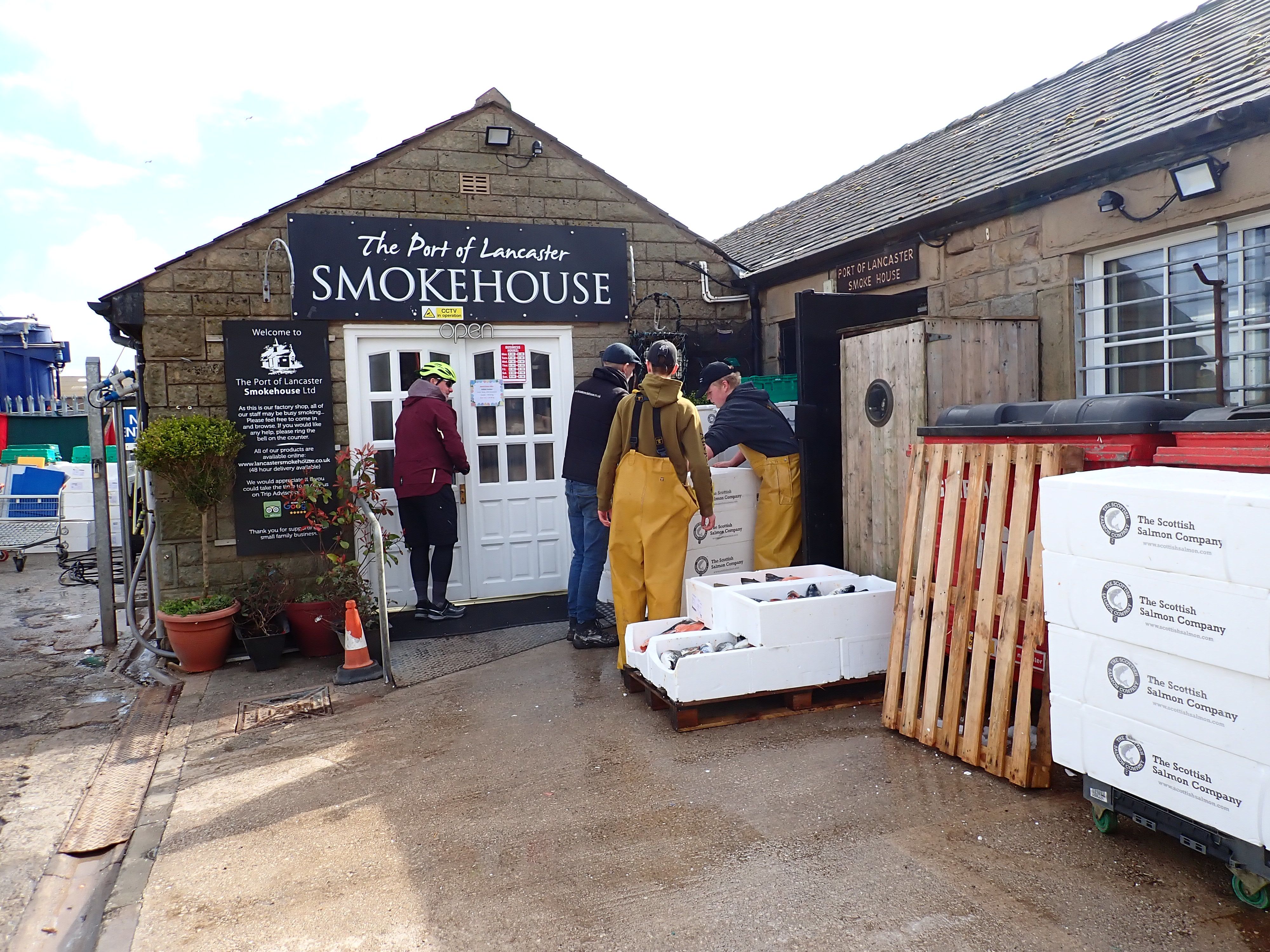
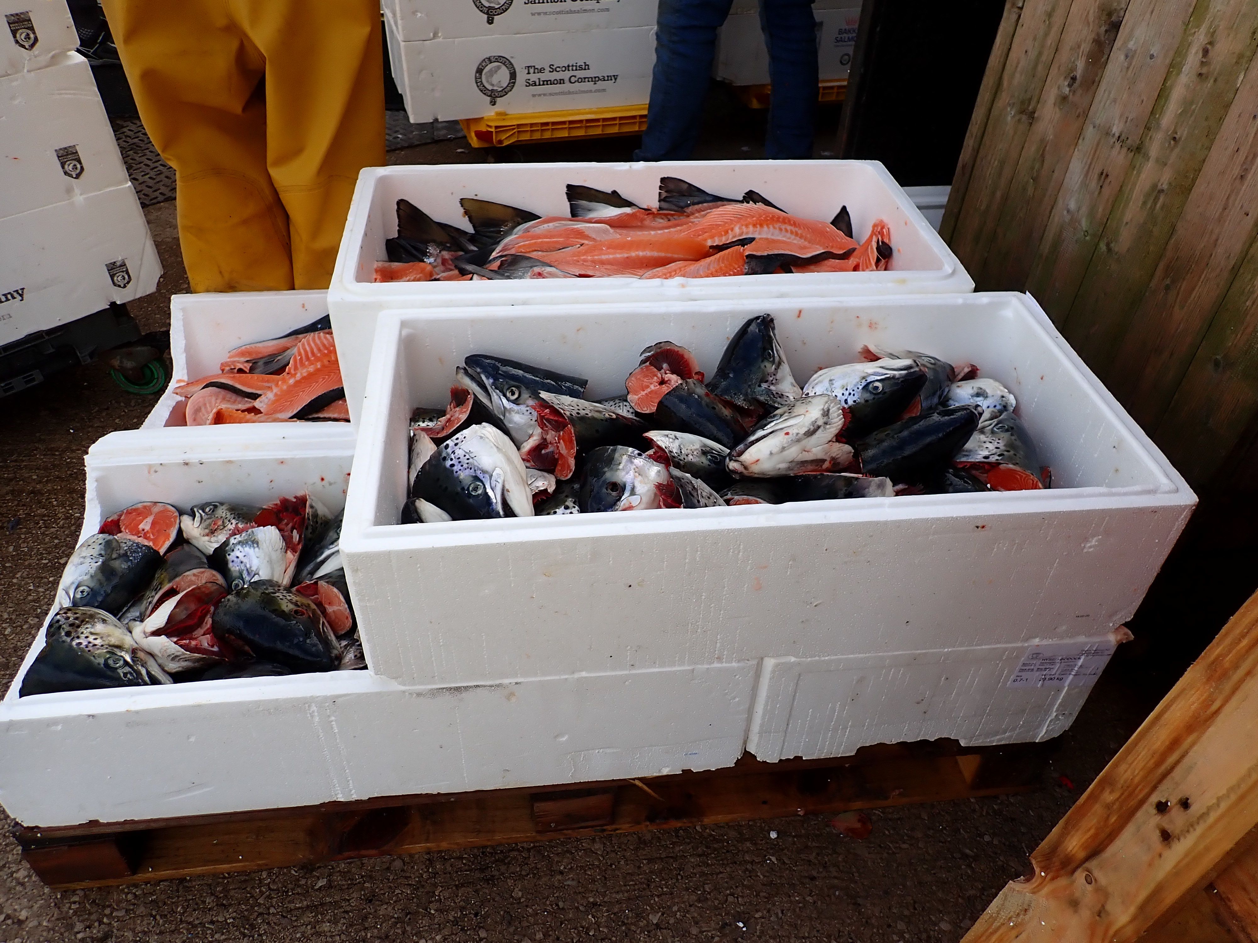
The Smokehouse at Glasson Dock where fish is brought from around the UK to be smoked.
The Smokehouse at Glasson Dock where fish is brought from around the UK to be smoked.
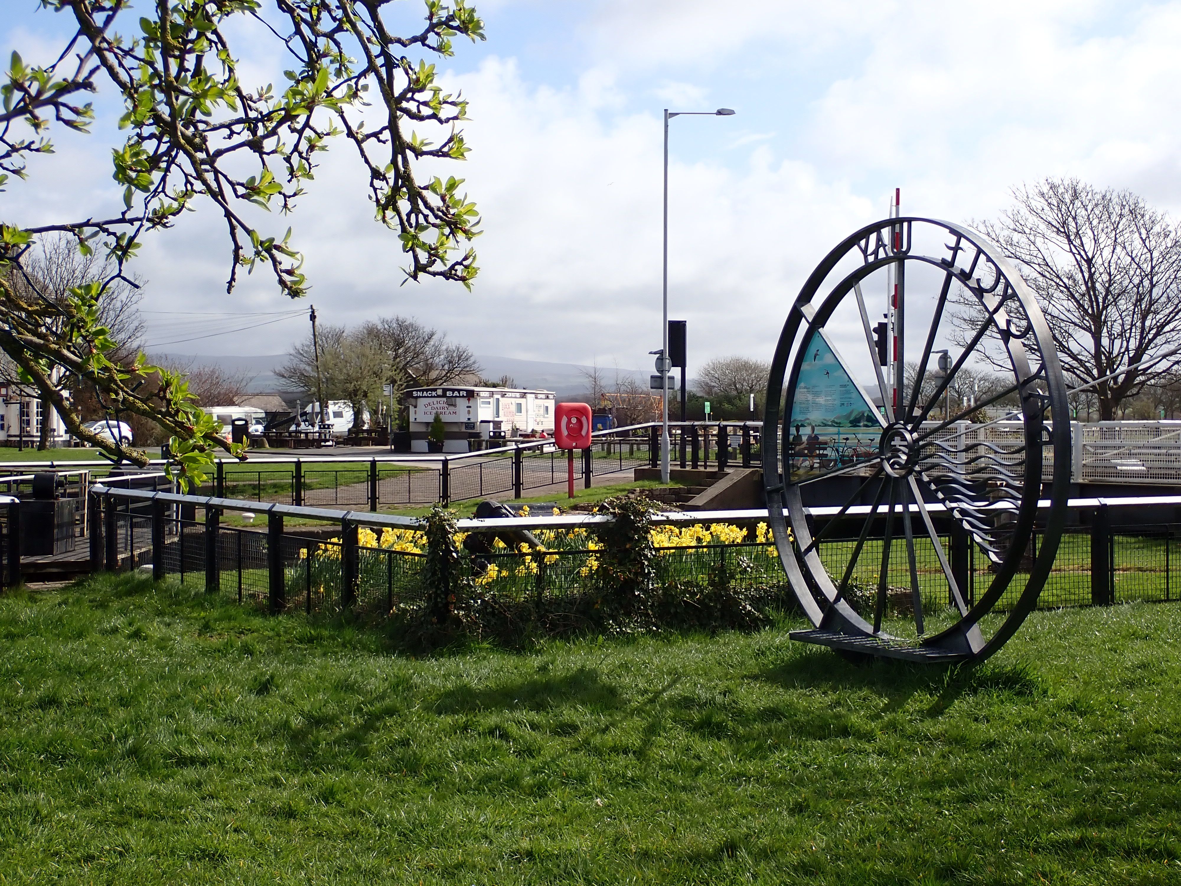
End point of the Bay Cycle Way next to the docks.
End point of the Bay Cycle Way next to the docks.
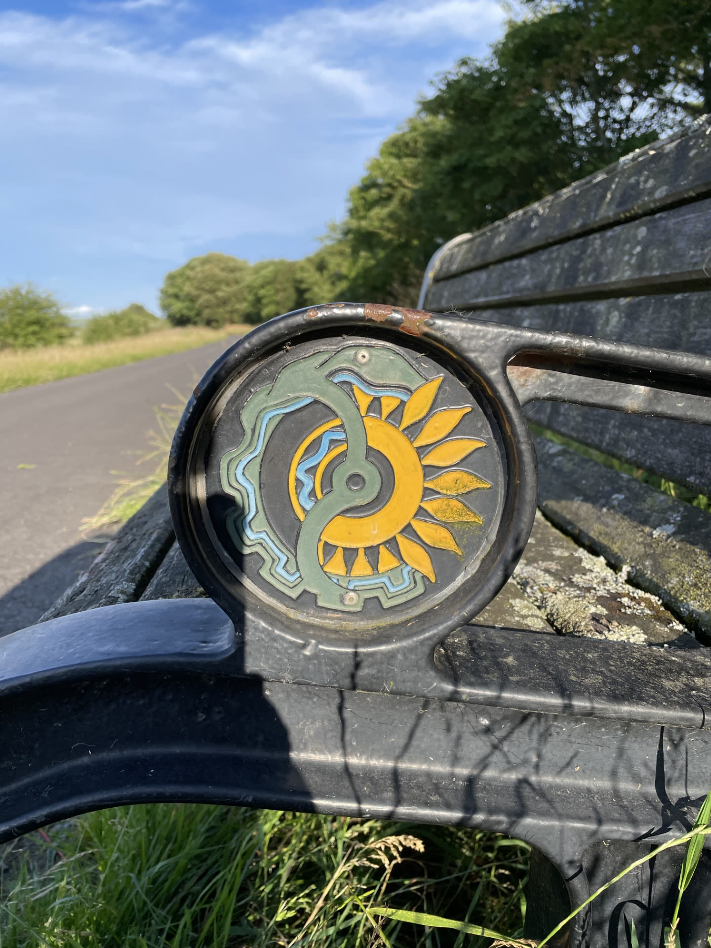
Detail of a Bench at Glasson Dock. David Cooper
Detail of a Bench at Glasson Dock. David Cooper
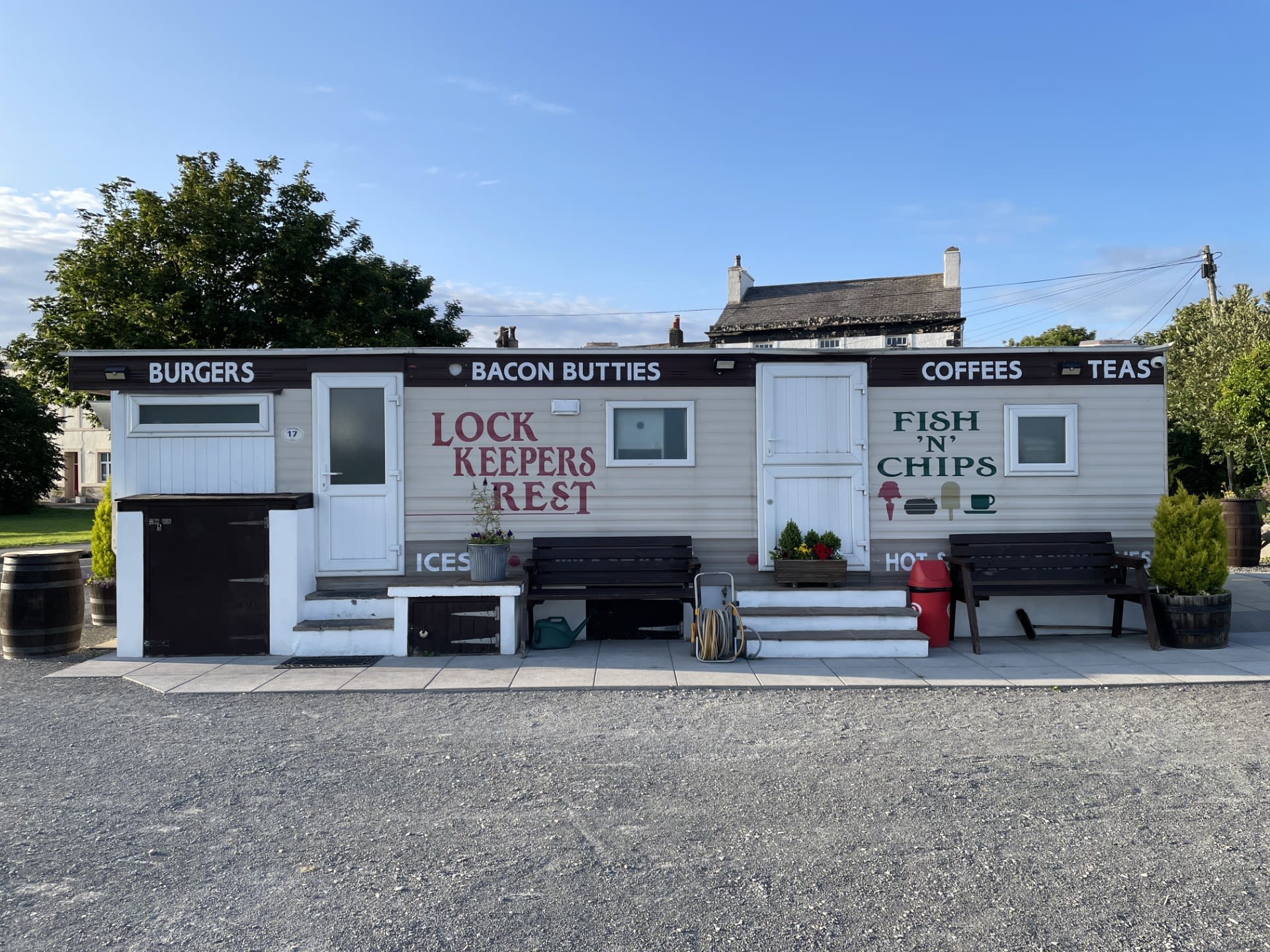
Lock Keeper's Rest. Glasson Dock. David Cooper
Lock Keeper's Rest. Glasson Dock. David Cooper
Mile 17: Glasson Dock to Conder
David Cooper
I lived, for a while, in York. There, I was able to walk along the City Walls to work and a view of the Minster was perfectly framed by my living room window. It was beautiful. Having grown up in Liverpool, though, I felt landlocked: I longed for the sea and that sea had to be to the west.
We now live in Lancaster and, at every opportunity, we head to the coast. Glasson Dock may be four miles or so from our house in Scotforth but it feels close enough to be home territory. Over the years, we have walked again and again from Glasson, alongside the Magwitchian marshes, to Conder Green and back. I remember coming here for our first trip out of Lancaster after our second child was born. I remember jogging along here, first thing on an August morning, as the sun crept up over Clougha. I remember sitting here, on one of the benches, in those all-too-raw days following the death of my Dad.
The walk from Glasson to Conder Green doesn’t provide the widescreen spectacle of the Bay seen from Fleetwood or Heysham, Morecambe or Grange. But, although it’s out-of-sight, I love that you’re constantly conscious that the vast tidalscape is there, just around the corner. Walking along here, then, invariably takes me back to the landscapes of my childhood and the promise that the open Irish Sea, and the world beyond, was never too far away.
It can be difficult, right now, to think too much about the future of our places and landscapes as everything is so uncertain.
There’s a need, though, to hold onto hope. The week before last, we went to Glasson and kids from the village were playing on the foreshore as the sun set over Sunderland.

Mile 18 - Conder Green
Susan Armitage
I have chosen this mile because I used to come here some time ago with my son and his friends when they were learning to ride bikes. It is a great picnic spot! More recently, I have been riding this stretch often and throughout the year. It is the first part of the millennium path which I access from the car park at Conder Green, heading either towards Glasson Dock or Lancaster.
The view is ever changing. Sometimes I can see the Lake District and sometimes not. Sometimes the tide is in, other times out and still other times somewhere in-between. This means different parts of the estuary itself are visible at different times. Along this mile, you can often take in the view back to Glasson Dock, across the estuary to Heysham Power Station as well as further up the Lune estuary towards Lancaster.
I enjoy watching the changing seasons along the path and the ever present sea or wading birds such as seagulls, herons and egrets. There is also constant change in the fields on the other side – crops and livestock growing and changing.

As a multi-user path, it is a really peaceful and stress-free route for horse-riding. We usually meet cyclists and walkers, either passing with a cheery hello, or stopping for a chat, which is appreciated by the pony who does some verge or hedge trimming until we’re done talking.
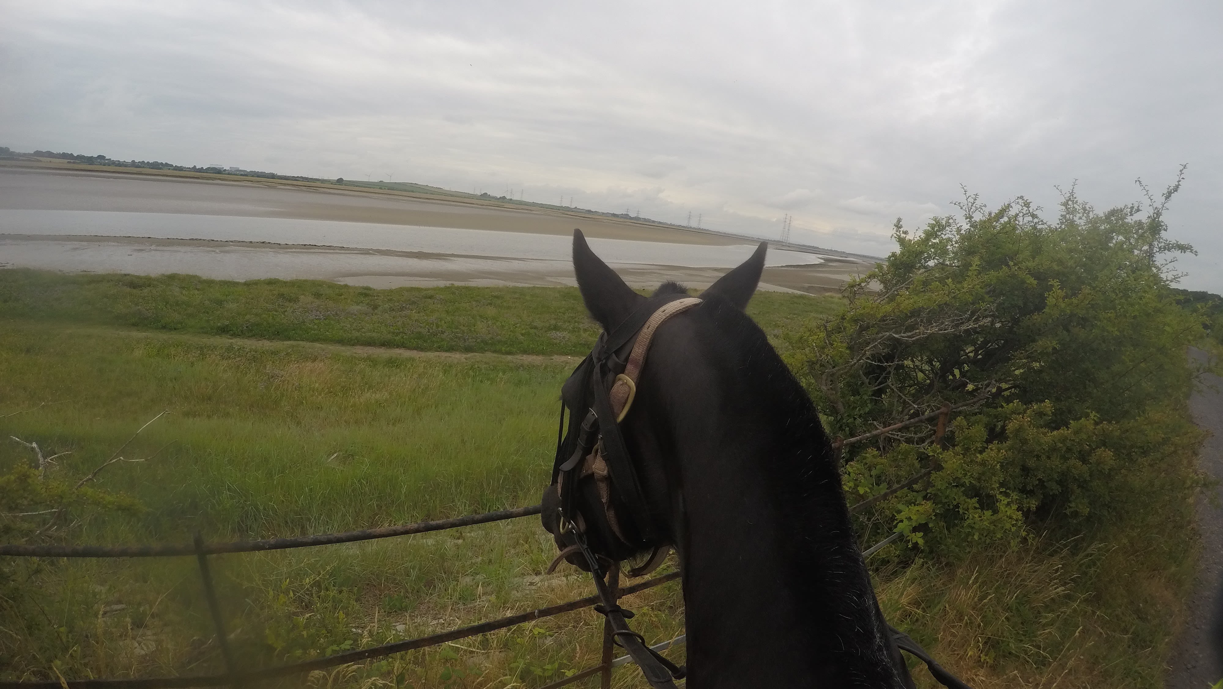
The surface is great to ride on all year round and the trees and hedges provide some protection from sun or rain, sometimes both!
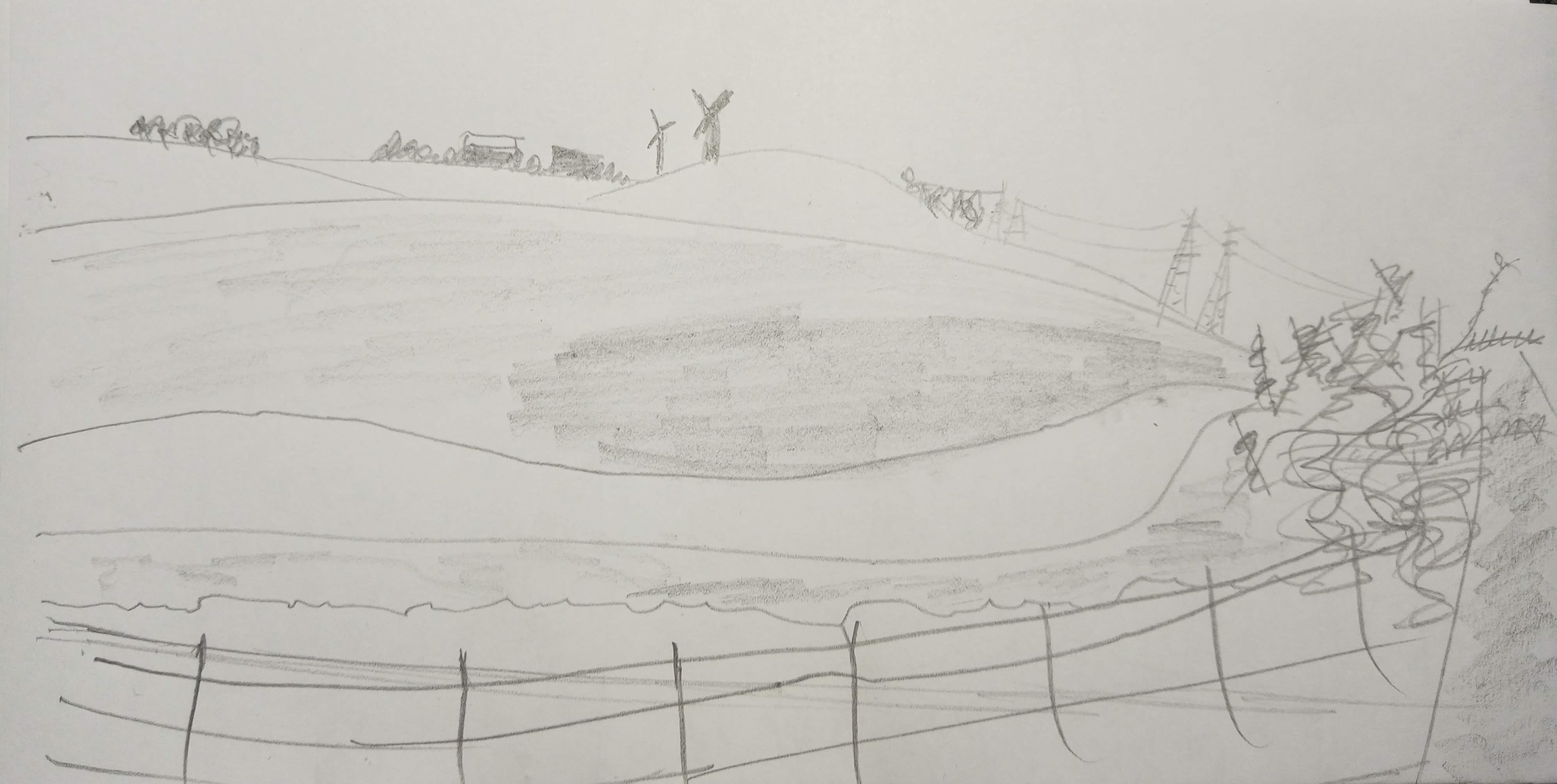
Line drawing for pennant of Mile 18. Susan Armitage.
For the future of this section of the coast my hope is that it remains a multi-user path, providing a safe alternative to the roads for anyone who wants to access the countryside for exercise, or just a place to be.


Line drawing for pennant of Mile 18. Susan Armitage.
Line drawing for pennant of Mile 18. Susan Armitage.
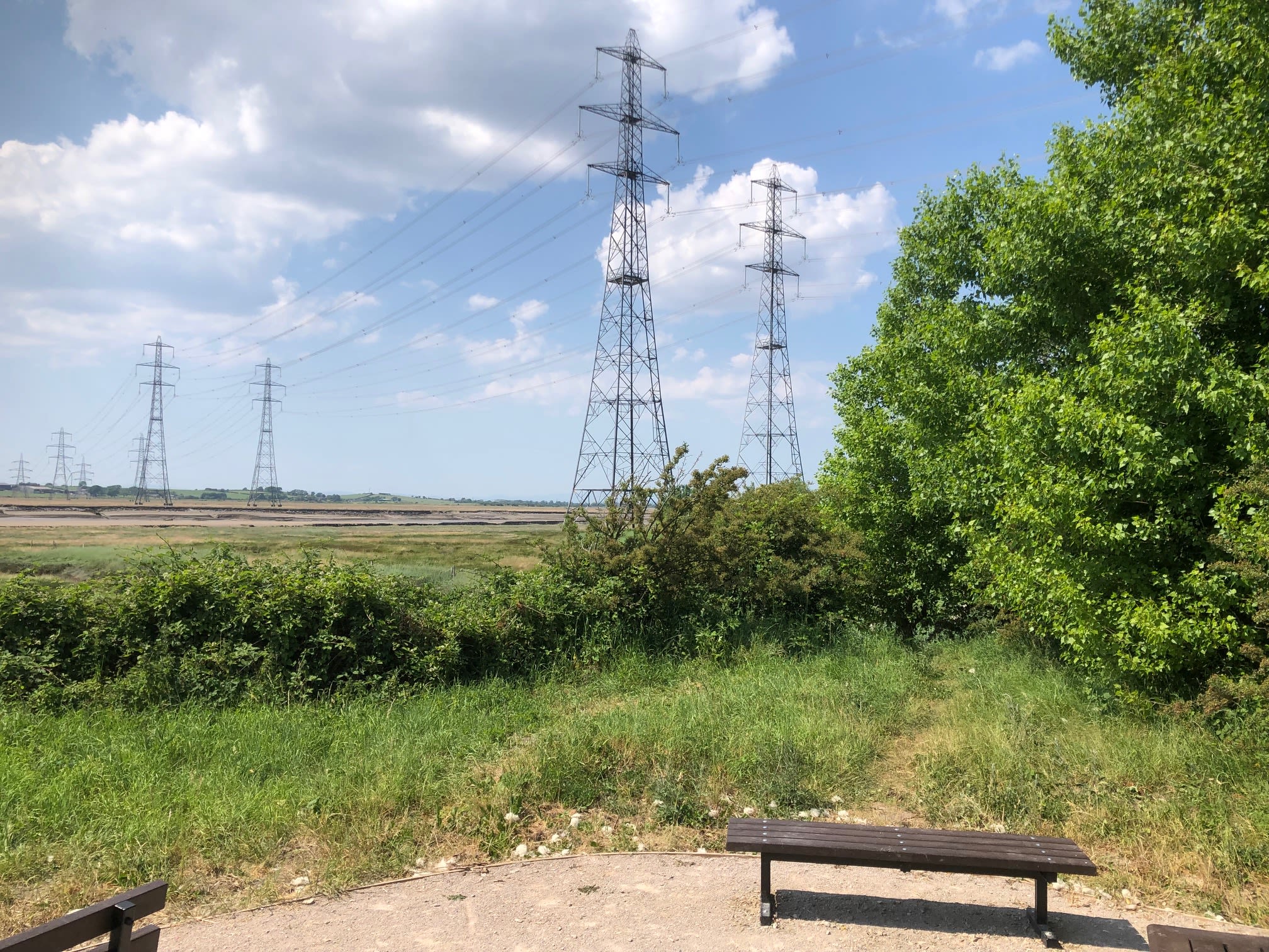
Mile 19 - From the Water Treatment Works to Smugglers Path, Aldcliffe
Hilary Smith
POWER AND THE LUNE
This particular spot along the Lune is one of contrasts, between natural power and man-made power, and the effects of both on the landscape and habitats. It is a unique and very atmospheric mile and a place that many people pass along the cycle path between Lancaster and Glasson Dock, the limits of the tidal river and the sea.
All the senses are engaged with contrasts:
Sight:
Wide open salt marsh and estuary
Harsh sunlight, reflection from water and mud
Huge electricity pylons marching across land
Enclosed tree lined cycle path corridor
Dappled green shade of rustling leaves
Birds, butterflies and insects flitting around
Sounds :
Tractor engine and machinery
Plane drone
Fizz of wires
Bird song
Bee buzz
Rustle of leaves
Smells:
Water treatment works
Muck spreading
Elderflower blossom
Salty tang
What do you know but can’t see?
There is Heysham Nuclear Power Station just over the horizon creating nuclear waste and using earth’s resources to create power for human lives. There are wind turbines and a big solar field nearby. Possible pollution from water treatment works, or run off from agricultural muck spreading releasing methane into atmosphere. The river is low, probably polluted with sewage. The wintering waders on the salt flats are regularly disturbed by dogs and people. The tide has energy and controls the habitat of the estuary.
My memories/connections?
When we were looking for somewhere up north to retire, (I am a northerner) we wanted somewhere with good cycling facilities. Our old friends from Lancaster took us a ride down the cycle path to what was the brilliant Café d’Lune and that decided us. We have seen this stretch in all weather and seasons and it never fails to lift our spirits.
Dreams?
That the insatiable demand for electricity by humans will diminish so that nuclear power station can close down and the site is released back to wildlife. The pylons, wires and wind turbines that can kill birds and bats will disappear. People will understand their impact on the precious wading and other birds and stop letting their dogs loose on the salt marshes. The cycle path will be properly maintained with a tarmac or similar surface and wide enough so that more people will cycle on it. (but no lighting!)
Fear: that someone will decide a river crossing for cars is essential to reduce traffic congestion in Lancaster and develop industrial businesses in Heysham. This could also be linked to tidal barrage which would radically change the river and the whole Bay.
Is the power of the politicians and developers greater than the Power of the river and Bay?
I hope not.

Mile 20 - Cycle Path
Mile 21 - The River Lune in Lancaster
Carys Nelkon
This area feels so different to where I grew up, it is so expansive.
When I moved back to Lancaster I would cycle by here and feel so lucky to live in such a beautiful place.
The stories of the miles and views of Morecambe Bay continue in Section 2 from Lancaster via Sunderland Point to Morecambe and Hest Bank.